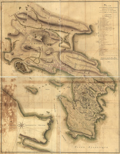
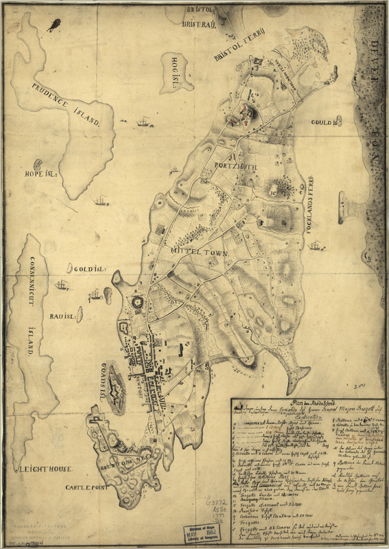
Plan von Rhode Island : und deren dem comando des Herrn General Majors Presgott inf dies-malig befundlichen campements
This map is also available in American Revolutionary Geographies Online (ARGO), a collections portal especially built for material relating to the American Revolutionary War Era. Visit ARGO to learn more about this item and explore the historical geography of North America in the late eighteenth century.
Item Information
- Title:
- Plan von Rhode Island : und deren dem comando des Herrn General Majors Presgott inf dies-malig befundlichen campements
- Creator:
- Schiffer, J. C.
- Name on Item:
-
Aufgenommen und gezeichnet den 8ten July 1777, von J. C. Schiffer, Artiy. Lieut.
- Date:
-
[1777]
- Format:
-
Maps/Atlases
Manuscripts
- Location:
- Library of Congress Geography and Map Division
- Collection (local):
-
Library of Congress Collection
- Subjects:
-
Rhode Island (R.I. : Island)--Defenses--Maps, Manuscript--Early works to 1800
- Places:
-
Newport (county)Rhode Island (island)
- Extent:
- 1 manuscript map : hand color 48 x 34 cm.
- Terms of Use:
-
No known copyright restrictions.
This work is licensed for use under a Creative Commons Attribution Non-Commercial Share Alike License (CC BY-NC-SA).

- Scale:
-
Scale ca. 1:50,000
- Language:
-
German
- Catalog Record:
-
https://lccn.loc.gov/75690704
- Notes:
-
Relief shown by hachures.
Manuscript, pen-and-ink.
Includes index to encampments, fortifications, and naval positions.
- Notes (date):
-
This date is inferred.
- Notes (citation):
-
LC Maps of North America, 1750-1789, 1014
- Identifier:
-
ar101400