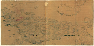
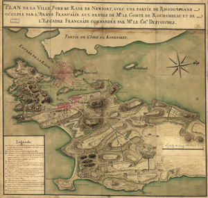
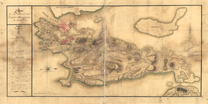
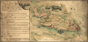
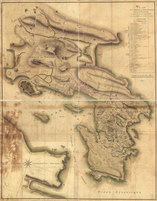
Plan de la position de l'armée françoise autour de Newport et du mouillage de l'escadre dans la rade de cette ville
This map is also available in American Revolutionary Geographies Online (ARGO), a collections portal especially built for material relating to the American Revolutionary War Era. Visit ARGO to learn more about this item and explore the historical geography of North America in the late eighteenth century.
Item Information
- Title:
- Plan de la position de l'armée françoise autour de Newport et du mouillage de l'escadre dans la rade de cette ville
- Date:
-
1780
- Format:
-
Maps/Atlases
Manuscripts
- Location:
- Library of Congress Geography and Map Division
- Collection (local):
-
Library of Congress Collection
- Subjects:
-
Newport (R.I.)--History--Revolution, 1775-1783--Maps, Manuscript--Early works to 1800
Rhode Island (R.I. : Island)--Defenses--Maps, Manuscript--Early works to 1800
- Places:
-
Rhode IslandNewport (county)Newport
- Extent:
- 1 manuscript map : hand color 148 x 115 cm. on 2 sheets 75 x 118 cm.
- Terms of Use:
-
No known copyright restrictions.
This work is licensed for use under a Creative Commons Attribution Non-Commercial Share Alike License (CC BY-NC-SA).

- Scale:
-
Scale ca. 1:7,250
- Language:
-
French
- Catalog Record:
-
https://lccn.loc.gov/gm71002159
- Notes:
-
Manuscript, pen-and-ink and watercolor.
Has watermarks.
Relief shown by hachures and shading.
Oriented with north toward the upper left.
Includes index to fortifications, French army camps, and French naval vessels.
- Notes (citation):
-
LC Maps of North America, 1750-1789, 1020
- Identifier:
-
ar102000z