Toggle navigation
LMEC Home
Exhibitions
Georeferencing
Tools for Teachers
Collections
My Favorites
Sign Up / Log In
Search
Search the map portal
Map Collection
Map Collection
Map Sets
Search
Search
Search for
Search In
All Fields
Creator
Title
Subject
Place
Search All Digital Collections
Advanced Search
8247 Results
My Search
Start Over
More Like
commonwealth:q524n3851
Remove constraint More Like: commonwealth:q524n3851
Filter your Search
Place
North and Central America
4,934
United States
3,761
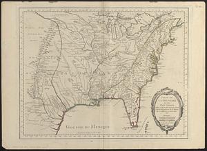
Suffolk (county)
1,026
Boston
999
Europe
963
Canada
437
North America
301
Massachusetts
294
more
Place
»
Topic
Boston (Mass.)--Maps
574
United States--Maps
270
North America--Maps--Early works to 1800
180
Real property--Massachusetts--Boston--Maps
174
Massachusetts--Maps
160
Landowners--Massachusetts--Boston--Maps
132
New England--Maps
99
Europe--Maps
78
more
Topic
»
Date
Date range begin
–
Date range end
Current results range from
1482
to
2023
View distribution
Creator
United States. Hydrographic Office
357
O.H. Bailey & Co
148
Des Barres, Joseph F. W. (Joseph Frederick Wallet), 1722-1824
123
United States. Post Office Dept
120
Ptolemy, 2nd cent
100
Walling, Henry Francis, 1825-1888
94
Jefferys, Thomas, -1771
92
Sayer, Robert, 1725-1794
84
more
Creator
»
Format
Maps/Atlases
8,188
Manuscripts
220
Prints
51
Books
36
Objects/Artifacts
10
Drawings/Illustrations
8
Posters
4
Georeferenced
Yes
872
No
7,375
Collection
Norman B. Leventhal Map Center Collection
8,172
Boston and New England Maps
2,185
Urban Maps
1,925
Maritime Charts and Atlases
750
American Revolutionary War-Era Maps
685
Boston Redevelopment Authority Collection
86
New York Public Library Collection
32
Richard H. Brown Revolutionary War Map Collection at Mount Vernon
19
more
Collection
»
Available to use
No known restrictions
8,025
Creative Commons license
113
Search Constraints
Sort by relevance
relevance
title
date (asc)
date (desc)
Number of results to display per page
100 per page
10
per page
20
per page
50
per page
100
per page
View results as:
grid view
map view
Search Results
1.
Carte de la Nouuelle France, augmentée depuis la derniere, seruant a la navigation faicte en son vray Meridien
2.
La Nuoua Francia
3.
An exact chart of the river St. Laurence, from Fort Frontenac to the island of Anticosti shewing the soundings, rocks, shoals...
4.
A new map of Nova Scotia, and Cape Britain : with the adjacent parts of New England and Canada, composed from a great number of...
5.
Carte du Canada ou de la Nouvelle France et des decouvertes qui y ont été faites
6.
A new chart of the coast of New England, Nova Scotia, New France or Canada, with the islands of Newfoundld. Cape Breton St....
7.
New Found Land, St. Laurence Bay, the fishing banks, Acadia, and part of New Scotland
8.
Partie orientale de la Nouvelle France ou du Canada
9.
Partie orientale de la Nouvelle France ou du Canada
10.
Pascaerte van Terra Nova Nova Francia Nievw Engeland En de Groote Revier van Canada
11.
An accurate map of North America : describing and distinguishing the British and Spanish dominions on this great continent :...
12.
An accurate map of North America : describing and distinguishing the British and Spanish dominions of this great continent;...
13.
An accurate map of North America : describing and distinguishing the British, Spanish and French dominions on this great...
14.
America : with those known parts in that unknowne worlde both people and manner of buildings discribed and inlarged
15.
America septentrionalis
16.
America Septentrionalis : concinnata juxta observationes Dnn Academiae Regalis Scientiarum et nonnullorum aliorum, et juxta...
17.
America Septentrionalis
18.
America Septentrionalis a Domino d'Anville in Galliis edita nunc in Anglia : Coloniis in interiorem Virginiam deductis nec non...
19.
America Settentrionale : colle nuove scoperte fin alle' anno 1688 divisa nelle sue partu secondo lo stato presente
20.
America sive novvs orbis respectv Evropaeorvm inferior globi terrestris pars
21.
Amérique Septentrionale
22.
Amérique Septentrionale
23.
Amérique Septentrionale : dressée sur les relations les plus modernes des voyageurs et navigateurs, et divisée suivant les...
24.
Amérique septentrionale
25.
L'Amerique septentrionale
26.
L'Amérique Septentrionale
27.
[Amerique septentrionale]
28.
Amérique septentrionale avec les routes, distances en miles, villages, et etablissements François et Anglois
29.
Amerique septentrionale divisée en ses principale parties
30.
Amerique septentrionale divisée en ses principales parties : ou sont distingués les uns des autres les etats suivant quils...
31.
L'Amérique Septentrionale divisée en ses principaux états
32.
British colonies in North America : drawn from the best authorities
33.
British dominions in America, drawn from the latest and best authorities
34.
Le Canada, ou Nouvelle France, &c : ce qui est le plus advance vers le Septentrion est tiré de diverses relations des Anglois,...
35.
Le Canada, ou Nouvelle France, la Floride, la Virginie, Pensilvanie, Caroline, Nouvelle Angleterre et Nouvelle Yorck, l'Isle de...
36.
Carte de la Louisiane et des pays voisins dédiée à M. Rouillé sécretaire d'état, ayant le Département de la marine
37.
Carte de la Nouuelle France et de la Louisiane nouuellement découuerte : dediée au Roy l'an 1683
38.
Carte de l'Amérique septentrionale, depuis la baye d'Hudson jusqu'au Mississipi : pour servir aux essais historiques et...
39.
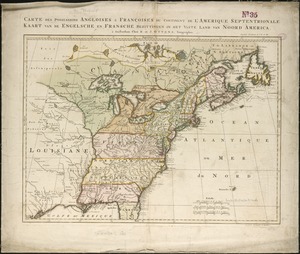
Carte des possessions angloises & françoises du continent de l'Amérique septentrionale = Kaart van de Engelsche en Fransche...
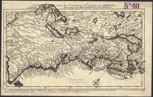
40.
Carte des possessions des Anglois en Amerique, par rapport à leurs differends avec la France
41.
Carte detaillée des possessions angloises dans l'Amerique Septentrionale : construite d'après les dernieres relations et les...
42.
Carte du Mexique et de la Florida : des terres angloises et des Isles Antilles, du cours et des environs de la Riviere de...
43.
Carte d'une partie de l'Amérique Septentrionale pour servir à l'intelligence du mémoire sur les prétentions des Anglois au...
44.
Carte générale du Canada, de la Louisiane, de la Floride, de la Caroline, de la Virginie, de la Nouvelle Angleterre etc
45.
Carte nouvelle de l'Amérique Angloise contenant tout ce que les Anglois possédent sur le continent de l'Amérique...
46.
Chart of the Atlantic Ocean, with the British, French, & Spanish settlements in North America, and the West Indies : as also on...
47.
Chart of the Atlantic Ocean, with the British, French, & Spanish settlements in North America, and the West Indies : as also on...
48.
Le Colonie Unite dell' America Settentr'le di nuova projezione a ss. ee. li signori riformatori dello studio di Padova : con...
49.
Domina Anglorum in America Septentrionali specialibus mappis Londini primum a Mollio edita, nunc recusa ab Homannianis Hered =...
50.
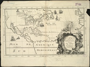
The English empire in America, Newfound-land, Canada, Hudsons Bay, &c. in plano
51.
The English Empire in America, Newfound-land, Canada, Hudsons Bay &c. in plano
52.
Extract from a map of the British and French dominions in North America
53.
A general map of North America : in which is express'd the several new roads, forts, engagements, &c, taken from actual surveys...
54.
Generalkarte von Nord America samt den Westindischen inseln
55.
The isle of California : New Mexico : Louisiane : The river Misisipi, and the lakes of Canada
56.
A map of Louisiana and of the River Mississipi
57.
A map of New England, and Nova Scotia : with part of New York, Canada, and New Britain & the adjacent islands of New Found...
58.
A map of North America, & the West India Islands, with part of South America, Europe, Africa & the Atlantic Ocean with it's...
59.
A map of North America, with the European settlements & whatever else is remarkable in ye West Indies, from the latest and best...
60.
A map of the British and French dominions in North America : with the roads, distances, limits, and extent of the settlements,...
61.
A map of the British and French dominions in North America : with the roads, distances, limits, and extent of the settlements,...
62.
A map of the British and French dominions in North America, with the roads, distances, limits, and extent of the settlements
63.
A map of the British and French settlements in North America
64.
A map of the British colonies in North America : with the roads, distances, limits, and extent of the settlements, humbly...
65.
A map of the British Empire in America with the French and Spanish settlements adjacent thereto
66.
A map of the British Empire in America with the French and Spanish settlements adjacent thereto
67.
A map of the discoveries made by the Russians on the North West coast of America
68.
A map of the n.e. part of Asia, and n.w. parts of America, shewing their situations with respect to Japan
69.
A map of the northern and middle states : comprehending the western territory & the British dominions in North America : from...
70.
Map of the northern, or, New England states of America, comprehending Vermont, New Hampshire, District of Main, Massachusetts,...
71.
Mexicum in hac forma in lucem
72.
A new and correct map of North America, with the West India Islands : divided according to the last Treaty of Peace, concluded...
73.
A New and correct map of the British colonies in North America comprehending eastern Canada with the province of Quebec, New...
74.
A new and exact map of the dominions of the King of Great Britain on ye continent of North America : containing Newfoundland,...
75.
A new and exact map of the dominions of the King of Great Britain on ye continent of North America : containing Newfoundland,...
76.
A new map of North America : with the British, French, Spanish, Dutch & Danish dominions on that great continent, and the West...
77.
A new map of North America
78.
A new map of North America from the latest discoveries
79.
A new map of North America from the latest discoveries
80.
A new map of North America shewing its principal divisions, chief cities, townes, rivers, mountains &c
81.
A New map of North America with the West India Islands : divided according to the preliminary articles of peace, signed at...
82.
A new map of the English empire in America viz. Virginia, Maryland, Carolina, Pennsylvania, New York, New Iarsey, New England,...
83.
A new map of the most considerable plantations of the English in America
84.
A new map of the north parts of America claimed by France under ye names of Louisiana, Mississipi, Canada, and New France with...
85.
A new map of the north parts of America claimed by France under ye names of Louisiana, Mississipi, Canada, and New France with...
86.
A new map of the United States of North America with the British dominions on that continent &c
87.
A new map of ye north parts of America claimed by France under ye names of Louisiana, Mississipi, Canada & new France with the...
88.
Nieuwe kaart van de Grootbrittannische volkplantingen in Noord America : waar in tevens de Fransche bezittingen en de Landen,...
89.
North America : from the French of Mr. d'Anville, improved with the back settlements of Virginia and course of Ohio,...
90.
North America
91.
North America : corrected from the observation communicated to the Royal Society at London and the Royal Academy at Paris
92.
North America
93.
North America
94.
North America : performed under the patronage of Louis Duke of Orleans, First Prince of the Blood
95.
North America divided into its III principall parts : 1st English part viz. English Empire containing ye Articklands near...
96.
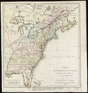
North America, divided into its principall parts where are distinguished the severall states which belong to the English,...
97.
North America, drawn from the best authorities
98.
North America from the French of Mr. D'Anville, improved with the back settlements of Virginia and course of Ohio, illustrated...
99.
The north part of America : conteyning Newfoundland, new England, Virginia, Florida, new Spaine, and Noua Francia wth ye rich...
100.
Noua et accurata totius Americae tabula
‹ Prev
Next ›
1
2
3
4
5
…
82
83


![[Amerique septentrionale]](https://bpldcassets.blob.core.windows.net/derivatives/images/commonwealth:8336h2955/image_thumbnail_300.jpg)