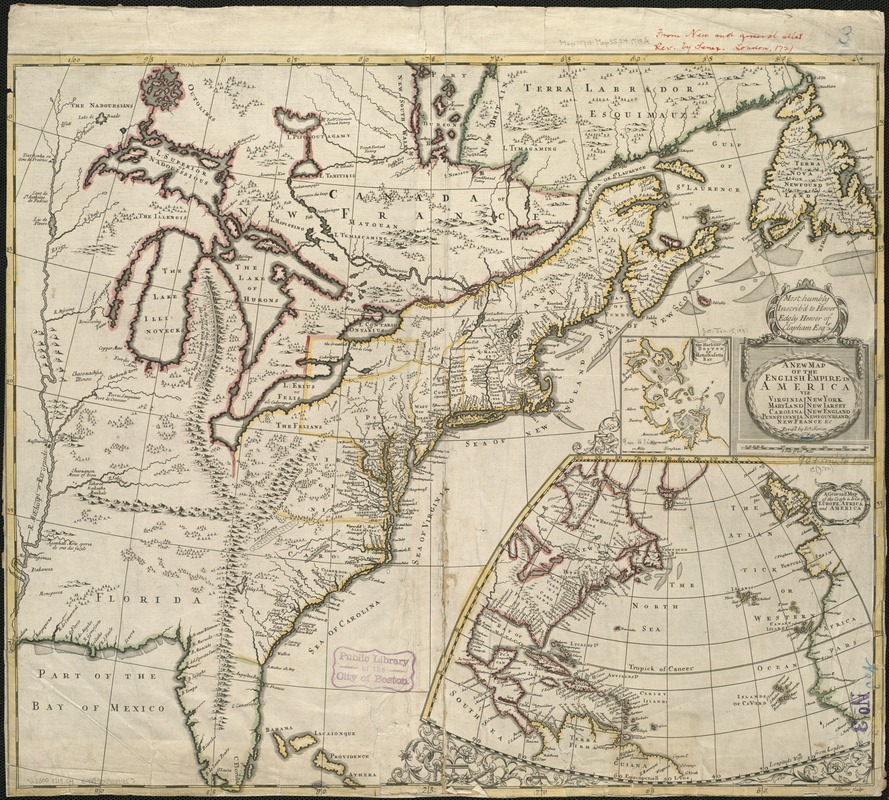
A new map of the English empire in America viz. Virginia, Maryland, Carolina, Pennsylvania, New York, New Iarsey, New England, Newfoundland, New France &c
Item Information
- Title:
- A new map of the English empire in America viz. Virginia, Maryland, Carolina, Pennsylvania, New York, New Iarsey, New England, Newfoundland, New France &c
- Creator:
- Senex, John, d. 1740
- Name on Item:
-
revised by Ion. Senex ; I. Harris sculp.
- Date:
-
1719
- Format:
-
Maps/Atlases
- Location:
-
Boston Public Library
Norman B. Leventhal Map & Education Center - Collection (local):
-
Norman B. Leventhal Map & Education Center Collection
- Subjects:
-
North America--Maps--Early works to 1800
- Places:
-
North America (area)
- Extent:
- 1 map ; 49 x 58 cm.
- Terms of Use:
-
No known copyright restrictions.
No known restrictions on use.
- Publisher:
-
London :
[s.n.]
- Scale:
-
Scale [ca. 1:6,500,000].
- Language:
-
English
- Notes:
-
Relief shown pictorially.
Insets: The harbour of Boston, or, Massachusetts Bay -- A general map of the coasts & isles of Europe, Africa and America.
Appears in author's New and General Atlas. 1721.
- Identifier:
-
06_01_006081
- Call #:
-
G3300 1719 .S4
- Barcode:
-
39999059019453


