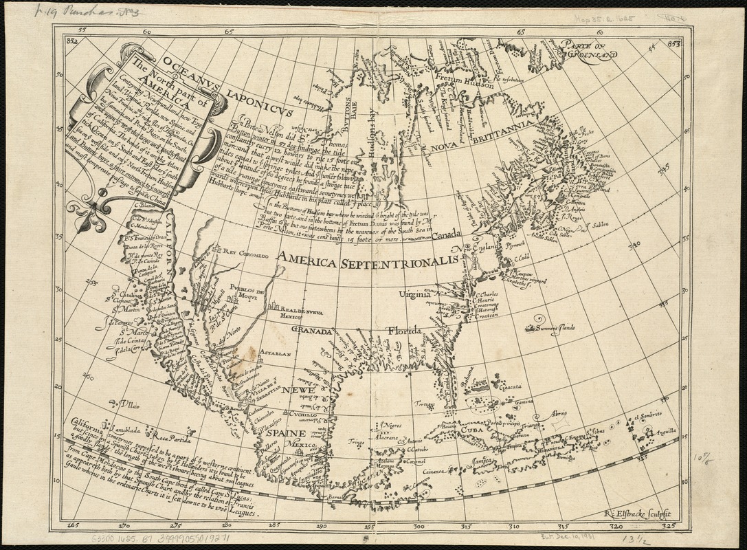
The north part of America : conteyning Newfoundland, new England, Virginia, Florida, new Spaine, and Noua Francia wth ye rich Iles of Hispaniola, Cuba, Iamaica, and Porto Rieco on the south, and upon ye west the large and goodly Iland of California
Item Information
- Title:
- The north part of America : conteyning Newfoundland, new England, Virginia, Florida, new Spaine, and Noua Francia wth ye rich Iles of Hispaniola, Cuba, Iamaica, and Porto Rieco on the south, and upon ye west the large and goodly Iland of California
- Creator:
- Elstracke, Renold, fl. 1590-1630
- Name on Item:
-
R. Elstracke sculpsit.
- Date:
-
[1625]
- Format:
-
Maps/Atlases
- Location:
-
Boston Public Library
Norman B. Leventhal Map & Education Center - Collection (local):
-
Norman B. Leventhal Map & Education Center Collection
- Subjects:
-
North America--Maps--Early works to 1800
- Places:
-
North America (area)
- Extent:
- 1 map ; 27 x 35 cm.
- Terms of Use:
-
No known copyright restrictions.
No known restrictions on use.
- Publisher:
-
London :
s.n.
- Scale:
-
Scale [ca. 1:23,000,000]
- Language:
-
English
- Notes:
-
Prime meridian: Ferro.
Shows drainage, towns, California as an island, etc.
From Hakluytus Posthumus, or Purchas his Pilgrimes, vol. III, p. 852-3, accompanying an article by Henry Briggs.
Includes historical text.
- Notes (date):
-
This date is inferred.
- Identifier:
-
06_01_006059
- Call #:
-
G3300 1625 .B7
- Barcode:
-
39999059019271


