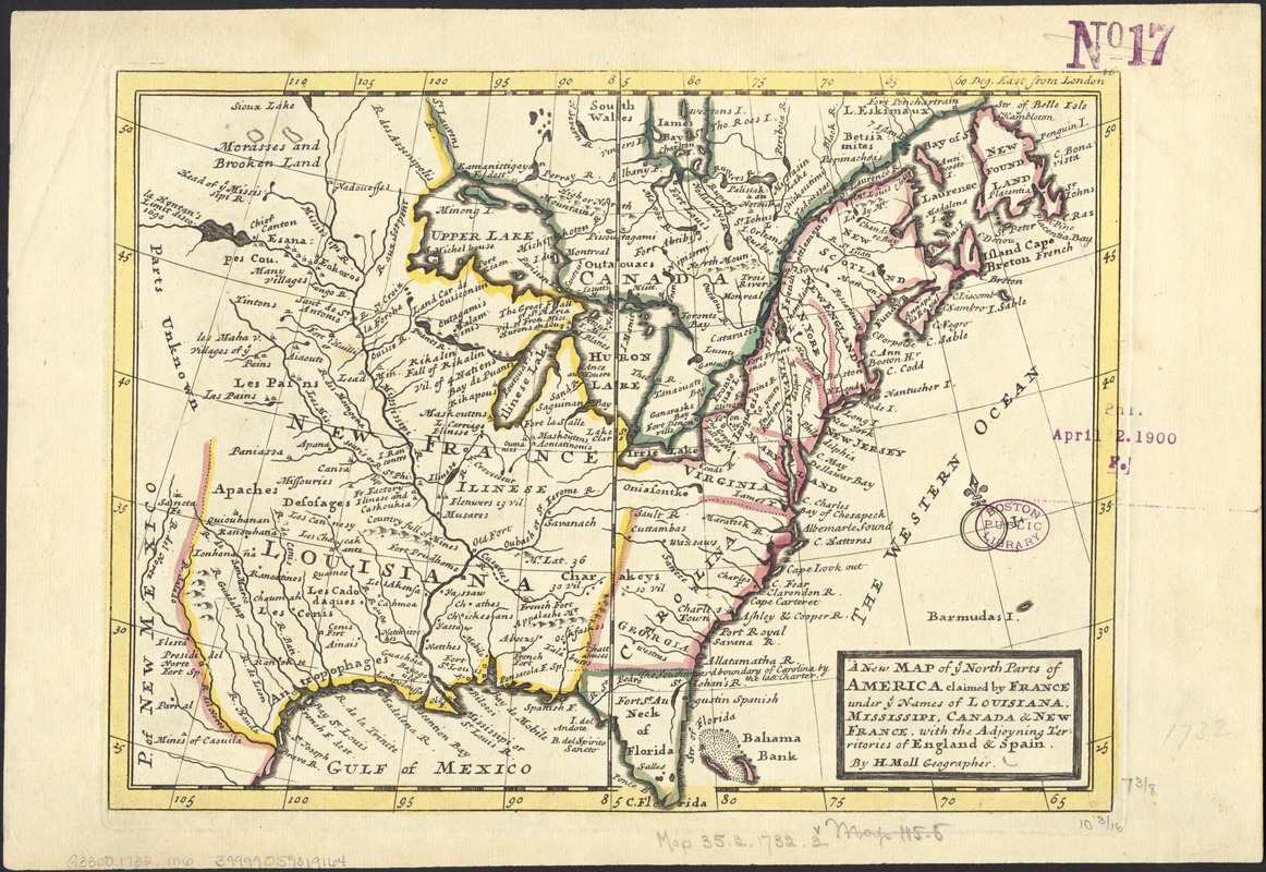
A new map of ye north parts of America claimed by France under ye names of Louisiana, Mississipi, Canada & new France with the adjooyning territories of England & Spain
Item Information
- Title:
- A new map of ye north parts of America claimed by France under ye names of Louisiana, Mississipi, Canada & new France with the adjooyning territories of England & Spain
- Creator:
- Moll, Herman, d. 1732
- Name on Item:
-
by H. Moll.
- Date:
-
[1732?]
- Format:
-
Maps/Atlases
- Location:
-
Boston Public Library
Norman B. Leventhal Map & Education Center - Collection (local):
-
Norman B. Leventhal Map & Education Center Collection
- Subjects:
-
North America--Maps--Early works to 1800
- Places:
-
North America (area)
- Extent:
- 1 map ; 20 x 26 cm.
- Terms of Use:
-
No known copyright restrictions.
No known restrictions on use.
- Publisher:
-
London :
Printed for Tho. Bowles and John Bowles
- Scale:
-
Scale [1:16,000,000].
- Language:
-
English
- Notes:
-
Relief shown pictorially.
Shows rivers, boundaries and settlements.
Imprint derived from the atlas in which the map was issued.
Numbered 46.
London meridian.
From the author's Atlas Minor. London : Thomas Bowles and John Bowles, 1732?
Eastern North America, from Florida and Louisiana to Newfoundland.
- Identifier:
-
06_01_006029
- Call #:
-
G3300 1732 .M6
- Barcode:
-
39999059019164


