Toggle navigation
LMEC Home
Exhibitions
Georeferencing
Tools for Teachers
Collections
My Favorites
Sign Up / Log In
Search
Search the map portal
Map Collection
Map Collection
Map Sets
Search
Search
Search for
Search In
All Fields
Creator
Title
Subject
Place
Search All Digital Collections
Advanced Search
8213 Results
My Search
Start Over
More Like
commonwealth:cj82kn67t
Remove constraint More Like: commonwealth:cj82kn67t
Filter your Search
Place
North and Central America
4,962
United States
3,639
Suffolk (county)
1,028
Boston
1,001
Europe
963
Canada
437
France
269
Massachusetts
253
more
Place
»
Topic
Boston (Mass.)--Maps
576
United States--Maps
270
Real property--Massachusetts--Boston--Maps
174
Massachusetts--Maps
163
Landowners--Massachusetts--Boston--Maps
132
New England--Maps
120
North America--Maps--Early works to 1800
103
New York (State)--Maps
81
more
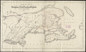
Topic
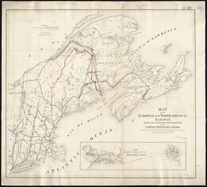
»
Date
Date range begin
–
Date range end
Current results range from
1482
to
2023
View distribution
Creator
United States. Hydrographic Office
357
O.H. Bailey & Co
148
Des Barres, Joseph F. W. (Joseph Frederick Wallet), 1722-1824
123
United States. Post Office Dept
120
Ptolemy, 2nd cent
100
Walling, Henry Francis, 1825-1888
94
Jefferys, Thomas, -1771
84
Geological Survey (U.S.)
82
more
Creator
»
Format
Maps/Atlases
8,154
Manuscripts
217
Prints
51
Books
36
Objects/Artifacts
10
Drawings/Illustrations
8
Posters
4
Georeferenced
Yes
872
No
7,341
Collection
Norman B. Leventhal Map Center Collection
8,165
Boston and New England Maps
2,188
Urban Maps
1,925
Maritime Charts and Atlases
750
American Revolutionary War-Era Maps
659
Boston Redevelopment Authority Collection
86
William L. Clements Library Collection
26
American Antiquarian Society Collection
14
more
Collection
»
Available to use
No known restrictions
8,025
Creative Commons license
49
Search Constraints
Sort by relevance
relevance
title
date (asc)
date (desc)
Number of results to display per page
100 per page
10
per page
20
per page
50
per page
100
per page
View results as:
grid view
map view
Search Results
1.
Williams' telegraph and rail road map of the New England states, eastern protion of New York state and Canada : compiled from...
2.
E.P. Dutton & Co.'s railroad, steam boat & stage route map of New England, New-York and Canada
3.
Map exhibiting the rail road, canal, lake and river routes from New York and Boston to the west, via Ogdensburgh, Buffalo and...
4.
Map exhibiting the rail road routes leading from Boston, to Ogdensburg and Buffalo, N.Y
5.
Map of the Troy & Greenfield Rail Road and its connections
6.
Map showing the comparative merits, and benefits to Massachusetts, of the proposed extension of the New York and Massachusetts...
7.
Post route map of the states of New Hampshire, Vermont, Massachusetts, Rhode Island, Connecticut, and parts of New York and Maine
8.
Rail road map of New England & eastern New York
9.
Rail road map of New England & eastern New York
10.
Sherman & Smith's rail road, steam boat & stage route map of New England, New-York, and Canada
11.
Lloyd's railroad, telegraph & express map of the Eastern States to accompany Lloyd's railroad, telegraph & express map of the...
12.
Map of New England exhibiting the rail road and telegraphic lines now in operation
13.
Telegraph and rail road map of the New England states
14.
Williams' telegraph and rail road map of the New England states, eastern portion of New York state and Canada
15.
Railroad map of New England & eastern New York complied from the most authentic sources
16.
Map of the Hudson River & Berkshire R. R. and its connections
17.
Hale's map of the central & western parts of Massachusetts, with a part of New-York
18.
Map of the eastern division and branches, Erie Railway
19.
Map of the several routes from Rochester to Buffalo : compiled from county maps and actual surveys in the office of the...
20.
Map of the State of New-York : showing its water and rail road lines, Jany. 1854
21.
Post route map of the State of New York and parts of Vermont, Massachusetts, Connecticut, New Jersey, and Pennsylvania also the...
22.
Post route map of the State of New York and parts of Vermont, Massachusetts, Connecticut, New Jersey, and Pennsylvania also the...
23.
Post route map of the state of New York showing post offices with the intermediate distances on mail routes in operation on the...
24.
Scarborough's new railroad, post office, township and county map of New York with distances between stations
25.
Transportation map of New York
26.
ABC pathfinder railway guide map : eastern division
27.
Boston Clinton Fitchburg and Mansfield Framingham Lowell Railroads, and connections
28.
Ensign, Bridgman & Fanning's rail road map of the United States, showing the depots & stations
29.
G. Woolworth Colton's railroad, township & distance map of New England : with adjacent portions of New York, Canada & New...
30.
Map first division railway mail service
31.
Map of New England : with adjacent portions of New York & Canada
32.
Map of New England with adjacent portions of New York & Canada
33.
Map of New England with adjacent portions of New York & Canada
34.
Map of New England with adjacent portions of New York & Canada
35.
Map of the Boston & Maine Railroad, showing its relative position & connection with other railroads
36.
Map of the Boston and Northwestern, Massachusetts Central, and Boston and Poughkeepsie Railroads and their connections
37.
Map of the Boston, Concord, Montreal & White Mountains Railroad and its principal connections
38.
Map of the Eastern Railroad and principal connections
39.
Map of the Eastern Railroad and principal connections
40.
Map of the New York & Boston Railway, with its connections with other railways
41.
Map of the South Mountain and Boston Railroad & connections showing territory passed through, rail-roads and canals crossed or...
42.
A map of the Yearly Meeting of Friends for New England : 1850
43.
Map showing the lines of canals & rail roads owned, leased & operated by the Delaware and Hudson Canal and Rail Road Co. with...
44.
Map showing the proposed rail roads from Boston to Burlington, from Hale's map of New England
45.
National map of New England states Vermont, New Hampshire, Massachusetts, Connecticut, Rhode Island and Maine showing counties...
46.
New post office, township, county and railroad map of New England : with distances
47.
The New York, New Haven & Hartford Railroad and connections
48.
Post route map of the states of New Hampshire, Vermont, Massachusetts, Rhode Island, Connecticut, and parts of New York and Maine
49.
Post route map of the states of New Hampshire, Vermont, Massachusetts, Rhode Island, Connecticut, and parts of New York and Maine
50.
Post route map of the states of New Hampshire, Vermont, Massachusetts, Rhode Island, Connecticut and parts of New York and...
51.
Post route map of the states of New Hampshire, Vermont, Massachusetts, Rhode Island, Connecticut and parts of New York and...
52.
Post route map of the states of New Hampshire, Vermont, Massachusetts, Rhode Island, Connecticut and parts of New York and...
53.
Post route map of the states of New Hampshire, Vermont, Massachusetts, Rhode Island, Connecticut showing post offices with the...
54.
Railroad map of New England, with adjacent portions of New York & Canada
55.
Railway map of the New England states, engraved expressly for the Pathfinder railway guide
56.
Sketch of the states of Massachusetts, Connecticut, and Rhode Island, and parts of New Hampshire & New York exhibiting the...
57.
Sketch of the states of Massachusetts, Connecticut, and Rhode Island, and parts of New Hampshire & New York exhibiting the...
58.
Summer resorts of the coast, lake, and mountain regions along the Boston & Maine Railroad and connections
59.
New England and New York in 1697
60.
Rand McNally official 1920 auto trails map : District number 6 : New England, eastern New York
61.
Old Colony & Newport railway and its connections
62.
Carte de la Nouvelle Angleterre, Nouvelle Yorck, et Pensilvanie. : Pour servir à l'Histoire générale des voyages
63.
An Exact map of New England, New York, Pensylvania & New Jersey, : from the latest surveys
64.
A Map of New England & ye country adjacent, : extending northward to Quebec, & westward to Niagara, on Lake Ontario; shewing...
65.
A Map of that part of America which was the principal seat of war in 1756
66.
A new and accurate map of the present seat of war in North America
67.
This plan of Kennebeck & Sagadahock Rivers & country adjacent
68.
Diagram of rail roads diverging from Boston : showing the depots and distances
69.
Map of the European & North American Railway and its connections
70.
Map of the European and North American Railway, showing its connection with the railways of the United States & Canada; made by...
71.
Map showing the relative distances of Porsmouth [i.e. Portsmouth] and Boston from Concord & Manchester, N.H
72.
Travel-map of New England
73.
Connecticut with portions of New York & Rhode Island
74.
Map of Ho-De-No-Sau-Nee-Ga or the people of the long house : compiled 1851 by Lewis H. Morgan & Ely S. Parker a Seneca sachem...
75.
Map of Morris's Purchase or West Geneseo in the state of New York : exhibiting part of the Lakes Erie and Ontario, the...
76.
Map of the canals and rail roads for transporting anthracite coal from the several coal fields to the city of New York
77.
Map of the country embracing the several routes examined with a view to a national road from Washington to Lake Ontario
78.
A map of the history of New York state
79.
Map of the New York Central & Hudson River and Boston & Albany Railroads : sea shore and summer resorts of New York and New...
80.
Map of the northern part of the state of New York
81.
A map of the Seneca villages and the Jesuit and French contacts 1615-1708
82.
Map of the Sodus Canal, and the internal improvements connecting with it forming the great route from the Atlantic to the Lakes
83.
Map of the State of New York
84.
Map of the state of New York
85.
A map of the State of New York
86.
Map of the State of New York with part of the states of Pennsylvania, New Jersey &c
87.
New York
88.
New York
89.
The official map of New York : compiled from United States government surveys, official state surveys, and other sources
90.
Road map of the Albany-Troy district
91.
The state of New York
92.
State of New York
93.
The state of New York, compiled from the best authorities
94.
The state of New York with part of the adjacent states
95.
A survey of the empire group : with a complete distance table, a compendious index of cities and post offices, with populations...
96.
A survey of the empire group : with a complete distance table, a compendious index of cities and post offices, with populations...
97.
The tourist's map of the state of New York : compiled from the latest authorities in the Surveyor General's office
98.
Automobile map of New England showing the ideal tour
99.
The Boston Globe ski map of northern New England and Canada
100.
A canoeist's guide to New England's rivers
‹ Prev
Next ›
1
2
3
4
5
…
82
83


![Map showing the relative distances of Porsmouth [i.e. Portsmouth] and Boston from Concord & Manchester, N.H](https://bpldcassets.blob.core.windows.net/derivatives/images/commonwealth:7h14b104z/image_thumbnail_300.jpg)


