The official map of New York : compiled from United States government surveys, official state surveys, and other sources
Item Information
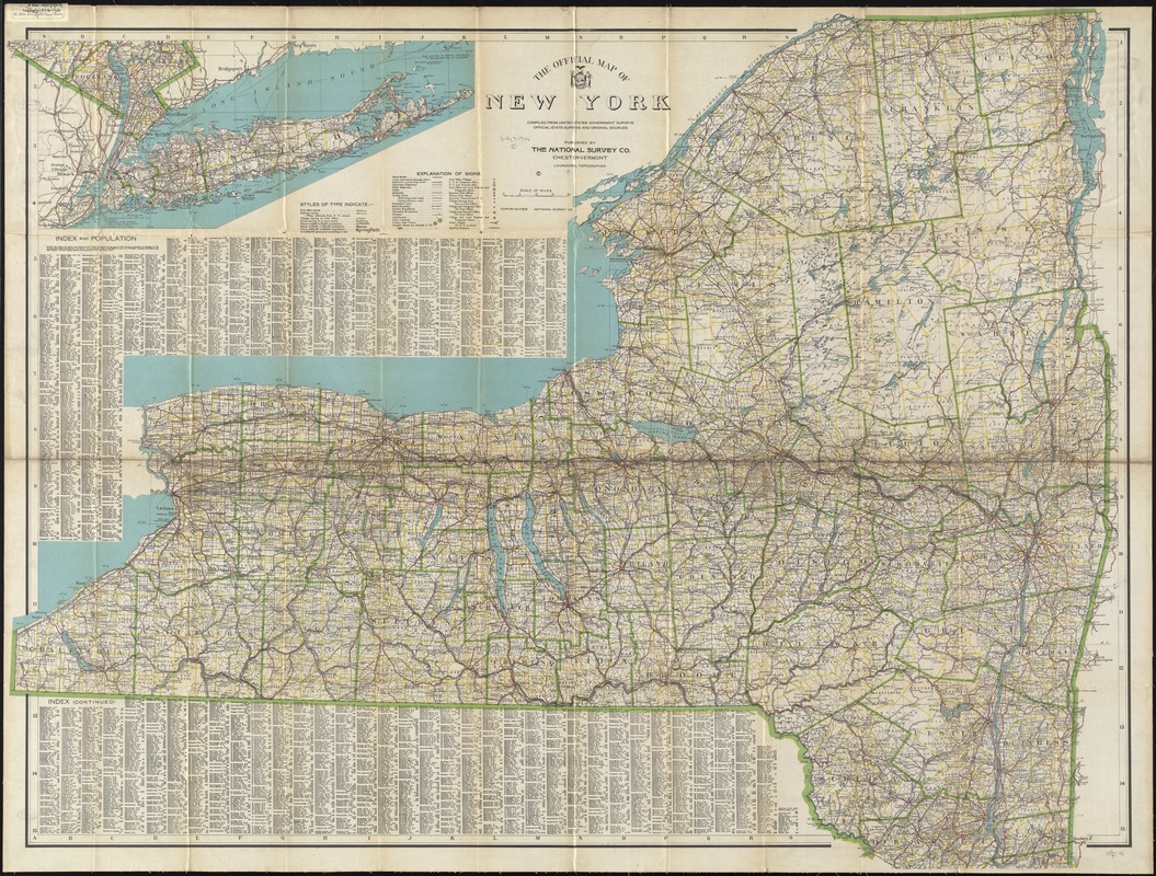
- Title:
- The official map of New York : compiled from United States government surveys, official state surveys, and other sources
- Creator:
- National Survey Company
- Name on Item:
-
L.V. Crocker, topographer.
- Date:
-
[1918?]
- Format:
-
Maps/Atlases
- Location:
-
Boston Public Library
Norman B. Leventhal Map & Education Center - Collection (local):
-
Norman B. Leventhal Map & Education Center Collection
- Subjects:
-
Roads--New York (State)--Maps
New York (State)--Maps
- Places:
-
New York
- Extent:
- 1 map : col. ; 91 x 117 cm., folded in cover 26 x 13 cm.
- Terms of Use:
-
No known copyright restrictions.
No known restrictions on use.
- Publisher:
-
Chester, Vt :
National Survey Co.
- Scale:
-
Scale [ca. 1:470,000]
- Language:
-
English
- Notes:
-
Continuation inset: [New York City and Long Island].
Includes index with 1910 population figures.
- Identifier:
-
06_01_009882
- Call #:
-
G3800 1918 .N38
- Barcode:
-
39999065664755


