Toggle navigation
LMEC Home
Exhibitions
Georeferencing
Tools for Teachers
Collections
My Favorites
Sign Up / Log In
Search
Search the map portal
Map Collection
Map Collection
Map Sets
Search
Search
Search for
Search In
All Fields
Creator
Title
Subject
Place
Search All Digital Collections
Advanced Search
8208 Results
My Search
Start Over
More Like
commonwealth:3f4638703
Remove constraint More Like: commonwealth:3f4638703
Filter your Search
Place
North and Central America
4,946
United States
3,784
Suffolk (county)
1,027
Boston
1,000
Europe
963
Canada
441
France
269
Massachusetts
258
more
Place
»
Topic
Boston (Mass.)--Maps
575
United States--Maps
314
Real property--Massachusetts--Boston--Maps
174
Massachusetts--Maps
160
Landowners--Massachusetts--Boston--Maps
132
North America--Maps--Early works to 1800
103
New England--Maps
99
Europe--Maps
78
more
Topic
»
Date
Date range begin
–
Date range end
Current results range from
1482
to
2023
View distribution
Creator
United States. Hydrographic Office
357
O.H. Bailey & Co
148
Des Barres, Joseph F. W. (Joseph Frederick Wallet), 1722-1824
123
United States. Post Office Dept
120
Ptolemy, 2nd cent
100
Walling, Henry Francis, 1825-1888
94
Jefferys, Thomas, -1771
84
Geological Survey (U.S.)
83
more
Creator
»
Format
Maps/Atlases
8,149
Manuscripts
215
Prints
52
Books
36
Objects/Artifacts
10
Drawings/Illustrations
8
Posters
4
Georeferenced
Yes
871
No
7,337
Collection
Norman B. Leventhal Map Center Collection
8,170
Boston and New England Maps
2,185
Urban Maps
1,926
Maritime Charts and Atlases
750
American Revolutionary War-Era Maps
651
Boston Redevelopment Authority Collection
87
American Antiquarian Society Collection
20
William L. Clements Library Collection
13
more
Collection
»
Available to use
No known restrictions
8,028
Creative Commons license
49
Search Constraints
Sort by relevance
relevance
title
date (asc)
date (desc)
Number of results to display per page
100 per page
10
per page
20
per page
50
per page
100
per page
View results as:
grid view
map view
Search Results
1.
Civil airways of the United States as designated in Civil Air Regulations - chapter 60
2.
Illustrated map of the route of Transcontinental Air Transport, Inc.
3.
In flight with United Air Lines
4.
Landing facilities and proposed airway system in the United States, 1923
5.
19th annual convention of the National Association of Real Estate Boards : at Tulsa, June 7 to June 11 in 1926
6.
The pictorial map, United States stamps
7.
PWA rebuilds the nation
8.
Landing facilities and proposed airway system in the United States, 1924
9.
Acapulco, México
10.
Being a cartograph of Ohio : the oldest state west of the thirteen original colonies; now the fourth state in the Union in...
11.
Bird's eye view of the city of Holyoke, and village of South Hadley Falls, Mass. looking north
12.
Boston kids count
13.
The Commonwealth of Connecticut
14.
Denmark
15.
A descriptive map of the region within one hundred miles of the capital of the United States : portraying the principal events...
16.
England
17.
France
18.
Germany
19.
Historical map of Watertown, 1630-1930
20.
Holland and Belgium
21.
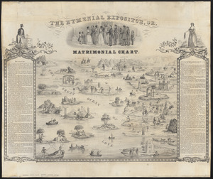
The hymenial expositor, or, matrimonial chart
22.
Ireland
23.
Italy
24.
Map of a woman's heart
25.
Map of Boston Common : with surrounding streets & adjacent parts of Beacon Hill
26.
A map of Cape Cod
27.
A map of Cape Cod
28.
A map of Concord, the old Musketaquid Plantation
29.
A map of New York which is published by the Washington Square Bookshop
30.
Map of Scituate Rhode Island
31.
A map of the Bermuda Islands : ya des demonios, isles of the devils
32.
Map of the island of Tangerina and Wild Island
33.
Mercator map of the world united : a pictorial history of transport and communications and paths to permanent peace
34.
The new map of the world
35.
Peoples of the Pacific
36.
A pictorial stamp map of navigation and exploration
37.
Prussia
38.
Racing routes of the Yankee clippers
39.
Russia
40.
Scotland
41.
Spain & Portugal
42.
The story map of flying : being a chronicle of man's conquest of the air
43.
A Texan's map of the United States [of Texas]
44.
Total war battle map
45.
The townships of Dedham, Westwood, Needham, Dover, Sherborn, Norwood, Medfield, Millis, Walpole, Norfolk, Massachusetts
46.
Wales
47.
World freedom : a factual & pictorial map
48.
World wonders : a pictorial map
49.
2005 significant U.S. hurricane strikes
50.
The 2100 project : an atlas for the Green New Deal
51.
38,000,000 escaped -- 10,000,000 died
52.
Abolition of Slavery, 1863
53.
Aboriginal map of North America, denoting the boundaries and the locations of various Indian tribes
54.
The adventures of Mark Twain
55.
Alden's pictorial map of the United States of North America
56.
Alien and Sedition Acts, February 25, 1799, Votes on resolutions for repeal
57.
America : beauty, wonders, inspiration, progress, without end
58.
America the wonderland : a pictorial map of the United States
59.
American explorations in the West, 1803-1852
60.
Amérique Septentrionale
61.
Appletons' railway map of the United States and Canada
62.
Appletons' railway map of the United States and the Canadas : representing railways in actual operation, and those in the...
63.
Armour food source map
64.
Base-map of the United States
65.
Being a map of the United States in the year 1831 when the Country Gentleman first made its appearance as the Genesee Farmer
66.
Broadway of America an all year ... all weather comfortable route from coast to coast
67.
Carte des Etats-Unis
68.
Carte des Etats-Unis de l'Amérique-Nord : pour servir aux observations géologiqueir
69.
Carte générale des États-Unis de l'Amérique avec les plans des principales villes
70.
Case's map of the United States, the British provinces, Mexico, and part of the West Indies : compiled from the latest...
71.
Catholic America : a pictorial map portraying the contribution of Catholics in the development of the United States of America...
72.
Clemens' silent teacher, dissected map of the United States and of each state in counties
73.
Colton's general map of the United States : showing the railroad routes across the continent
74.
Colton's map of the United States of America, the British provinces, Mexico and the West Indies : showing the country from the...
75.
Colton's new railroad map of the United States & Canada
76.
Colton's plans of U.S. harbors : showing the position & vicinities of the most important fortifications on the sea-board and in...
77.
Complete map of the rail roads and water courses in the United States & Canada
78.
Compromise of 1850, September 6, 1850, vote on passage of Texas-New Mexico provisions
79.
Density of population, 1790
80.
Density of population, 1800
81.
Density of population, 1810
82.
Density of population, 1820
83.
Density of population, 1830
84.
Density of population, 1840
85.
Density of population, 1850
86.
Density of population, 1860
87.
Density of population, 1870
88.
Density of population, 1880
89.
Density of population, 1890
90.
Density of population, 1900
91.
Density of population, 1910
92.
Density of population, 1920
93.
Diagram of the United States of America, Mexico, the West India Islands and Isthmus of Darien : showing proposed routes of the...
94.
Dinsmore's complete map of the railroads & canals in the United States & Canada
95.
Dinsmore's complete map of the railroads & canals in the United States & Canada
96.
Dinsmore's new railroad map of the United States and the Canadas, showing all the railroads completed and in progress,...
97.
Disturnell's new map of the United States and Canada showing all the canals, rail roads, telegraph lines and principal stage...
98.
The Dominion of Canada from the latest surveys and data
99.
The eagle map of the United States
100.
Election map of the United States with 49 novel diagrams
‹ Prev
Next ›
1
2
3
4
5
…
82
83


![A Texan's map of the United States [of Texas]](https://bpldcassets.blob.core.windows.net/derivatives/images/commonwealth:fn107c388/image_thumbnail_300.jpg)


