Landing facilities and proposed airway system in the United States, 1924
Item Information
- Title:
- Landing facilities and proposed airway system in the United States, 1924
- Cartographer:
- United States. Army. Air Service
- Publisher:
- United States. Army. Engineer Reproduction Plant
- Name on Item:
-
compiled and published by the Airways Section of the Training and War Plans Division, Office Chief of Air Service
- Date:
-
1924
- Format:
-
Maps/Atlases
- Location:
-
Boston Public Library
Norman B. Leventhal Map & Education Center - Collection (local):
-
Norman B. Leventhal Map & Education Center Collection
- Subjects:
-
Airports--United States--Maps
Airways--United States--Maps
- Places:
-
United States
- Extent:
- 1 map : color ; on sheet 77 x 113 cm
- Terms of Use:
-
No known copyright restrictions.
No known restrictions on use.
- Publisher:
-
Washington, D.C. :
Army Air Service
- Scale:
-
Scale ca. 1:4,000,000. 1 in. = 63 miles
- Language:
-
English
- Notes:
-
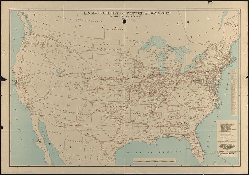
Shows government or Army landing fields, Navy or Marine landing fields, aerial mail landing fields, municipal landing fields, commercial landing fields, emergency or unimproved landing fields, seaplane landing sites, and the routes of the proposed airway system.
Includes index of 76 landing fields.
"4894."
- Identifier:
-
06_01_017011
- Call #:
-
G3701.P61 1924 .U55
- Barcode:
-
39999065657981


