Map of Scituate Rhode Island
Item Information
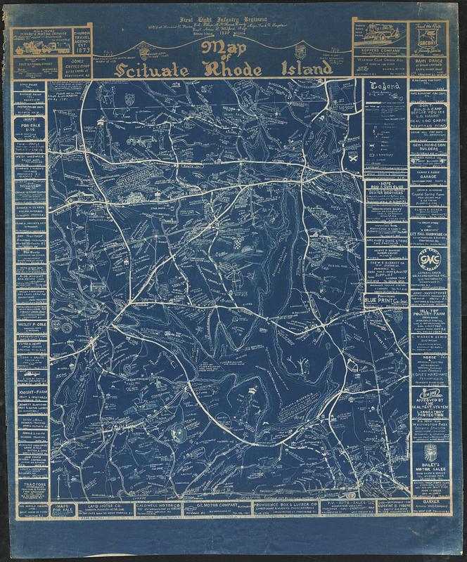
- Title:
- Map of Scituate Rhode Island
- Cartographer:
- Matteson, George Everett
- Printer:
- Providence Blue Print Company
- Name on Item:
-
surveyed, drawn & compiled 1939 by Captain George E. Matteson, First Light Infantry Regiment R.I.M.
- Date:
-
(c) 1939
- Format:
-
Maps/Atlases
- Location:
-
Boston Public Library
Norman B. Leventhal Map & Education Center - Collection (local):
-
Norman B. Leventhal Map & Education Center Collection
- Subjects:
-
Scituate (R.I. : Town)--Maps
Blueprints
Pictorial maps
- Places:
-
Rhode IslandProvidence (county)Scituate
- Extent:
- 1 map : blueprint ; 96 x 82 cm, on sheet 126 x 104 cm
- Terms of Use:
-
No known copyright restrictions.
No known restrictions on use.
- Publisher:
-
Providence :
Providence Blue Print Co., Inc.
- Language:
-
English
- Notes:
-
Pictorial map with illustrations and notes about historical and current events and activities.
Relief shown by form lines.
Includes advertisements for local businesses.
- Identifier:
-
06_01_017030
- Call #:
-
G3774.S4A5 1939 .M38
- Barcode:
-
39999085952859


