Boston kids count


Item Information
- Title:
- Boston kids count
- Artist:
- Raúl the Third, 1976-
- Colorist:
- Bay, Elaine, 1976-
- Copyright holder:
- Boston Public Library. Norman B. Leventhal Map and Education Center
- Name on Item:
-
by Raúl the Third & Elaine Bay
- Date:
-
2020
- Format:
-
Maps/Atlases
- Location:
-
Boston Public Library
Norman B. Leventhal Map & Education Center - Collection (local):
-
Norman B. Leventhal Map & Education Center Collection
- Subjects:
-
Pictorial maps
Children--Massachusetts--Boston--Maps
- Places:
-
MassachusettsSuffolk (county)Boston
- Extent:
- 1 map : color
- Terms of Use:
-
(c) Norman B. Leventhal Map & Education Center at the Boston Public Library
This work is licensed for use under a Creative Commons Attribution Non-Commercial License (CC BY-NC).

- Place of origin:
-
[Boston, Massachusetts]
- Language:
-
English
- Notes:
-
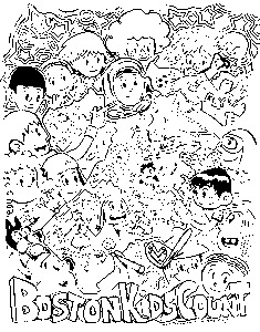
Caricature map of children in Boston, with illustrations of children and features of areas.
Color indicates the number of children under 18 as percent of total population, by census tract.
Data from ACS 2018 (5 yr. estimates).
- Notes (exhibitions):
-
Exhibited: "Bending lines: maps and data from distortion to deception," organized by the Norman B. Leventhal Map & Education Center at the Boston Public Library, 2020-2021.
- Identifier:
-
BostonKidsCount-MAP


