Toggle navigation
LMEC Home
Exhibitions
Georeferencing
Tools for Teachers
Collections
My Favorites
Sign Up / Log In
Search
Search the map portal
Map Collection
Map Collection
Map Sets
Search
Search
Search for
Search In
All Fields
Creator
Title
Subject
Place
Search All Digital Collections
Advanced Search
8695 Results
My Search
Start Over
More Like
commonwealth:rr173g25m
Remove constraint More Like: commonwealth:rr173g25m
Filter your Search
Place
North and Central America
5,926
United States
4,844
Massachusetts
2,078
Europe
1,396
Suffolk (county)
1,046
Boston
1,019
Canada
449
Asia
438
more
Place
»
Topic
Boston (Mass.)--Maps
587
United States--Maps
282
Real property--Massachusetts--Boston--Maps
175
Massachusetts--Maps
162
Landowners--Massachusetts--Boston--Maps
133
North America--Maps--Early works to 1800
103
New England--Maps
102
Europe--Maps
79
more
Topic
»
Date
Date range begin
–
Date range end
Current results range from
1482
to
2023
View distribution
Creator
United States. Hydrographic Office
595
O.H. Bailey & Co
148
Des Barres, Joseph F. W. (Joseph Frederick Wallet), 1722-1824
123
United States. Post Office Dept
120
Ptolemy, 2nd cent
100
Walling, Henry Francis, 1825-1888
94
Geological Survey (U.S.)
86
Jefferys, Thomas, -1771
85
more
Creator
»
Format
Maps/Atlases
8,635
Manuscripts
215
Prints
56
Books
36
Objects/Artifacts
10
Drawings/Illustrations
8
Posters
5
Georeferenced
Yes
869
No
7,826
Collection
Norman B. Leventhal Map & Education Center Collection
8,694
Boston and New England Maps
2,233
Urban Maps
2,024
Maritime Charts and Atlases
1,083
American Revolutionary War-Era Maps
616
Boston Redevelopment Authority Collection
88
Available to use
No known restrictions
8,554
Creative Commons license
46
Search Constraints
Sort by relevance
relevance
title
date (asc)
date (desc)
Number of results to display per page
20 per page
10
per page
20
per page
50
per page
100
per page
View results as:
grid view
map view
Search Results
1.
19th annual convention of the National Association of Real Estate Boards : at Tulsa, June 7 to June 11 in 1926
2.
Acapulco, México
3.
Being a cartograph of Ohio : the oldest state west of the thirteen original colonies; now the fourth state in the Union in...
4.
Bird's eye view of the city of Holyoke, and village of South Hadley Falls, Mass. looking north
5.
The Commonwealth of Connecticut
6.
Denmark
7.
A descriptive map of the region within one hundred miles of the capital of the United States : portraying the principal events...
8.
England
9.
France
10.
Germany
11.
Historical map of Watertown, 1630-1930
12.
Holland and Belgium
13.
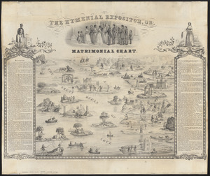
The hymenial expositor, or, matrimonial chart
14.
Ireland
15.
Italy
16.
Map of a woman's heart
17.
Map of Boston Common : with surrounding streets & adjacent parts of Beacon Hill
18.
A map of Cape Cod
19.
A map of Cape Cod
20.
A map of Concord, the old Musketaquid Plantation
‹ Prev
Next ›
1
2
3
4
5
…
434
435