A map of Cape Cod
Item Information
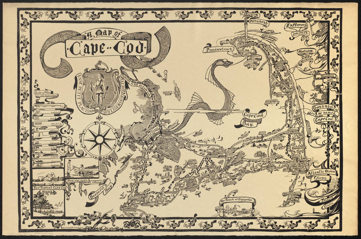
- Title:
- A map of Cape Cod
- Cartographer:
- Leonard, Mélanie Elizabeth, 1868-1933
- Donor:
- Leonard, Jonathan Norton, 1903-1975
- Name on Item:
-
Mélanie Elisabeth Leonard fecit ; [text by Jonathan Norton Leonard]
- Date:
-
1926
- Format:
-
Maps/Atlases
- Location:
-
Boston Public Library
Norman B. Leventhal Map & Education Center - Collection (local):
-
Norman B. Leventhal Map & Education Center Collection
- Subjects:
-
Cape Cod (Mass.)--Maps
Pictorial maps
- Places:
-
MassachusettsBarnstable (county)Cape Cod (area)
- Extent:
- 1 map : col. ; 53 x 81 cm.
- Terms of Use:
-
No known copyright restrictions.
No known restrictions on use.
- Publisher:
-
[Sandwich, Mass.] :
Mélanie Elisabeth Leonard
- Scale:
-
Scale [ca. 1:67,500]
- Language:
-
English
- Notes:
-
2 hand-colored copies and 1 uncolored copy gift of Eugenie and Jonathan A. Shaw, grandson of Melanie Elisabeth (Norton) Leonard.
Relief shown pictorially.
Insets: Two typical Cape Cod houses -- "Them ain't clams, them's cohawgs!" -- The beach at Craigville.
Text by Jonathan Nortan Leonard, according to Leonard family archives.
Enclosed in border illustrated with cod fish; decorative title cartouche and coat-of-arms with slogan, "Ense petit placidam sublibertate quie tem."
Available also through the Norman B. Leventhal Map Center website as a raster image.
- Identifier:
-
06_01_016736
- Call #:
-
G3762.C35A5 1926 .L4
- Barcode:
-
39999065696187


