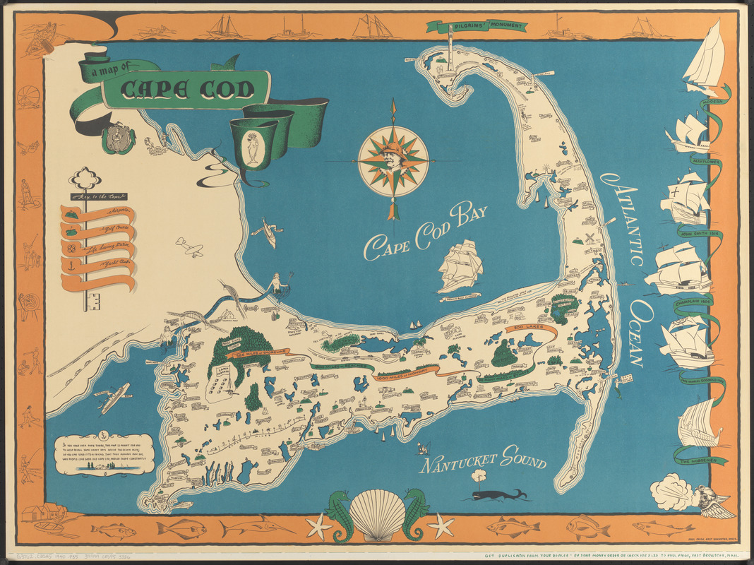
A map of Cape Cod
Item Information
- Title:
- A map of Cape Cod
- Cartographer:
- Paige, Paul
- Name on Item:
-
Paul Paige
- Date:
-
[ca. 1940]
- Format:
-
Maps/Atlases
- Location:
-
Boston Public Library
Norman B. Leventhal Map & Education Center - Collection (local):
-
Norman B. Leventhal Map & Education Center Collection
- Subjects:
-
Cape Cod (Mass.)--Maps
Pictorial maps
- Places:
-
MassachusettsBarnstable (county)Cape Cod (area)
- Extent:
- 1 map : color ; 66 x 90 cm
- Terms of Use:
-
No known copyright restrictions.
No known restrictions on use.
- Publisher:
-
East Brewster :
Paul Paige
- Scale:
-
Not drawn to scale
- Language:
-
English
- Notes:
-
Pictorial map.
Indicates airports, golf courses, life saving stations, and yacht clubs.
Includes notes and illustrations of activities, ships, mermaids and a whale.
Decorative border depicting activities on the Cape, fish, ships, and a windhead.
Compass includes illustration of a man wearing a hat.
- Identifier:
-
06_01_016833
- Call #:
-
G3762.C35A5 1940 .P35
- Barcode:
-
39999085953386


