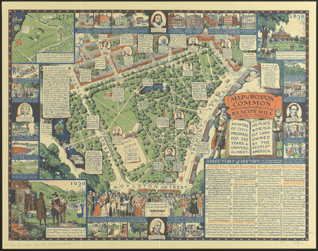
Map of Boston Common : with surrounding streets & adjacent parts of Beacon Hill
Item Information
- Title:
- Map of Boston Common : with surrounding streets & adjacent parts of Beacon Hill
- Cartographer:
- Tyng, Griswold
- Publisher:
- Little, Brown and Company
- Name on Item:
-
designed by Griswold Tyng
- Date:
-
[1934]
- Format:
-
Maps/Atlases
- Location:
-
Boston Public Library
Norman B. Leventhal Map & Education Center - Collection (local):
-
Norman B. Leventhal Map & Education Center Collection
- Subjects:
-
Parks--Massachusetts--Boston--Maps
Boston Common (Boston, Mass.)--History--Maps
Boston (Mass.)--Maps
Pictorial maps
- Places:
-
MassachusettsSuffolk (county)Boston
- Extent:
- 1 map : col. ; 51 x 68 cm., folded in envelope 30 x 21 cm.
- Terms of Use:
-
No known copyright restrictions.
No known restrictions on use.
- Publisher:
-
[Boston] :
Little, Brown, & Co.
- Scale:
-
Scale [ca. 1:1,800]
- Language:
-
English
- Notes:
-
Pictorial map showing buildings and points of interest.
"A centre of civic progress for 300 years - a universal meeting place & the oldest land owned by the people in America."
Illustrated with historic scenes in margins.
Includes directory of historic sites and existing points of interest.
Envelope shows a section of the map.
Date of publication from copyright registration.
- Notes (date):
-
This date is inferred.
- Identifier:
-
06_01_016819
- Call #:
-
G3764.B6:2B2A5 1934 .T96
- Barcode:
-
39999065651596


