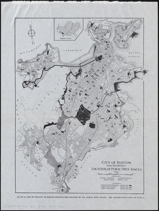
Location of public open spaces
Item Information
- Title:
- Location of public open spaces
- Title (alt.):
-
Map of the city of Boston showing the location of all public open spaces
- Publisher:
- Boston (Mass.). Department of Parks
- Compiler:
- Shurcliff, Arthur A. (Arthur Asahel), 1870-1957
- Name on Item:
-
City of Boston Park Department ; compiled by Arthur A. Shurtleff
- Date:
-
[1925]
- Format:
-
Maps/Atlases
- Location:
-
Boston Public Library
Norman B. Leventhal Map & Education Center - Collection (local):
-
Norman B. Leventhal Map & Education Center Collection
- Subjects:
-
Boston (Mass.)--Maps
Parks--Massachusetts--Boston--Maps
Cemeteries--Massachusetts--Boston--Maps
- Places:
-
MassachusettsSuffolk (county)Boston
- Extent:
- 1 map ; 33 x 25 cm
- Terms of Use:
-
No known copyright restrictions.
No known restrictions on use.
- Publisher:
-
[Boston] :
[Park Department]
- Scale:
-
Scale approximately 1:55,000
- Language:
-
English
- Notes:
-
Shows parks of city of Boston, parks of met. district and large cemeteries.
From Special report 1925 / City of Boston Park Department.
Inset: Breeds Island.
"Plate II."
"See accompanying list on page 30."
- Notes (date):
-
This date is inferred.
- Identifier:
-
06_01_017819
- Call #:
-
G3764.B6G5 1925 .B67
- Barcode:
-
39999085963260


