World wonders : a pictorial map
Item Information
- Title:
- World wonders : a pictorial map
- Creator:
- Chase, Ernest Dudley, 1878-
- Artist:
- Chase, Ernest Dudley, 1878-
- Cartographer:
- Chase, Ernest Dudley, 1878-
- Name on Item:
-
designed and drawn by Ernest Dudley Chase, Winchester, Mass. U.S.A.
- Date:
-
1939
- Format:
-
Maps/Atlases
- Location:
-
Boston Public Library
Norman B. Leventhal Map & Education Center - Collection (local):
-
Norman B. Leventhal Map & Education Center Collection
- Subjects:
-
World maps
Pictorial maps
- Places:
-
World
- Extent:
- 1 map : color ; 42 x 60 cm
- Terms of Use:
-
No known copyright restrictions.
No known restrictions on use.
- Publisher:
-
Winchester, Mass. :
Ernest Dudley Chase
- Scale:
-
Scale not given
- Projection:
- Mercator projection
- Language:
-
English
- Notes:
-
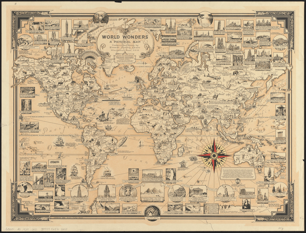
Contains text and images on the maps and in framed images.
Shows famous tourist sites, natural and man-made features, first discoverer's ships with notes, and more.
"In 1959 the famous Flemish Mathemetician and Geographer, Gerardus Mercator (Gerhard Kremer) issued the first World map in this method of projection."
Includes decorative border, numerous illustrations and historical notes, and text within a box that begins "The greatest Wonder of the World is the earth itself..."
- Identifier:
-
06_01_014709
- Call #:
-
G3201.A5 1939 .C43
- Barcode:
-
39999065705848


