Toggle navigation
LMEC Home
Exhibitions
Georeferencing
Tools for Teachers
Collections
My Favorites
Sign Up / Log In
Search
Search the map portal
Map Collection
Map Collection
Map Sets
Search
Search
Search for
Search In
All Fields
Creator
Title
Subject
Place
Search All Digital Collections
Advanced Search
161 Results
My Search
Start Over
1876
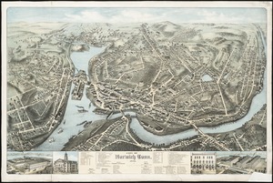
Remove constraint 1876
Filter your Search
Place
North and Central America
115
United States
99
Massachusetts
43
South America
21
Suffolk (county)
19
Boston
17
Chile
12
Europe
12
more
Place
»
Topic
Coasts--Chile--Maps
11
Long Trail (Vt.)--Maps
9
Trails--Vermont--Maps
9
Boston (Mass.)--Maps
8
Hiking--Vermont--Maps
5
Gettysburg (Pa.)--Maps
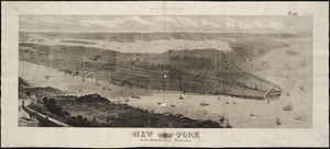
4
Gettysburg, Battle of, Gettysburg, Pa., 1863--Maps
4
Hiking--Vermont--Long Trail--Maps
4
more
Topic
»
Date
Date range begin
–
Date range end
Current results range from
1760
to
1932
View distribution
Creator
United States. Hydrographic Office
50
Boston (Mass.). Park Commissioners
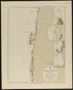
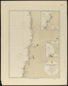
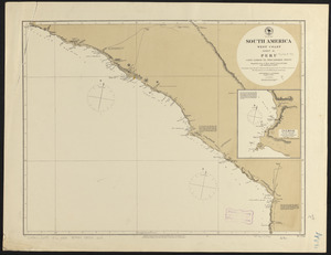
9
Congdon, Herbert Wheaton, 1876-1965
9
Campbell-Copeland, T. (Thomas)
7
Harper & Brothers
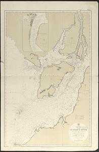
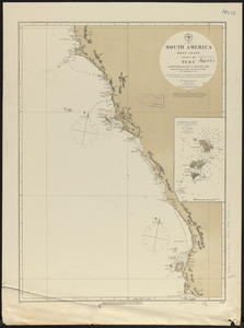
7
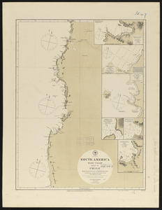
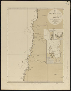
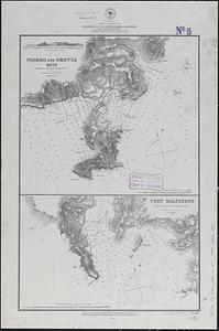
Bailey, H. H. (Howard Heston), 1836-1878
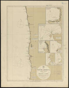
6
O.H. Bailey & Co
6
Bachelder, John B. (John Badger), 1825-1894
4
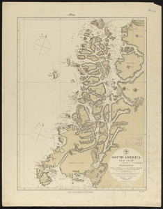
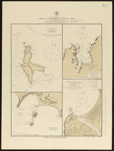
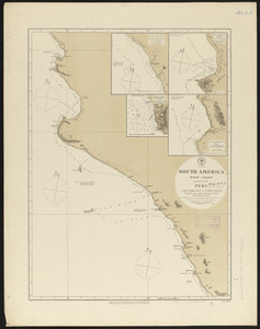
more
Creator
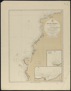
»
Format
Maps/Atlases
159
Manuscripts
3
Books
2
Ephemera
1
Georeferenced
Yes
14
No
147
Collection
Norman B. Leventhal Map & Education Center Collection
157
Boston and New England Maps
52
Maritime Charts and Atlases
52
Urban Maps
48
American Revolutionary War-Era Maps
2
David Judkins Weaver Papers
1
Library of Congress Collection
1
MacLean Collection Map Library
1
more
Collection
»
Available to use
No known restrictions
156
Creative Commons license
2
Search Constraints
Sort by date (asc)
relevance
title
date (asc)
date (desc)
Number of results to display per page
100 per page
10
per page
20
per page
50
per page
100
per page
View results as:
grid view
map view
Search Results
1.
A Sketch of the harbour of Port Francoise on the Island of Hispaniola
2.
The United States of America with the British possessions of Canada, Nova Scotia, New Brunwsick, and Newfoundland, divided with...
3.
Plan of Sheffield made by Chester Owen, dated 1830
4.
Canal du Cap-Cod : plan général du tracé du canal
5.
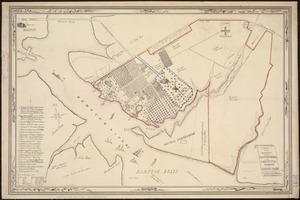
Boston
6.
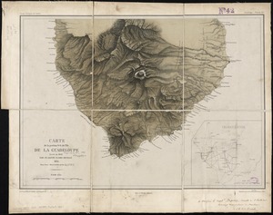
Carte de la portion S.O de l'ile de la Guadeloupe : levée en 1842
7.
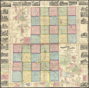
Map of the counties of Washtenaw and Lenawee, Michigan
8.
The Great Bahama Bank, from Old Bahama Channel to Exuma
9.
Map[s] illustrating the military operations of the Atlanta campaign ... 1864
10.
Africa, north coast, Strait of Gibraltar, Ceuta anchorages and approaches : from the French surveys 1855, corrected to 1876
11.
Atlas of Norfolk County Mass. : from recent and actual surveys & records
12.
Back Bay and Parker Hill parks : Parker Hill and Jamaica parkways : Boston and Roxbury districts
13.
Baltic Sea : additional plans to chart no. 293
14.
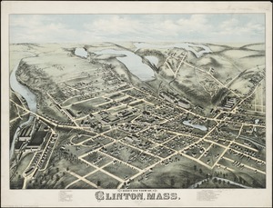
Bird's eye view of Clinton, Mass : 1876
15.
Birds eye view of Lowell, Mass : 1876
16.
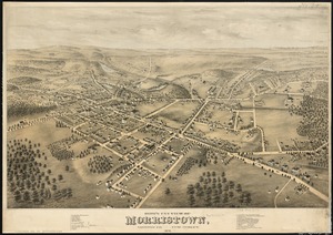
Bird's eye view of Morristown, Morris Co., New Jersey : 1876
17.
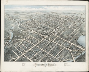
Bird's eye view of Pittsfield, Mass : 1876
18.
Bird's eye view of the city of Portland, Maine, 1876
19.
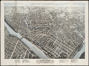
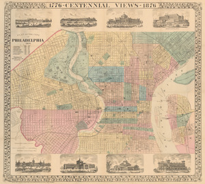
Bird's-eye view of the city of Philadelphia : its streets, avenues, and public buildings--and of the Centennial buildings in...
20.
Birmingham, Conn : 1876
21.
Brattleboro, Vt : 1876
22.
Brighton park : Brighton district
23.
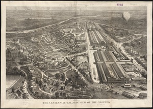
The Centennial-balloon view of the grounds
24.
Charles River embankment : Boston district
25.
Chart of Jamaica Pond and plan of surroundings
26.
Chicopee River
27.
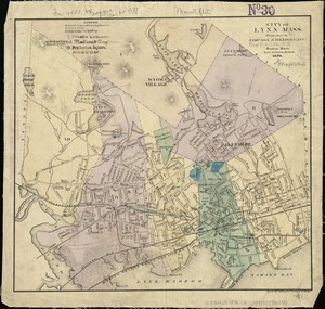
City of Lynn, Mass
28.
City of Norwich, Conn : 1876
29.
County atlas of Berkshire Massachusetts
30.
Eldridge's chart no. 10 : Buzzard's Bay
31.
[Fort Moultrie, Charlestown, South Carolina]
32.
France, north west coast : from the Pilote Français 1823 ; republication of Brit. Admty. chart no. 2644, corrected to 1876
33.
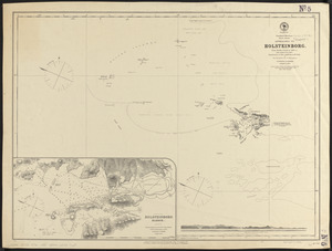
Greenland, west coast, Davis Strait, approaches to Holsteinborg : from British surveys of 1853-4, with additions to 1875
34.
Haverhill, Mass : 1876
35.
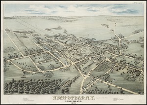
Hempstead, N.Y : Long Island, 1876
36.
Index map showing the principal river basins within the state of Massachusetts
37.
Jamaica Park and Bussey Farm Parkway : West Roxbury district
38.
Japan, harbors in Kii Channel and Isumi Strait : from British surveys in 1861 with auditions in 1866-7 ; republication of Brit....
39.
Japan, south coast of Nipon, Kii Channel to Owasi Bay : from Brit. surveys in 1874 ; republication of Brit. Admty. chart no. 951
40.
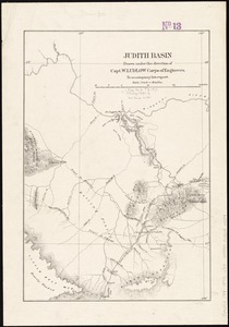
Judith Basin
41.
Lawrence, Mass : 1876
42.
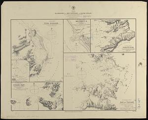
Makatea or Aurora Island, Paumotu Group ; Taweree or St. Simeon or Resolution Island, Paumotu Group ; Takurea or Wolconsky...
43.
Manchester, N.H : 1876
44.
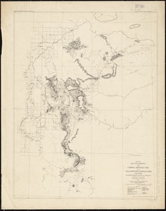
Map of a reconnaissance from Carroll Montana Ter. to the Yellowstone National Park and return by Captain William Ludlow, Corps...
45.
Map of Boston 1876 : from the latest surveys
46.
Map of Boston, for 1876
47.
Map of North America : to illustrate facts of geographical distribution
48.
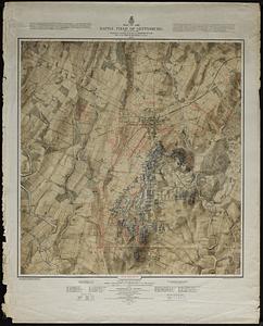
Map of the battle field of Gettysburg : July 1st, 2nd, 3rd, 1863
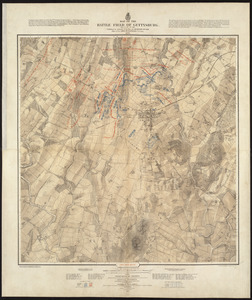
49.
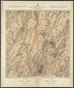
Map of the battle field of Gettysburg, July 1st, 2nd, 3rd, 1863 : Second day's battle
50.
Map of the battle field of Gettysburg, July 1st, 2nd, 3rd, 1863 : Third day's battle
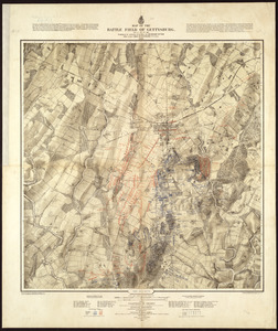
51.
Map of the battle field of Gettysburg, July 1st, 2nd, 3rd, 1863 : First day's battle
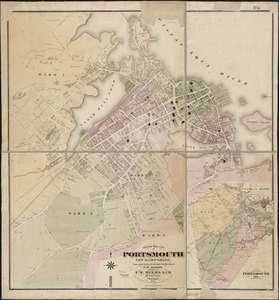
52.
Map of the city of Portsmouth New Hampshire
53.
Map of the South Mountain and Boston Railroad & connections showing territory passed through, rail-roads and canals crossed or...
54.
[Map] of the state of Massachusetts
55.
Map of Virginia and West Va., North and part of South Carolina, Maryland and Delaware, showing the situation in these states of...
56.
Map showing horse rail roads and the surface steam roads with 104 stations in and around Boston : including 91 surface steam...
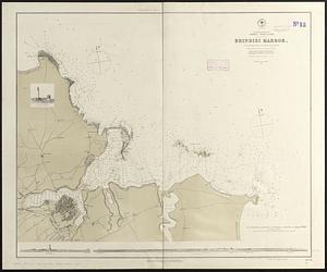
57.
Mediterranean Sea, Adriatic--coast of Italy, Brindisi Harbor : from an Italian survey in 1872, corrected to 1876 ;...
58.
Mediterranean Sea, harbors on the south coast of Sardinia : from a British survey in 1865 ; republished from British Admiralty...
59.
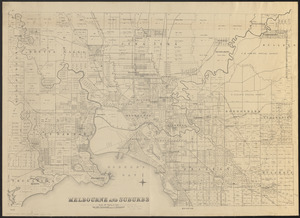
Melbourne and suburbs
60.
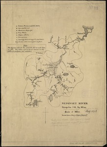
Neponset River
61.
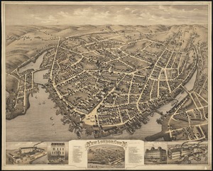
New London, Conn : 1876
62.
New York : From Bergen Hill, Hoboken
63.
New Zealand, North Island - east coast, Auckland Hr. and approaches : from British surveys in 1849-55 ; republication of Brit....
64.
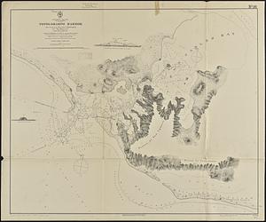
Newfoundland, east coast, Orange Bay or Great Harbor Deep : from a French survey in 1870
65.
North America, east coast, anchorages on the n.e. coast of Labrador : republication of Brit. Admty. chart no. 225
66.
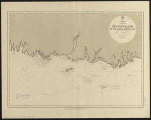
North America, south coast of Newfoundland : Devil Bay to Knife Bay : from a British survey in 1872 & 1873 ; republication of...
67.
North America, west coast, Gulf of California, Topolobampo Harbor : from a survey by the officers of the U.S. Ship...
68.
[Notice for] View of Dedham
69.
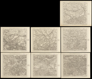
Part of Turkey in Europe
70.
Plan of burnt district by fire of Nov. 9th and 10th, 1872 : showing street improvements as adopted by Board of Street...
71.
Plan of Mayflower Park situated in the town of Braintree owned by the Braintree Land Associates
72.
Plan of the city of Philadelphia
73.
[Plan of the cove between Savin Hill and Commercial Point, Dorchester]
74.
A plan of the property of the Hampton Normal and Agricultural Institute at Hampton Virginia
75.
Proposed parks and parkways
76.
Proposed route of the Boston and Mystic Valley railroad
77.
Scattergood's map of sixteen miles around Philadelphia
78.
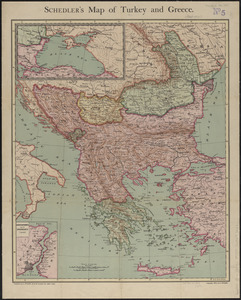
Schedler's map of Turkey and Greece
79.
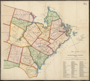
Sea coast of Rockingham County, N.H
80.
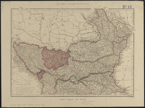
The seat of war
81.
Sketch map of New South Wales showing the localities of the principal minerals 1876
82.
Sketch showing arrangement for park-way with adjacent streets and building lots
83.
South America, west coast : republication of Brit. Admty. chart no. 1374, with additions to 1876
84.
South America, west coast : republication of Brit. Admty. chart no. 1277, with additions to 1876
85.
South America, west coast : republication of Brit. Admty. chart no. 1287, with additions to 1876
86.
South America, west coast : republication of Brit. Admty. chart no. 1325, with additions to 1876
87.
South America, west coast : republication of Brit. Admty. chart no. 1276, with additions to 1876
88.
South America, west coast : republication of Brit. Admty. chart no. 1282, with additions to 1876
89.
South America, west coast, Ecuador, Guayaquil River : from a British survey in 1847, corrected to 1876 ; republication of Brit....
90.
South America, west coast, ports and anchorages on the coast of Chile : special plans to chart no. 752, Santa Maria Id. &...
91.
South America, west coast, sheet 10, Bolivia and Peru, C.S. Francisco to Cape Lobos : republication of Brit. Admty. chart no....
92.
South America, west coast, sheet 11, Peru, Cape Lobos to Pescadores Point : republication of Brit. Admty. chart no. 1283, with...
93.
South America, west coast, sheet 13, Peru, Independencia Bay to Begueta : republication of Brit. Admty. chart no. 1323 with...
94.
South America, west coast, sheet 15, Peru, Chicama Riv. to Port Payta : republication of Brit. Admty. chart no. 1335, with...
95.
South America, west coast, sheet 17, Ecuador, Ayangui Pt. to Verde Pt : republication of Brit. Admty. chart no. 1814, with...
96.
South America--west coast, anchorages on the coast of Chile : special plans to chart no. 751, Mocha Island, from Brit. surveys...
97.
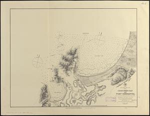
South America--west coast, Chile, Coquimbo Bay and Port Herradura : from a survey by the officers of H.B.M.S. Nassau, 1868 ;...
98.
South Bay and Savin Hill parks : Dorchester district
99.
Spain--west coast, Arosa and Pontevedra Bays : from the latest Spanish surveys : republication of Brit. Admty. chart no. 1756
100.
Special plans to chart no. 394, western shore of the Caribbean Sea : from British surveys, corrected to 1872
‹ Prev
Next ›
1
2


![Map[s] illustrating the military operations of the Atlanta campaign ... 1864](https://bpldcassets.blob.core.windows.net/derivatives/images/commonwealth:3f463432v/image_thumbnail_300.jpg)


![[Fort Moultrie, Charlestown, South Carolina]](https://bpldcassets.blob.core.windows.net/derivatives/images/commonwealth:9s161d527/image_thumbnail_300.jpg)


![[Map] of the state of Massachusetts](https://bpldcassets.blob.core.windows.net/derivatives/images/commonwealth:wd376589g/image_thumbnail_300.jpg)


![[Notice for] View of Dedham](https://bpldcassets.blob.core.windows.net/derivatives/images/commonwealth:q524nh961/image_thumbnail_300.jpg)


![[Plan of the cove between Savin Hill and Commercial Point, Dorchester]](https://bpldcassets.blob.core.windows.net/derivatives/images/commonwealth:js956k66d/image_thumbnail_300.jpg)