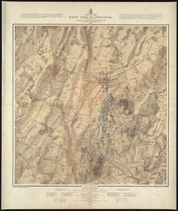
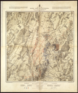
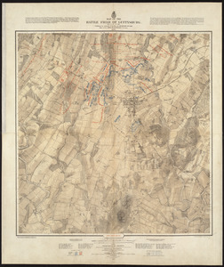
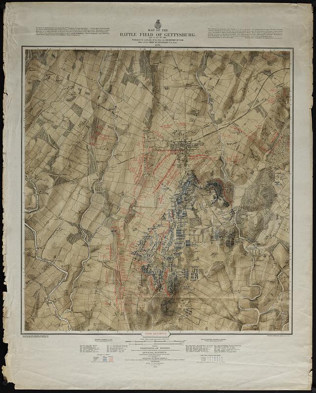
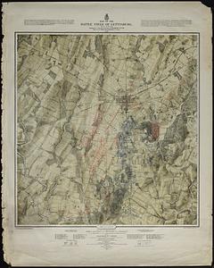
Map of the battle field of Gettysburg : July 1st, 2nd, 3rd, 1863

Item Information
- Title:
- Map of the battle field of Gettysburg : July 1st, 2nd, 3rd, 1863
- Cartographer:
- Bachelder, John B. (John Badger), 1825-1894
- Engraver:
- Bien, Julius, 1826-1909
- Engraver:
- Neumann, Louis E.
- Printer:
- Endicott & Co. (New York, N.Y.)
- Name on Item:
-
Published by authority of the Hon. the Secretary of War, office of the Chief of Engineers, U.S. Army, 1876 ; Positions of troops compiled and added for the Government by John B. Bachelder
- Date:
-
1876
- Format:
-
Maps/Atlases
- Location:
-
Boston Public Library
Norman B. Leventhal Map & Education Center - Collection (local):
-
David Judkins Weaver Papers
- Subjects:
-
Gettysburg (Pa.)--Maps
Gettysburg, Battle of, Gettysburg, Pa., 1863--Maps
- Places:
-
PennsylvaniaAdams (county)Gettysburg National Military Park
- Extent:
- 3 maps : col. ; each 72 x 69 cm, on sheets 95 x 80 cm.
- Terms of Use:
-
No known copyright restrictions.
No known restrictions on use.
- Publisher:
-
Boston :
John B. Bachelder
- Scale:
-
Scale 1:12,000.
- Language:
-
English
- Table of Contents:
-
Second day's battle
Third day's battle
- Notes:
-
Detailed topographic maps of the Gettysburg battlefield.
Drainage, vegetation, roads, railroads, fences, houses with names of residents, and a detailed plan of the town of Gettysburg is shown.
Topography engraved by Julius Bien
Positions and lettering by Louis E. Neuman
Printed by Endicott & Co.
Lacking First day's battle.
- Notes (citation):
-
LC Civil War Maps (2nd ed.), 325.
- Identifier:
-
06_01_018883A
06_01_018883B
- Call #:
-
Weaver folder 35 no.21-22