Charles River embankment : Boston district
Item Information
- Title:
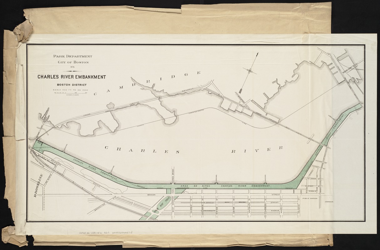
- Charles River embankment : Boston district
- Creator:
- Boston (Mass.). Park Commissioners
- Date:
-
1876
- Format:
-
Maps/Atlases
- Location:
-
Boston Public Library
Norman B. Leventhal Map & Education Center - Collection (local):
-
Norman B. Leventhal Map & Education Center Collection
- Subjects:
-
Parks--Massachusetts--Boston--Back Bay--Maps
Esplanade, Boston (Mass.)--Maps
Charles River (Mass.)--Maps
- Places:
-
MassachusettsCharles (river)
MassachusettsSuffolk (county)BostonBack Bay
- Extent:
- 1 map : col. ; 43 x 82 cm.
- Terms of Use:
-
No known copyright restrictions.
No known restrictions on use.
- Publisher:
-
Boston :
[s.n.]
- Scale:
-
Scale 1:4,800.
- Language:
-
English
- Notes:
-
Oriented with north toward the upper right.
Boston Public Library copy one attached to verso of "Plan of public library lot," by S.P. Fuller and A. Wadsworth, Boston, 1855.
- Identifier:
-
06_01_004292
- Call #:
-
G3764.B6:2E8 1876 .B67
- Barcode:
-
39999058996594
39999058996602
39999059005718


