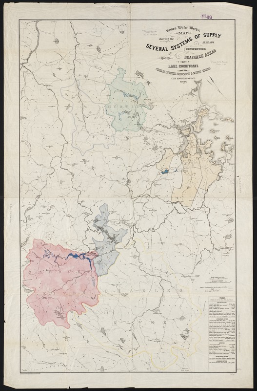
Boston water works : map showing the several sources of supply already constructed, also the drainage areas of Lake Cochituate and the Charles, Sudbury, Shawshine & Mystic Rivers
Item Information
- Title:
- Boston water works : map showing the several sources of supply already constructed, also the drainage areas of Lake Cochituate and the Charles, Sudbury, Shawshine & Mystic Rivers
- Creator:
- Boston (Mass.). Engineering Dept
- Date:
-
1878
- Format:
-
Maps/Atlases
- Location:
-
Boston Public Library
Norman B. Leventhal Map & Education Center - Collection (local):
-
Norman B. Leventhal Map & Education Center Collection
- Subjects:
-
Water-supply--Massachusetts--Boston--Maps
Boston (Mass.)--Maps
Charles River (Mass.)--Maps
Mystic River (Mass.)--Maps
Sudbury River (Mass.)--Maps
- Places:
-
MassachusettsCharles (river)
MassachusettsMystic (river)
MassachusettsSudbury (river)
- Extent:
- 1 map : col. ; 111 x 69 cm.
- Terms of Use:
-
No known copyright restrictions.
No known restrictions on use.
- Publisher:
-
Boston, Mass :
[City Engineer's Office]
- Scale:
-
Scale [1:63,360].
- Language:
-
English
- Notes:
-
Oriented with north toward the upper left.
- Identifier:
-
06_01_002678
- Call #:
-
G3764.B6N44 1878 .B6
- Barcode:
-
39999058997055


