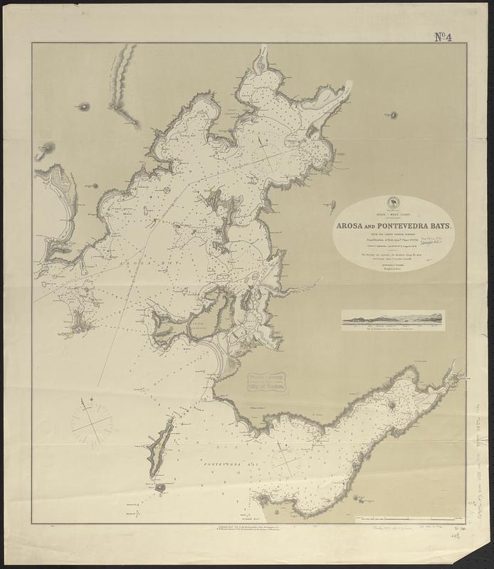
Spain--west coast, Arosa and Pontevedra Bays : from the latest Spanish surveys : republication of Brit. Admty. chart no. 1756
Item Information
- Title:
- Spain--west coast, Arosa and Pontevedra Bays : from the latest Spanish surveys : republication of Brit. Admty. chart no. 1756
- Issuing body:
- United States. Hydrographic Office
- Date:
-
1876
- Format:
-
Maps/Atlases
- Genre:
-
Nautical charts
- Location:
-
Boston Public Library
Norman B. Leventhal Map & Education Center - Collection (local):
-
Norman B. Leventhal Map & Education Center Collection
- Subjects:
-
Arosa Bay (Spain)--Maps
Pontevedra Estuary (Spain)--Maps
Coasts--Spain--Galicia (Region)--Maps
Nautical charts--Spain--Arosa Bay
Nautical charts--Spain--Pontevedra Estuary
- Places:
-
SpainGalicia (region)Arosa, Ría de (estuary)
SpainGalicia (region)Pontevedra (province)Pontevedra, Ría de (estuary)
- Extent:
- 1 map ; 71 x 63 cm
- Terms of Use:
-
No known copyright restrictions.
No known restrictions on use.
- Publisher:
-
Washington, D.C. :
Hydrographic Office
- Scale:
-
Scale approximately 1:55,000
- Language:
-
English
- Notes:
-
Relief shown by hachures and spot heights. Depths shown by soundings.
Includes coastal view of Pontevedra Bay.
- Identifier:
-
06_01_017610
- Call #:
-
G9096.P5 svar .U55 no. 710
- Barcode:
-
39999085961736


