Baltic Sea : additional plans to chart no. 293
Item Information
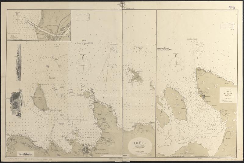
- Title:
- Baltic Sea : additional plans to chart no. 293
- Title (alt.):
-
Revel Roadstead
Port Baltic
Libau
- Issuing body:
- United States. Hydrographic Office
- Date:
-
[1876]
- Format:
-
Maps/Atlases
- Genre:
-
Nautical charts
- Location:
-
Boston Public Library
Norman B. Leventhal Map & Education Center - Collection (local):
-
Norman B. Leventhal Map & Education Center Collection
- Subjects:
-
Liepāja (Latvia)--Maps
Tallinn (Estonia)--Maps
Paldiski (Estonia)--Maps
Nautical charts--Latvia--Liepāja
Nautical charts--Estonia--Tallinn
Nautical charts--Estonia--Paldiski
- Places:
-
LatviaLibau
EstoniaHarjumaa (county)Tallin
EstoniaHarjumaa (county)Paldiski
- Extent:
- 3 maps on 1 sheet ; 60 x 94 cm
- Terms of Use:
-
No known copyright restrictions.
No known restrictions on use.
- Publisher:
-
Washington, D.C. :
Hydrographic Office
- Scale:
-
Scale approximately 1:15,300
Scale approximately 1:38,000
Scale approximately 1:71,000
- Language:
-
English
- Table of Contents:
-
Libau from a Russian survey of 1868
Gulf of Finland, Revel Roadstead, from a Russian survey of 1846 corrected to 1872
Gulf of Finland, Port Baltic or Råger Wik from a Russian survey of 1822
- Notes:
-
Relief shown by hachures. Depths shown by soundings and isolines.
Includes 4 illustrations of the coast.
Manuscript corrections and additions in red ink.
"Cor. II-76."
- Notes (date):
-
This date is inferred.
- Identifier:
-
06_01_017609
- Call #:
-
G9096.P5 svar .U55 no. 342
- Barcode:
-
39999085961728


