Boston
Item Information
- Title:
- Boston
- Description:
-
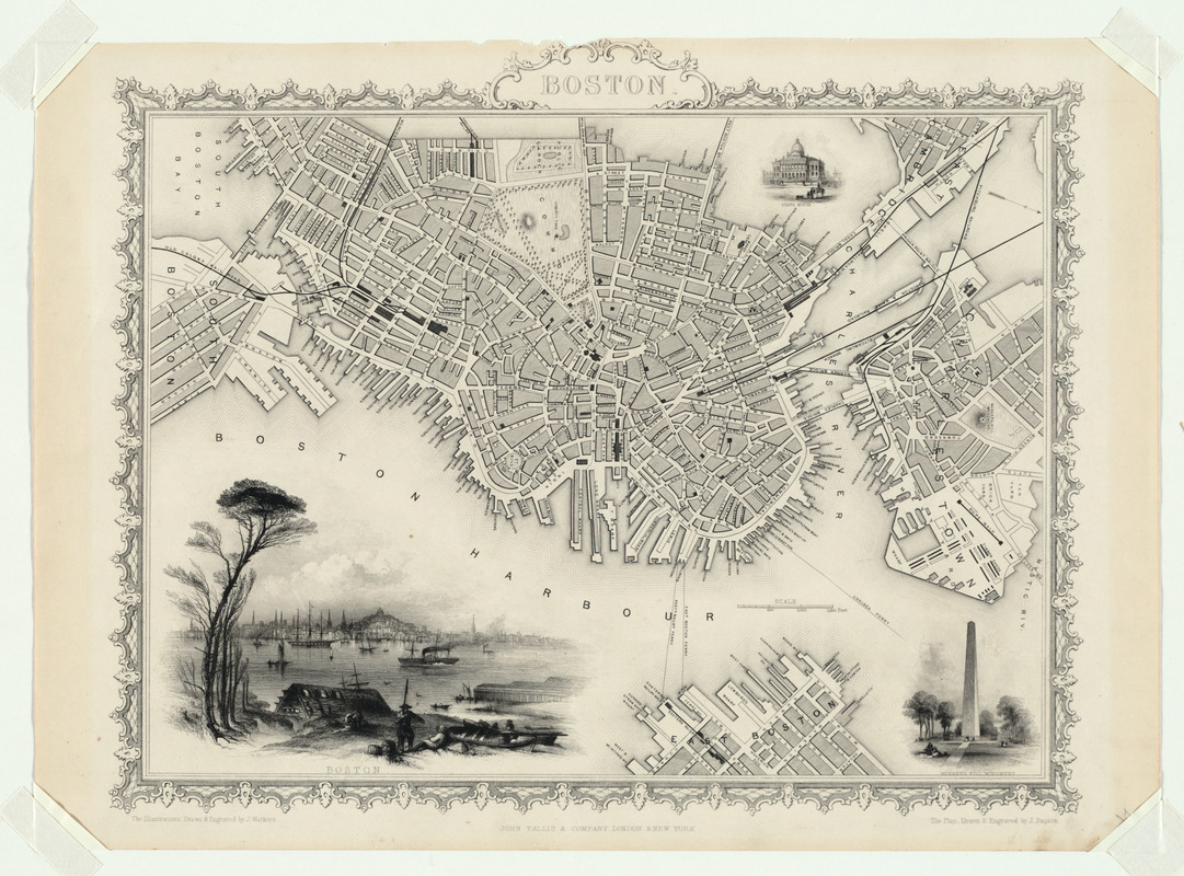
This attractively designed map focuses on Boston proper and features inset views of Boston Harbor, the State Capital building, and the Bunker Hill Monument. In addition to delineating the street pattern and identifying major public buildings, the map highlights the city's role as a transportation center by labeling the wharves along the harbor and by showing the location of railroad stations, with terminals of at least four rail lines radiating out from the city and providing access to the neighboring countryside.
- Creator:
- Tallis, John, 1817-1876
- Name on Item:
-
John Tallis ; the illustrations drawn and engraved by J. Watkins
- Date:
-
1838
- Format:
-
Maps/Atlases
- Location:
- Private Collection
- Collection (local):
-
Mapping Boston Collection
- Subjects:
-
Boston (Mass.)--Maps
- Places:
-
MassachusettsSuffolk (county)Boston
- Extent:
- 1 map ; 40 x 46 cm.
- Terms of Use:
-
No known copyright restrictions.
This work is licensed for use under a Creative Commons Attribution Non-Commercial Share Alike License (CC BY-NC-SA).

- Publisher:
-
London ; New York :
[s.n.]
- Scale:
-
Scale not given
- Language:
-
English
- Notes:
-
Relief shown by hachures.
Includes ill.
- Identifier:
-
05_04_000076
- Barcode:
-
39999052509336


