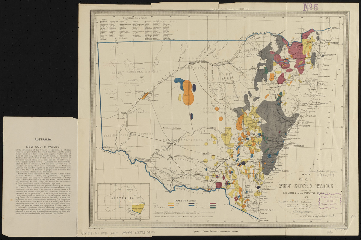
Sketch map of New South Wales showing the localities of the principal minerals 1876
Item Information
- Title:
- Sketch map of New South Wales showing the localities of the principal minerals 1876
- Title (alt.):
-
Mineral map and general statistics of New South Wales, Australia
- Publisher:
- New South Wales. Department of Mines
- Cartographer:
- Taylor, Jasper
- Engraver:
- Sharp, G. W.
- Name on Item:
-
compiled and drawn by J. Taylor ; engraved by G.W. Sharp
- Date:
-
1876
- Format:
-
Maps/Atlases
- Location:
-
Boston Public Library
Norman B. Leventhal Map Center - Collection (local):
-
Norman B. Leventhal Map Center Collection
- Subjects:
-
Mines and mineral resources--Australia--New South Wales--Maps
New South Wales--Maps
- Places:
-
AustraliaNew South Wales
- Extent:
- 1 map : color ; 35 x 42 cm, folded in cover 21 x 13 cm
- Terms of Use:
-
No known copyright restrictions.
No known restrictions on use.
- Publisher:
-
Sydney :
Thomas Richards, Government Printer
- Scale:
-
Scale approximately 1:3,168,000
- Language:
-
English
- Notes:
-
Includes location map and list of proclaimed gold fields.
Text and statistics on verso.
Text on inside of front cover.
- Identifier:
-
06_01_015410
- Call #:
-
G8971.H1 1876 .N49
- Barcode:
-
39999085936340


