Toggle navigation
LMEC Home
Exhibitions
Georeferencing
Tools for Teachers
Collections
My Favorites
Sign Up / Log In
Search
Search the map portal
Map Collection
Map Collection
Map Sets
Search
Search
Search for
Search In
All Fields
Creator
Title
Subject
Place
Search All Digital Collections
Advanced Search
13385 Results
Filter your Search
Place
North and Central America
9,353
United States
7,286
Suffolk (county)
1,664
Boston
1,621
Europe
1,035
Canada
949
Massachusetts
806
New York
534
more
Place
»
Topic
Boston (Mass.)--Maps
741
City planning--Massachusetts--Boston--Maps
418
United States--History--Revolution, 1775-1783--Maps
329
United States--Maps
315
Urban renewal--Massachusetts--Boston--Maps
254
Real property--Massachusetts--Boston--Maps
252
Massachusetts--Maps
219
Insurance surveys
197
more
Topic
»
Date
Date range begin
–
Date range end
Current results range from
1482
to
2023
View distribution
Creator
United States. Hydrographic Office
595
Boston Redevelopment Authority
403
Des Barres, Joseph F. W. (Joseph Frederick Wallet), 1722-1824
247
Royal United Services Institute for Defence and Security Studies
160
Jefferys, Thomas, -1771
154
George, III, King of Great Britain, 1738-1820
152
George, IV, King of Great Britain, 1762-1830
151
O.H. Bailey & Co
148
more
Creator
»
Format
Maps/Atlases
13,205
Manuscripts
985
Prints
102
Books
49
Drawings/Illustrations
44
Photographs
15
Objects/Artifacts
13
Documents
7
more
Format
»
Georeferenced
Yes
979
No
12,406
Collection
Norman B. Leventhal Map Center Collection
8,891
American Revolutionary War-Era Maps
3,305
Boston and New England Maps
2,804
Urban Maps
2,397
Maritime Charts and Atlases
1,150
William L. Clements Library Collection
910
Library of Congress Collection
618
Boston Redevelopment Authority Collection
475
more
Collection
»
Available to use
No known restrictions
9,952
Creative Commons license
1,677
Search Constraints
Sort by date (asc)
relevance
title
date (asc)
date (desc)
Number of results to display per page
100 per page
10
per page
20
per page
50
per page
100
per page
View results as:
grid view
map view
Search Results
13001.
Charlestown urban renewal area project no. Mass. R-55 Boston - Suffolk County - Massachusetts delivery parcel plan : parcel...
13002.
The good things in life belong to all of us, let's protect them
13003.
Illustrative re-use site plan for the regional core
13004.
Metropolitan Boston transportation map : subway, bus, rail
13005.
Park Plaza building study stage environmental impact analysis : environmental base : sanitary sewerage and storm drainage
13006.
Plan of Lafayette Mall (Boston Common)
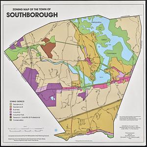
13007.
Wards & precincts
13008.
Contract documents for the Waterfront Park, Boston, Massachusetts : planting plan
13009.
Boston Common Brewer Fountain - exist. conditions, demolition plan and site plan for comfort station area
13010.
The 1976 proposed regional open space plan
13011.
Boston urban wilds
13012.
General and zoning map for town of Wakefield Mass.
13013.
Metropolitan Boston transportation map : subway, bus, rail
13014.
Metropolitan Boston transportation map : subway, bus, rail
13015.
Metropolitan Boston transportation map : subway, bus, rail
13016.
Port facilities at Boston, MA
13017.
Resources on Georges Bank and Nantucket Shoals
13018.
Resources on Georges Bank and Nantucket Shoals
13019.
Revere, Sales Creek - flood control study
13020.
Transportation map of New York
13021.
Park Plaza : illustrative site plan
13022.
Park Plaza : illustrative site plan showing alternate apartment building configuration
13023.
Adams Nervine Asylum
13024.
Boston urban wilds : geology
13025.
Boston urban wilds : ownership
13026.
Boston urban wilds inventory
13027.
Dot matrix printouts of Landsat satellite images
13028.
Massachusetts coastal zone management program : volume 1, summary map
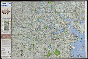
13029.
MBTA map : 1977-1978
13030.
Metropolitan Boston transportation map : subway, bus, rail
13031.
Park Plaza urban renewal area : map no. 3 land acquisition map
13032.
Boylston Street : Fenway to Massachusetts Avenue
13033.
Free 1978 Boston bikemap : featuring an illustrated guide to commuting & recreation
13034.
Major transportation system : Boston region MAPC area
13035.
Parcel 13 rehabilitation
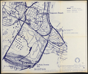
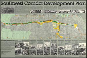
13036.
Park Plaza traffic improvements & grade level controls
13037.
Roxbury
13038.
Selected hurricanes affecting the southern United States 1954-1977
13039.
T system map : 1978-1979
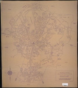
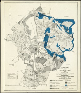
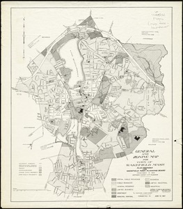
13040.
Wakefield, Massachusetts
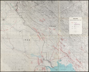
13041.
Park Plaza urban renewal area : map no. 6 land disposal map
13042.
South End urban renewal area project Mass. r-56 : site preparation contract no. 16 street lighting and drainage
13043.
Boston Harbor : challenges and opportunities for the 1980's
13044.
China
13045.
Major thoroughfare system, city of Boston, July 1979
13046.
New Orleans
13047.
Nuclear America
13048.
Southwest corridor development plan
13049.
T 1980 system map
13050.
Waterfront project, Pierhead Line, Boston, Mass.
13051.
Acapulco, México
13052.
Aerial photo of Charlestown, Massachusetts
13053.
Allston-Brighton open space plan site inventory
13054.
Appleton St. Woonerf
13055.
Boston City Hall ninth floor plan
13056.
Boston University buildings
13057.
Columbia Point development study
13058.
Egleston Square improvement program
13059.
Forest Hills improvement area
13060.
Historical map of the Emerald Necklace
13061.
Iraq-Iran, central and southern border areas
13062.
A land ownership map for the Longwood Medical Area as of January 1980
13063.
Metropolitan District Commission combined sewer overflow project Dorchester Bay area
13064.
Neighborhood and census tract boundaries 1980
13065.
Outline map and view of the Prudential Center area
13066.
Parcel 22
13067.
Plan of Longwood Medical Area and Mission Hill
13068.
Portsmouth Harbor to Boston Harbor
13069.
Printer test page
13070.
Topographic map of Boston, Mass.
13071.
Views of the area around Dudley Station in Roxbury
13072.
A cidade de Angra na ilha de Iesu xpō da Tercera que esta em 39. graos
13073.
City of Boston
13074.
General and zoning map for town of Wakefield Mass.
13075.
New England fishery, recreation and scenic resources
13076.
Zoning districts, city of Boston
13077.
Off-street parking inventory within Boston proper
13078.
Parcel D-10
13079.
Boston city map & guide to the Freedom Trail & national historical park
13080.
Boston public schools and districts : and school attendance areas
13081.
The county of Essex, Massachusetts
13082.
T system map
13083.
St. James Avenue garage parcel
13084.
Marketplace Center : topographical survey plan
13085.
Central business district urban renewal area project no. Mass. R-82L site preparation contract T : planting plan and details
13086.
Louisiana, a dream state
13087.
North Atlantic Ocean, eastern portion
13088.
Plan for the construction of improvements at the Boston Common
13089.
The United States of America circa 1900
13090.
Neighborhood boundaries 1980
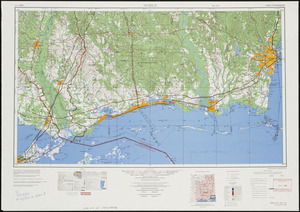
13091.
Airbrush base for the Pelorus Linea region of Europa
13092.
Clothing recommendations for travel in China
13093.
Mobile
13094.
Shaded relief map of the Aeolis quadrangle of Mars : MC-23, M 5M-15/202 RN
13095.
Zoning map of the town of Southborough
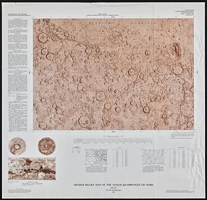
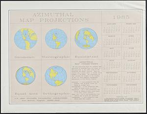
13096.
Azimuthal map projections
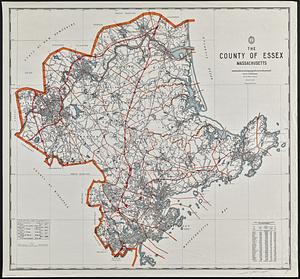
13097.
British Isles
13098.
Illustration of a building at 290 Tremont St. in Boston
13099.
Massachusetts river basins
13100.
Science & policy of Boston Harbor symposium poster
‹ Prev
Next ›
1
2
…
127
128
129
130
131
132
133
134