A land ownership map for the Longwood Medical Area as of January 1980
Item Information
- Title:
- A land ownership map for the Longwood Medical Area as of January 1980
- Title (alt.):
-
Land ownership 1980
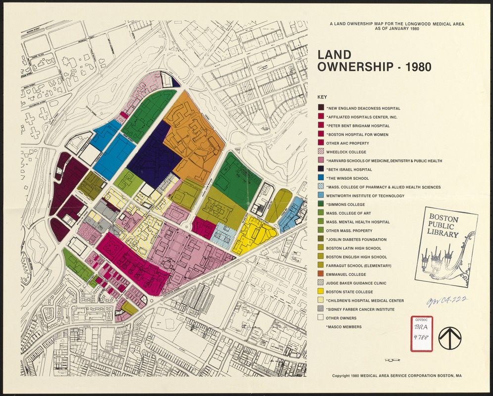
- Description:
-
A color-keyed map of Boston's Longwood Medical Area showing land ownership of the various institutions (hospitals, health facilities, clinics, colleges and universities, schools, etc.) in the area. Indicates whether they are MASCO members.
- Cartographer:
- Medical Area Service Corporation (Boston, Mass.)
- Date:
-
(c) January 1980
- Format:
-
Maps/Atlases
- Location:
-
Boston Public Library
Central Library in Copley Square - Collection (local):
-
Boston Public Library Collection
- Subjects:
-
Health facilities--Massachusetts--Boston--Maps
Universities and colleges--Massachusetts--Boston--Maps
Hospitals--Massachusetts--Boston--Maps
Land tenure--Massachusetts--Boston--Maps
Land owners--Massachusetts--Boston--Maps
Real property--Massachusetts--Boston--Maps
Schools--Massachusetts--Boston--Maps
Longwood Medical Area (Boston, Mass.)--Maps
Medical Academic and Scientific Community Organization
- Places:
-
Suffolk (county)Boston
- Extent:
- 1 map : color ; 41 x 51 cm
- Terms of Use:
-
No known copyright restrictions.
No known restrictions on use.
- Publisher:
-
Boston, MA :
Medical Area Service Corporation (Boston, Mass.)
- Scale:
-
Scale approximately 1:4,200
- Language:
-
English
- Catalog Record:
-
http://bpl.bibliocommons.com/item/show/1031749075
- Identifier:
-
06_01_017168
- Call #:
-
BRA/4788
- Barcode:
-
39999065854497


