Boston city map & guide to the Freedom Trail & national historical park


Item Information
- Title:
- Boston city map & guide to the Freedom Trail & national historical park
- Title (alt.):
-
Map of downtown Boston & Cambridge
- Description:
-
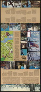
Brief description (with photos) of historic sites along Boston's Freedom Trail. Includes map of the Trail and map of downtown Boston and Cambridge showing the location of 211 facilities in the following categories: hotels and motels, major parking facilities, transportation centers, exhibition halls and auditoriums, sightseeing centers, historic sites, museums and exhibits, public buildings and places, performance centers and sports facilities, and educational and medical Centers. Also includes a map of the rapid transit lines and a map of greater Boston accompanied by a text description of how to get in and out of Boston.
- Cartographer:
- Greater Boston Convention & Visitors Bureau
- Date:
-
[ca. 1982]
- Format:
-
Maps/Atlases
- Location:
-
Boston Public Library
Central Library in Copley Square - Collection (local):
-
Boston Public Library Collection
- Subjects:
-
Arts facilities--Massachusetts--Boston--Maps
Universities and colleges--Massachusetts--Boston--Maps
Historic sites--Massachusetts--Boston--Maps
Hotels--Massachusetts--Boston--Maps
Health facilities--Massachusetts--Boston--Maps
Parking--Massachusetts--Boston--Maps
Stadiums--Massachusetts--Boston--Maps
Transportation--Massachusetts--Boston--Maps
Freedom Trail (Boston, Mass.)--Maps
Tourist maps
- Places:
-
Suffolk (county)Boston
- Extent:
- 1 map : color ; 64 x 28 cm
- Terms of Use:
-
No known copyright restrictions.
No known restrictions on use.
- Publisher:
-
Greater Boston Convention & Visitors Bureau
- Scale:
-
Scale not given
- Language:
-
English
- Catalog Record:
-
http://bpl.bibliocommons.com/item/show/1031688075
- Notes:
-
Panel title. Text, illustrations, and map of downtown Boston showing other sites of interest on verso.
- Identifier:
-
06_01_017171A
06_01_017171B
- Call #:
-
BRA/4740
- Barcode:
-
39999065854141


