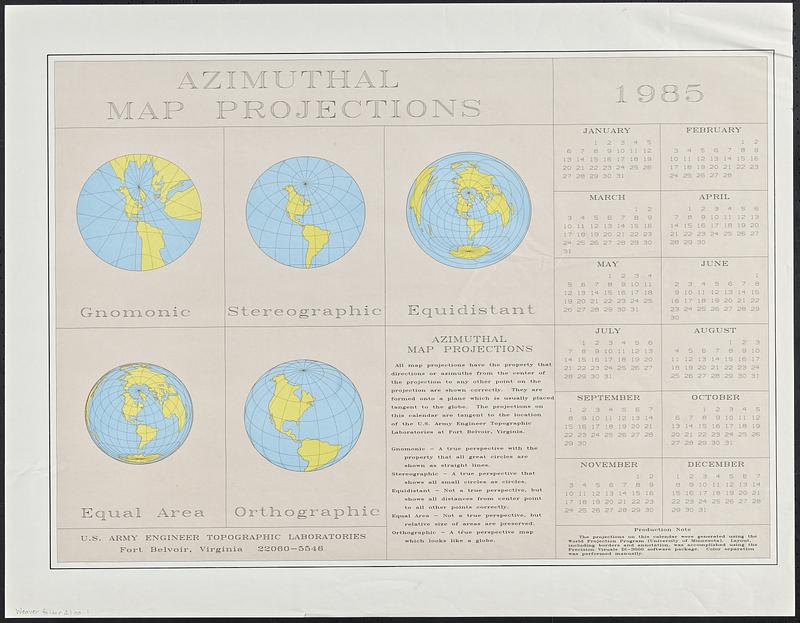
Azimuthal map projections
Item Information
- Title:
- Azimuthal map projections
- Cartographer:
- U.S. Army Engineer Topographic Laboratories
- Date:
-
[1985]
- Format:
-
Maps/Atlases
- Genre:
-
World maps
Calendars
- Location:
-
Boston Public Library
Norman B. Leventhal Map & Education Center - Collection (local):
-
David Judkins Weaver Papers
- Subjects:
-
Azimuthal projection (Cartography)--Maps
- Extent:
- 5 maps on 1 sheet : color ; 4 hemispheres each 11 cm in diameter and 1 hemisphere 10 cm in diameter, on sheet 58 x 74 cm
- Terms of Use:
-
No known copyright restrictions.
No known restrictions on use.
- Publisher:
-
Fort Belvoir, Virginia :
U.S. Army Engineer Topographic Laboratories
- Language:
-
English
- Table of Contents:
-
Gnomonic
Stereographic
Equisdistant
Equal area
Orthographic
- Notes:
-
"The projections on this calendar were generated using the World Projection Program (University of Minnesota). Layout, including borders and annotations, was accomplished using the Precision Visuals DI-3000 software package. Color separation was performed manually."
Includes text and 1985 calendar.
- Notes (date):
-
This date is inferred.
- Identifier:
-
06_01_018836
- Call #:
-
Weaver folder 21 no. 1


