China
Item Information
- Title:
- China
- Description:
-
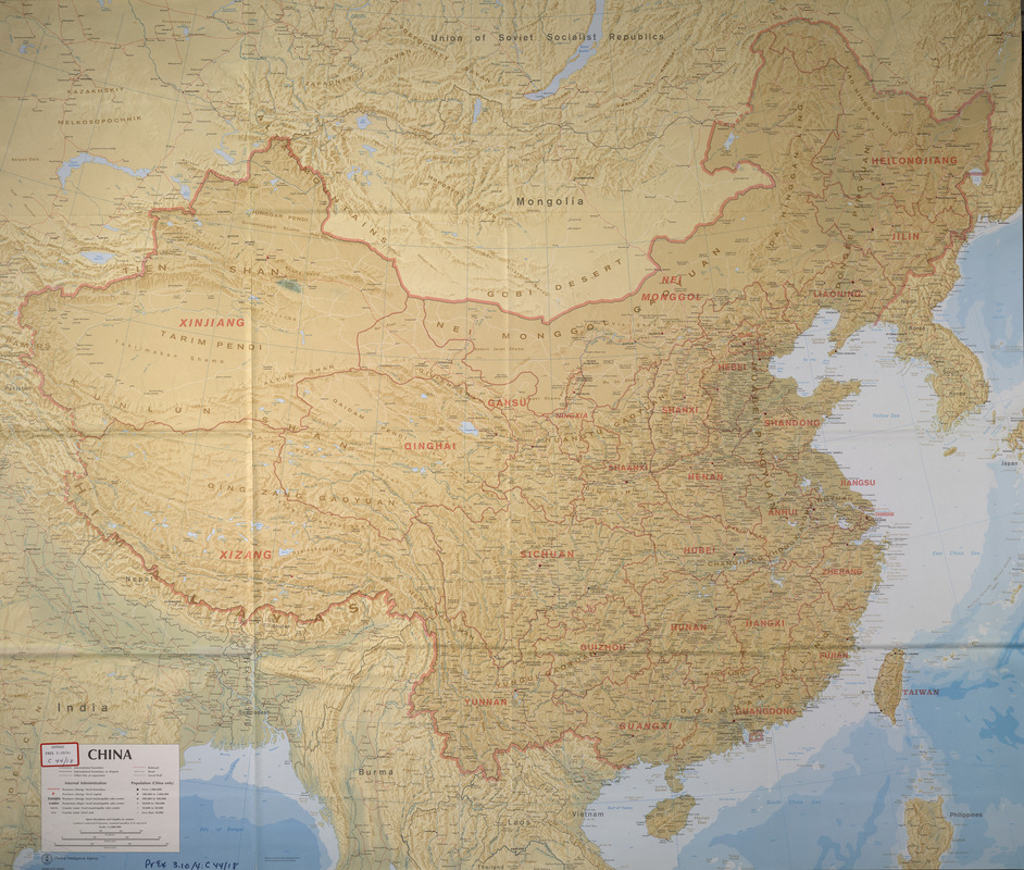
The Central Intelligence Agency is known for publishing high quality and detailed general reference maps. This map of China, made during the height of the Cold War, is no exception. In addition to the detailed representation of settlements, topographical features, waterways, and provincial boundaries, the alphabetical gazetteer on the back locates, with precision, some 2,500 Chinese cities and towns.
- Creator:
- United States. Central Intelligence Agency
- Name on Item:
-
United States Central Intelligence Agency
- Date:
-
[1979]
- Format:
-
Maps/Atlases
- Location:
-
Boston Public Library
Norman B. Leventhal Map & Education Center - Collection (local):
-
Norman B. Leventhal Map & Education Center Collection
- Subjects:
-
China--Maps
- Places:
-
China
- Extent:
- 1 map : col. ; 42 x 49 cm.
- Terms of Use:
-
No known copyright restrictions.
No known restrictions on use.
- Publisher:
-
Washington, D.C :
CIA
- Scale:
-
Scale 1:5,000,000
- Language:
-
English
- Notes:
-
Relief shown by spot heights.
Depths shown by bathymetric tints.
"Base 504301 12-79 (544061)."
Exhibited in “Faces and Places,” at the Boston Public Library, Boston, MA, October 2003 - September 2004.
- Notes (date):
-
This date is inferred.
- Identifier:
-
05_04_000155
- Call #:
-
BPL Gov. Docs. Dept. PREX 3.10/4:C 44/18
- Barcode:
-
30000002782815