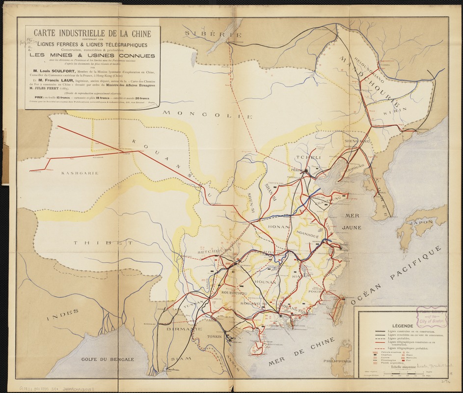
Carte industrielle de la Chine : contenant les lignes ferrées & lignes télégraphiques construites, concédées & probables, les mines & usines connues, avec les divisions en Provinces et les limites avec les Puissances viosines d'après les documents les plus récents et inédits
Item Information
- Title:
- Carte industrielle de la Chine : contenant les lignes ferrées & lignes télégraphiques construites, concédées & probables, les mines & usines connues, avec les divisions en Provinces et les limites avec les Puissances viosines d'après les documents les plus récents et inédits
- Creator:
- Sculfort, Louis.
- Name on Item:
-
par Louis Sculfort et Francis Laur.
- Date:
-
[1885]
- Format:
-
Maps/Atlases
- Location:
-
Boston Public Library
Norman B. Leventhal Map & Education Center - Collection (local):
-
Norman B. Leventhal Map & Education Center Collection
- Subjects:
-
Industries--China--Maps
China--Maps
- Places:
-
China
- Extent:
- 1 map : col. ; 46 x 55 cm.
- Terms of Use:
-
No known copyright restrictions.
No known restrictions on use.
- Publisher:
-
Paris :
Société Anonyme des Publications Scientifiques & Industrielles
- Scale:
-
Scale [ca. 1:4,625,000].
- Language:
-
French
- Notes:
-
Depicts tecnological construction and mineral resouces in China.
- Notes (date):
-
This date is inferred.
- Identifier:
-
06_01_004268
- Call #:
-
G7821.N1 1885 .S4x
- Barcode:
-
39999059005411


