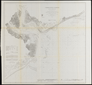
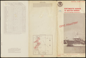
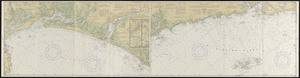
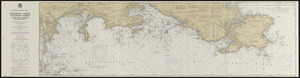
Portsmouth Harbor to Boston Harbor

Item Information
- Title:
- Portsmouth Harbor to Boston Harbor
- Cartographer:
- National Ocean Survey
- Name on Item:
-
National Ocean Survey
- Date:
-
1980
- Format:
-
Maps/Atlases
- Location:
-
Phillips Academy
Archives and Special Collections - Collection (local):
-
Ralph Finos Map Collection
- Subjects:
-
Oceans
Coastlines
Navigation
- Places:
-
New England (area)
- Extent:
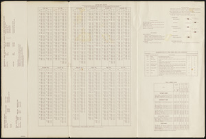
- 1 map in segments : col., both sides ; on sheet 39 x 150 cm, folded to 39 x 19 cm, folded in cover 40 x 20
- Terms of Use:
-
We believe that this item has no known US copyright restrictions. Though not required, if you want to credit us as the source, please use the following statement, "From The Trustees of Phillips Academy." Doing so helps us track how our collection is used and helps justify freely releasing even more content in the future.
This work is in the public domain under a Creative Commons No Rights Reserved License (CC0).
- Publisher:
-
Washington, D. C. :
U. S. Department of Commerce, National Oceanic and Atmospheric Administration, National Ocean Survey
- Edition:
- Edition 12
- Scale:
-
Scale 1:40,000
- Language:
-
English
- Notes:
-
Title from item.
Nautical chart 13274.
- Notes (date):
-
Date from item.
- Identifier:
-
2018_080