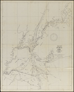
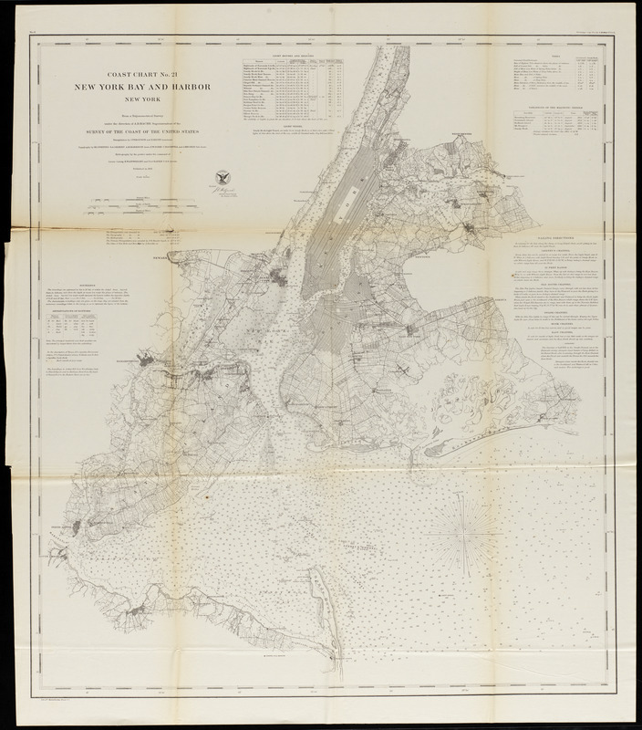
New York Bay and Harbor
Item Information
- Title:
- New York Bay and Harbor
- Cartographer:
- Bache, A. D. (Alexander Dallas), 1806-1867
- Cartographer:
- United States Coast Survey
- Lithographer:
- Knickerbocker, C.
- Name on Item:
-
From a trigonometrical survey under the direction of A. D. Bache, Superintendent of the Survey of the Coast of the United States ; Lith. Of C. Knickerbocker
- Date:
-
1861
- Format:
-
Maps/Atlases
- Location:
-
Phillips Academy
Archives and Special Collections - Collection (local):
-
Robert E. Diefenbach Map Collection
- Subjects:
-
Harbors
Coastlines
Navigation
- Places:
-
Lower Bay
Upper Bay
- Extent:
- 1 map ; 75 x 66 cm
- Terms of Use:
-
We believe that this item has no known US copyright restrictions. Though not required, if you want to credit us as the source, please use the following statement, "From The Trustees of Phillips Academy." Doing so helps us track how our collection is used and helps justify freely releasing even more content in the future.
This work is in the public domain under a Creative Commons No Rights Reserved License (CC0).
- Publisher:
-
[Washington, D. C.] :
Survey of the Coast of the United States
- Scale:
-
Scale 1:80,000
- Language:
-
English
- Notes:
-
Title from item.
- Notes (date):
-
Date from item.
- Identifier:
-
2018_054