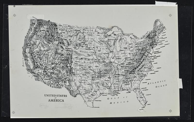
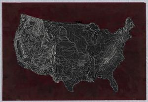
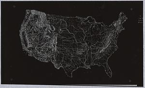
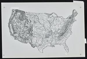
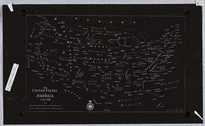
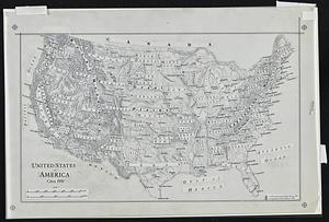
The United States of America circa 1900

Item Information
- Title:
- The United States of America circa 1900
- Cartographer:
- Weaver, David Judkins, 1951-
- Cartographer:
- Raisz, Erwin, 1893-1968
- Name on Item:
-
cartography by David Weaver
- Date:
-
1983
- Format:
-
Maps/Atlases
- Genre:
-
Physical maps
- Location:
-
Boston Public Library
Norman B. Leventhal Map & Education Center - Collection (local):
-
David Judkins Weaver Papers
- Subjects:
-
United States--Maps
- Places:
-
United States
- Extent:
- 6 maps : paper, plastic ; sheets 51 cm or smaller
- Terms of Use:
-
No known copyright restrictions.
No known restrictions on use.
- Language:
-
English
- Notes:
-
Overlays to add text to Erwin Raisz's Landform outline map of the United States with adjacent parts of Canada and Mexico.
"Landform drawing by Erwin Raisz, 1954."
- Identifier:
-
06_01_018853C
06_01_018853D
06_01_018853F
06_01_018853A
06_01_018853E
06_01_018853B
- Call #:
-
Weaver folder 3


