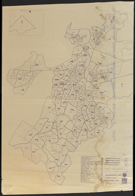
Neighborhood and census tract boundaries 1980
Item Information
- Title:
- Neighborhood and census tract boundaries 1980
- Cartographer:
- Boston Redevelopment Authority
- Name on Item:
-
Boston Redevelopment Authority
- Date:
-
[ca. 1980]
- Format:
-
Maps/Atlases
- Location:
-
Boston Public Library
Norman B. Leventhal Map & Education Center - Collection (local):
-
Norman B. Leventhal Map & Education Center Collection
- Series:
- Boston Redevelopment Authority Maps & Manuscript Plans Collection
- Subjects:
-
Boston (Mass.)--Administrative and political divisions--Maps
Neighborhoods--Massachusetts--Boston--Maps
Census districts--Massachusetts--Boston--Maps
- Places:
-
MassachusettsSuffolk (county)Boston
- Extent:
- 1 map ; on sheet 157 x 108 cm
- Terms of Use:
-
No known copyright restrictions.
No known restrictions on use.
- Publisher:
-
[Boston, Mass.] :
Boston Redevelopment Authority
- Scale:
-
Scale approximately 1:14,200
- Language:
-
English
- Notes:
-
Shows neighborhood boundary, neighborhood district, census tract boundary, and census tract number.
Oriented with north to the upper left.
Includes list of neighborhood abbreviations with number of sub-neighborhoods.
Inset: Harbor Islands.
"E-1949."
Manuscript in pencil on sticky note in lower left: Allston/Brighton census tract. Topo Boston.
- Identifier:
-
06_01_018567
- Call #:
-
BRA MAP FOLDER 52 no.3
- Barcode:
-
30000008307631


