Boston streets & neighborhoods
Item Information
- Title:
- Boston streets & neighborhoods
- Title (alt.):
-
Boston streets and neighborhoods
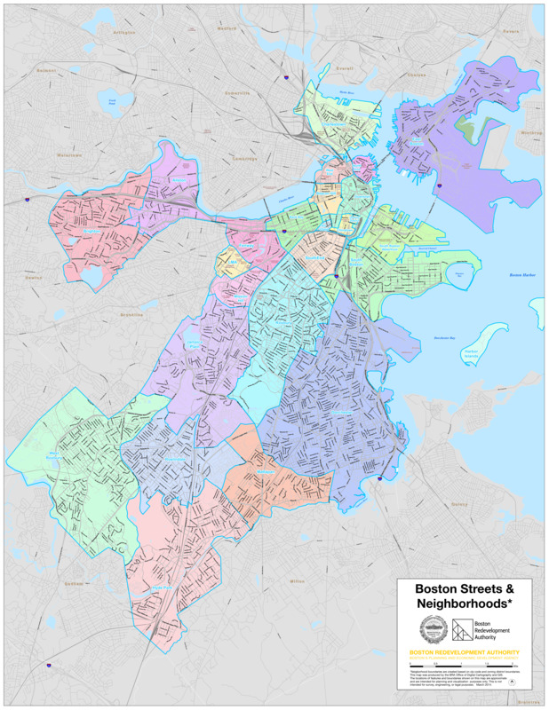
- Description:
-
This map outlines the 26 neighborhoods in Boston by zip code and zoning district boundaries. Boston is often thought of as a collection of neighborhoods, each uniquely reflecting who lives and works there. These municipally-defined boundaries are compared to those displayed in the nearby “neighborhood consensus” map, which illustrates the “mental maps” residents create for their own neighborhoods.
- Cartographer:
- Boston Redevelopment Authority
- Name on Item:
-
This map was produced by the BRA Office of Digital Cartography and GIS
- Date:
-
2014
- Format:
-
Maps/Atlases
- Location:
-
Boston Public Library
Norman B. Leventhal Map & Education Center - Collection (local):
-
Norman B. Leventhal Map & Education Center Collection
- Subjects:
-
Boston (Mass.)--Maps
Streets--Massachusetts--Boston--Maps
Neighborhoods--Massachusetts--Boston--Maps
- Places:
-
MassachusettsSuffolk (county)Boston
- Extent:
- 1 map : color
- Terms of Use:
-
No known copyright restrictions.
No known restrictions on use.
- Publisher:
-
Boston :
Boston Redevelopment Authority
- Language:
-
English
- Notes:
-
"Neighborhood boundaries are created base on zip code and zoning district boundaries."
March 2014.
- Notes (exhibitions):
-
Exhibited: "Who We Are: Boston Immigration Then and Now," organized by the Norman B. Leventhal Map Center at the Boston Public Library, 2017.
- Identifier:
-
Citywide_SaN_2011-Neighborhoods-colors


