Toggle navigation
LMEC Home
Exhibitions
Georeferencing
Tools for Teachers
Collections
My Favorites
Sign Up / Log In
Search
Search the map portal
Map Collection
Map Collection
Map Sets
Search
Search
Search for
Search In
All Fields
Creator
Title
Subject
Place
Search All Digital Collections
Advanced Search
13385 Results
Filter your Search
Place
North and Central America
9,353
United States
7,078
Suffolk (county)
1,664
Boston
1,621
Europe
1,035
Canada
949
Massachusetts
794
New York
532
more
Place
»
Topic
Boston (Mass.)--Maps
741
City planning--Massachusetts--Boston--Maps
418
United States--History--Revolution, 1775-1783--Maps
329
United States--Maps
315
Urban renewal--Massachusetts--Boston--Maps
254
Real property--Massachusetts--Boston--Maps
252
Massachusetts--Maps
219
Insurance surveys
197
more
Topic
»
Date
Date range begin
–
Date range end
Current results range from
1482
to
2023
View distribution
Creator
United States. Hydrographic Office
595
Boston Redevelopment Authority
403
Des Barres, Joseph F. W. (Joseph Frederick Wallet), 1722-1824
247
Royal United Services Institute for Defence and Security Studies
160
Jefferys, Thomas, -1771
154
George, III, King of Great Britain, 1738-1820
152
George, IV, King of Great Britain, 1762-1830
151
O.H. Bailey & Co
148
more
Creator
»
Format
Maps/Atlases
13,205
Manuscripts
985
Prints
102
Books
49
Drawings/Illustrations
44
Photographs
15
Objects/Artifacts
13
Documents
7
more
Format
»
Georeferenced
Yes
979
No
12,406
Collection
Norman B. Leventhal Map Center Collection
8,891
American Revolutionary War-Era Maps
3,305
Boston and New England Maps
2,804
Urban Maps
2,397
Maritime Charts and Atlases
1,150
William L. Clements Library Collection
910
Library of Congress Collection
618
Boston Redevelopment Authority Collection
475
more
Collection
»
Available to use
No known restrictions
9,952
Creative Commons license
1,677
Search Constraints
Sort by date (desc)
relevance
title
date (asc)
date (desc)
Number of results to display per page
100 per page
10
per page
20
per page
50
per page
100
per page
View results as:
grid view
map view
Search Results
11201.
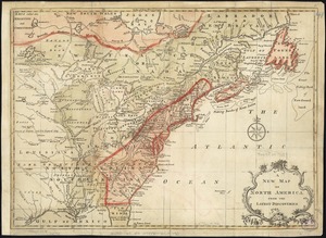
A new and accurate map of North America : laid down according to the latest, and most approved observations and discoveries
11202.
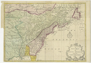
A new and accurate map of North America : laid down according to the latest, and most approved observations and discoveries
11203.
A new and accurate map of North America laid down according to the latest and most approved observations, and discoveries
11204.
A new map of North America : with the British, French, Spanish, Dutch & Danish dominions on that great continent, and the West...
11205.
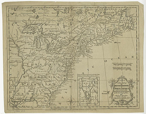
A new map of North America from the latest discoveries
11206.
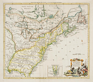
A new map of North America from the latest discoveries 1763
11207.
A new map of North America wherein the British Dominions in the continent of North America : and on the islands of the West...
11208.
A new map of the British dominions in North America with the limits of the governments annexed thereto by the late treaty of...
11209.
A new map of the British empire in Nth. America, drawn from the latest authorities
11210.
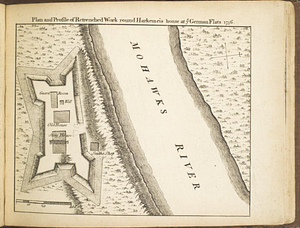
Plan and profile of retrenched work round Harkemeis house at ye German Flats 1756
11211.
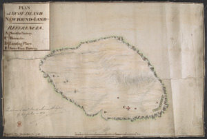
PLAN of CARBONERA ISLAND situated at the Entrance of CARBONERA HARBOUR in CONCEPTION BAY NEWFOUNDLAND
11212.
Plan of Fort Edward situated lat. 43 lon. 72 30'
11213.
Plan of Fort Frederick at Albany
11214.
A plan of Fort Frederick, situated at the entrance of St. John's River : lat 47 long. 66 30'
11215.
Plan of Fort Frontenac
11216.
Plan of Fort Niagara, with its environ
11217.
A plan of Fort Ontario
11218.
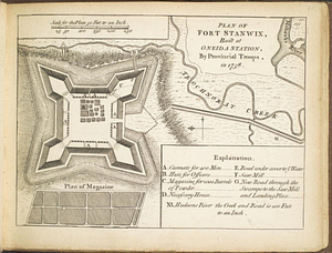
Plan of Fort Stanwix, built at Oneida Station, by provincial troops, in 1758
11219.
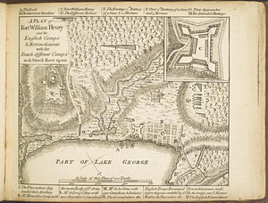
A plan of Fort William Henry and the English camps & retrenchments with the French different camps and attack there upon
11220.
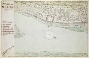
PLAN of MOBILE
11221.
Plan of part of Fort George, with the barracks &c. erected in the year 1759 : situated lat. 4 30' long. 73 30'
11222.
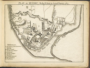
Plan of Québec, reduc'd from an actual survey 1763
11223.
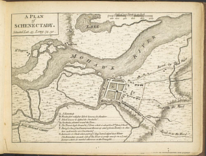
A plan of Schenectady situated lat. 43 long 74. 30
11224.
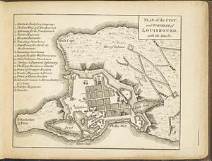
Plan of the city and fortress of Louisbourg, with the attacks
11225.
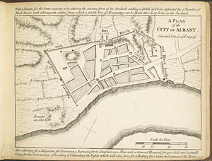
A plan of the city of Albany situated lat. 42, 30" long. 74
11226.
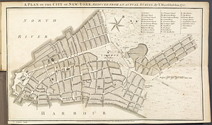
A plan of the city of New-York, reduced from an actual survey
11227.
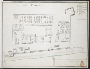
PLAN of the FORT at PENSACOLA
11228.
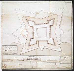
PLAN of the FORT at SAINT AUGUSTINE
11229.
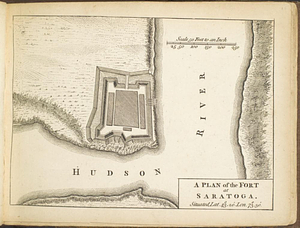
A plan of the fort at Saratoga : situated lat. 43 20' lon. 73 30'
11230.
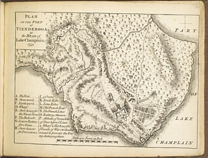
Plan of the fort at Tienderoga at the head of Lake Champlain, 1758
11231.
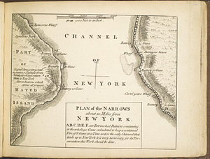
Plan of the narrows about 10 miles from New York
11232.
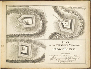
Plan of the new fort & redoubts, at Crown Point
11233.
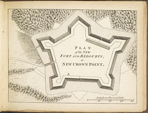
Plan of the new fort and redoubts, at New Crown Point
11234.
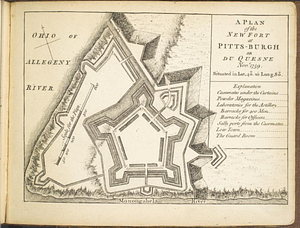
A plan of the new fort at Pitts-Burgh or Du Quesne Novr. 1759 : situated in lat. 40 20' long. 80
11235.
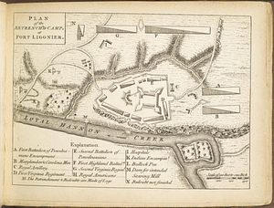
Plan of the retrench'd camp, at Fort Ligonier
11236.
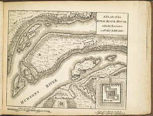
A plan of the Royal Block House, with the environs at Fort Edward
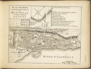
11237.
Plan of the town and fortifications of Montréal or Ville Marie in Canada
11238.
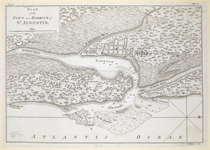
PLAN of the TOWN and HARBOUR of S.T AUGUSTIN
11239.
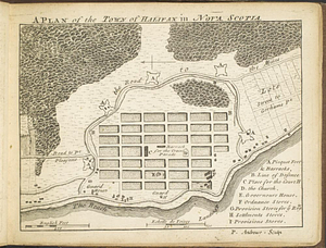
A plan of the town of Halifax in Nova Scotia
11240.
A Plan of West Florida, the Isle of Orleans, and some parts of the Spanish dominions to the westward of the Mississipi
11241.
Porti della Nuova York e Perthamboy
11242.
SCETCH of the CITY and Environs of S.T AUGUSTINE
11243.
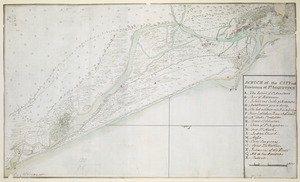
Scetch [sic] of the blockhouse at the east of Oneda Lake
11244.
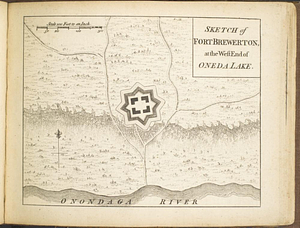
Sketch of Fort Brewerton at the west end of Oneda Lake
11245.
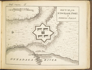
Sketch of the stockade fort, at Oswego Falls
11246.
A south east view of the city of New York, in North America = Vue de sud est de la ville de New York, dans l'Amerique...
11247.
A south west view of the city of New York, in North America = Vue de sud ouest de la ville de New York, dans l'Amerique...
11248.
Theodolite's pattern, shewing the provinces in North America which were in the respective possessions of England, France &...
11249.
An accurate map of Cuba, and the adjacent islands
11250.
An accurate map of the British Empire in Nth. America as settled by the preliminaries in 1762
11251.
An accurate map of the British empire in Nth. America as settled by the preliminaries in 1762
11252.
An accurate map of the British, French & Spanish settlements in Nth. America and the West Indies : as stipulated by the...
11253.
An Accurate map of the West Indies, with the adjacent coast
11254.
America
11255.
L'Amerique divisée par grand etats
11256.
L'Amerique meridionale divisée en ses principaux etats
11257.
L'Amérique Septentrionale divisée en ses principaux états
11258.
Carte geo-hydrographique du Golfe du Mexique et de ces isles : construit d'après les mémoires les plus recens, et assujeties...
11259.
Carte hydrographique de la baye de la Havane : avec le plan de la ville et de ses forts pour joindre a la Carte de l'isle de Cube
11260.
Carte réduite de l'isle de Cube
11261.
Chart of the Atlantic Ocean, with the British, French, & Spanish settlements in North America, and the West Indies : as also on...
11262.
A general map of North America : in which is express'd the several new roads, forts, engagements, &c, taken from actual surveys...
11263.
A general map of North America : in which is express'd the several new roads, forts, engagements, &c, taken from actual surveys...
11264.
Map of Quebec City with plans of the citadel by Captain Samuel Holland for Report of the government of Quebec and dependencies
11265.
A map of the isle of Cuba : with the Bahama Islands, Gulf of Florida, and Windward Passage ; drawn from English and Spanish...
11266.
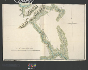
[Map of the towns of Western Massachusetts]
11267.
Neu und verbesseter plan der st. u. hafens Havanah auf der ins. Cvba mit den wasser tiefen, sand, baencken und klippen...
11268.
A new and correct map of the American islands, now called the West Indies, : with the whole coast of the neighbouring continent
11269.
A new and correct map of the American islands, now called the West Indies, with the whole coast of the neighbouring continent
11270.
A new chart of the seas surrounding the island of Cuba, with the soundings, currents, ships, courses &c. and a map of the...
11271.
A new map of the only useful and frequented part of New Found Land
11272.
Plan and project, for fortifying the high commanding ground at the church of Deschambeaux as also the island of Richlieu [sic]
11273.
Plan (no. 1) To explain the report of the state of defence of the fortifications of Quebec
11274.
Plan (no. 2) shewing the ground whereon the citadel is proposed to be built : the ground lines of the present fortifications...
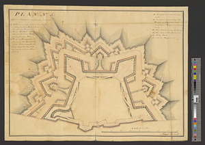
11275.
Plan (no. 3) of the citadel compleatly finished
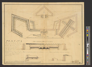
11276.
Plan no. 4 shewing the bastion A with its foundations and casemates and bastion B finish'd with its ambrazures and platforms C...
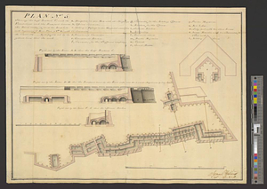
11277.
Plan (no. 5) shewing the half bastion C with its foundations and the rampart towards the river side, as far as the loop-hole...
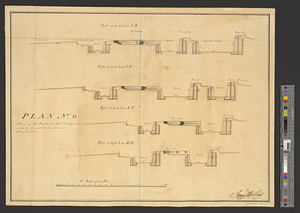
11278.
Plan no. 6 shewing the profils cut thro' the different works by the yellow lines seen on plan no. 3
11279.
PLAN of BUOY ISLAND NEW FOUND-LAND
11280.
Plan of Niagara with the adjacent country surrendered to the English army under the command of Sr. Willm: Johnson Bart: on the...
11281.
Plan of the harbour town and fort of St. Iohns in Newfoundland with part of the country adjacent, shewing the operations...
11282.
Plan of the river of St. Johns from Fort Frederick in the Bay of Fundy to the river of Medouesqua with the lake of Temescouata...
11283.
Plan of the siege of the Havana surrenderid [sic] Aug. 12, 1762 to the English commanded by the Earl of Albemarle General and...
11284.
Province of the Massachusetts Bay & pursuant to an order made by the great & Genl. Court of the province June 11th 1762 : to me...
11285.
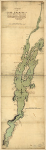
A survey of Lake Champlain, from Crown Point to Windmil Point, and from thence to St. Iohns
11286.
A draught of a route from Québec to Fort Halifax on the River Kennebec and back again to Québec by the rivers Chaudière and...
11287.
Fort Halifax and the Kennebec River : Québec July 25th, 1761
11288.
Lake Megantic and the Chaudière River : Québec July 25th, 1761
11289.
Moosehead Lake and the immediate area to the west : Québec July 25th, 1761
11290.
Southern portion of Lake Megantic and the Dead River : Québec July 25th, 1761
11291.
[Account of the action at Fort Niagara]
11292.
An accurate map of Canada, with the adjacent countries : exhibiting the late seat of war between the English & French in those...
11293.
An accurate map of Canada, with the adjacent countries; exhibiting the late seat of war between the English & French in those...
11294.
An accurate map of His Majesty's province of New-Hampshire in New England : taken from actual surveys of all the inhabited...
11295.
An accurate map of His Majesty's province of New-Hampshire in New England : taken from actual surveys of all the inhabited...
11296.
The Cedres
11297.
Continuation of the Grande Riviere with the village of Fariole lying near Cape Torment on the north shore
11298.
Continuation of the River Chaudière &c.
11299.
Continuation of the River Chaudière from where it falls into the St. Lawrence, as laid down in the lower plan, to the village...
11300.
Continuation of the River Chaudière joining to A
‹ Prev
Next ›
1
2
…
109
110
111
112
113
114
115
116
117
…
133
134


![Scetch [sic] of the blockhouse at the east of Oneda Lake](https://bpldcassets.blob.core.windows.net/derivatives/metadata/commonwealth-oai:zs2626251/image_thumbnail_300.jpg)


![[Map of the towns of Western Massachusetts]](https://bpldcassets.blob.core.windows.net/derivatives/images/commonwealth:6108vv02d/image_thumbnail_300.jpg)


![Plan and project, for fortifying the high commanding ground at the church of Deschambeaux as also the island of Richlieu [sic]](https://bpldcassets.blob.core.windows.net/derivatives/metadata/commonwealth-oai:pz50mt24s/image_thumbnail_300.jpg)
![Plan of the siege of the Havana surrenderid [sic] Aug. 12, 1762 to the English commanded by the Earl of Albemarle General and Sir George Pococke K.B. Admiral](https://bpldcassets.blob.core.windows.net/derivatives/images/commonwealth:q524nf87n/image_thumbnail_300.jpg)


![[Account of the action at Fort Niagara]](https://bpldcassets.blob.core.windows.net/derivatives/images/commonwealth:6108vv66z/image_thumbnail_300.jpg)


