Toggle navigation
LMEC Home
Exhibitions
Georeferencing
Tools for Teachers
Collections
My Favorites
Sign Up / Log In
Search
Search the map portal
Map Collection
Map Collection
Map Sets
Search
Search
Search for
Search In
All Fields
Creator
Title
Subject
Place
Search All Digital Collections
Advanced Search
230 Results
My Search
Start Over
More Like
commonwealth:z603vn753
Remove constraint More Like: commonwealth:z603vn753
Filter your Search
Place
North and Central America
206
United States
94
New England
88
Canada
26
Middle Atlantic
21
New York
13
Boston Harbor
11
Northeastern United States
10
more
Place
»
Topic
Manuscript maps--Early works to 1800
138
New England--Maps--Early works to 1800
91
Middle Atlantic States--Maps--Early works to 1800
21
Northeastern States--Maps--Early works to 1800
10
New York (State)--Maps--Early works to 1800
8
North America--Maps--Early works to 1800
7
Añasco (P.R.)--Maps--Early works to 1800
6
Boston (Mass.)--Maps--Early works to 1800
6
more
Topic
»
Date
Date range begin
–
Date range end
Current results range from
1617
to
1999
View distribution
Creator
Dumont de Montigny
14
Adlum, John, 1759-1836
9
Bingham, William, 1752-1804
9
Jefferys, Thomas, d. 1771
9
Bellin, Jacques Nicolas, 1703-1772
4
De Brahm, John Gerar William, 1717-approximately 1799
4
Green, John, d. 1757
4
Jefferys, Thomas, -1771
4
more
Creator
»
Format
Maps/Atlases
230
Manuscripts
139
Georeferenced
Yes
10
No
220
Collection
American Revolutionary War-Era Maps
180
Library of Congress Collection
97
Norman B. Leventhal Map Center Collection
65
Newberry Library Collection
39
Boston and New England Maps
32
Maritime Charts and Atlases
27
Mapping Boston Collection
23
Sidney R. Knafel Map Collection at Phillips Academy
15
more
Collection
»
Available to use
Creative Commons license
132
No known restrictions
43
Search Constraints
Sort by relevance
relevance
title
date (asc)
date (desc)
Number of results to display per page
100 per page
10
per page
20
per page
50
per page
100
per page
View results as:
grid view
map view
Search Results
1.
1. Prise de Newport par d'Estaing, 1778 : 2. Embossage de Ternay à Newport, 1780
2.
Carte du Cap Franc̨ois de Saint Domingue, de l'isle de Cuba, de la Jamaique avec le canal de Bahama, l'entrée du fleuve St....
3.
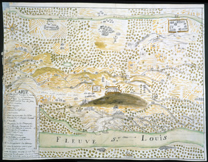
Carte du Fort Rozalie des Natches franc̦ois avec ses dependances et village des sauvages
4.
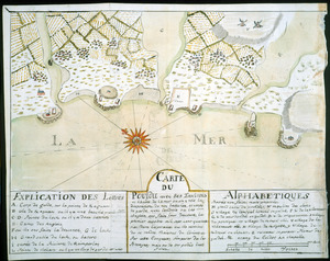
Carte du Pouldu avec ses environs et la côte de la mer : ou on y voit la disposition de nos batteries, et corps de garde, avec...
5.
Carte d'un partie de l'Amerique Septentrionale : ou est tracée notre route d'Halifax à New York, par Quebec, Montreal, le Lac...
6.
Concession des Chaoüachas appartenante cy devant a Mgr. le duc de Belleisle et associez
7.
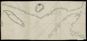
[Continuation of Plan du detroit de Belle Isle et du Golphe St. Laurent]
8.
Copy of a map presented to the Congres [sic]
9.
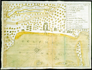
Fort St. Loüis ou Nouveau Billoxy, 3eme etablissement
10.
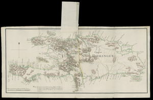
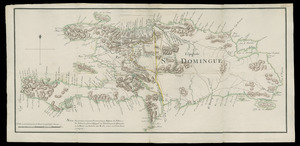
I. de St. Domingue
11.
I. de St. Domingue
12.
[Plan de defense de New-Port] : [dans l'Isle Rhode (Amerique Septentrionalle) par l'escadre du Roy aux ordres de Monsieur le...
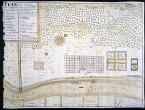
13.
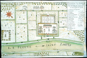
Plan de la Nlle. Orleans, ville capitalle de la Louissianne
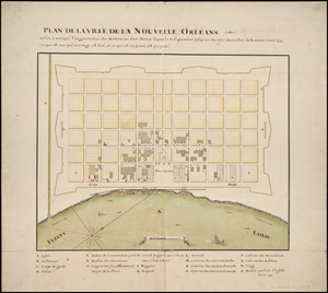
14.
Plan de la ville de la Nouvelle Orleans : ou l'on à marqué l'augmentation des maisons qui sont baties depuis le 3. septembre...
15.
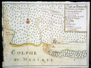
Plan de Pensacolle
16.
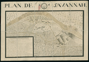
Plan de Savannah
17.
Plan du detroit de Belle Isle et du Golphe St. Laurent pour la coste du nord
18.
Plan du Fort du Sault de St. Louis et du village des sauvages Iroquois
19.
An Accurate map of New Hampshire in New England, from a late survey
20.
An accurate map of Rhode Island, part of Connecticut and Massachusets, shewing Admiral Arbuthnot's station in blocking up...
21.
An accurate map of Rhode Island, part of Connecticut and Massachusets, shewing Admiral Arbuthnot's station in blocking up...
22.
An accurate map of the four New England states : shewing in a distinct manner all the mountains, forts, rivers, swamps,...
23.
An actual survey of the sea coast from New York to the I. Cape Brition : with tables of the direct and thwart courses &...
24.
Belgii Novi, Angliae Novae, et partis Virginiae : novissima delineatio
25.
Bowles's map of the seat of war in New England, comprehending the provinces of Massachusets Bay, and New Hampshire : with the...
26.
Bowles's new pocket map of the most inhabited part of New England : comprehending the provinces of Massachusets Bay and New...
27.
Bowles's new pocket map of the most inhabited part of New England : comprehending the provinces of Massachusets Bay and New...
28.
Carta particolare della nuoua Belgia è parte della nuoua Anglia
29.
Carte de la Nouvelle Angleterre, comprenant les etats de Massachusets Bay, N. Hamp Shire, Connecticut et Rhode Island
30.
Carte de la Nouvelle Angleterre, New York, Pensilvanie et Nouveau Jersay suivant les cartes angloises
31.
Carte de la Nouvelle Angleterre, Nouvelle Yorck, et Pensilvanie : pour servir à l'Histoire générale des voyages
32.
Carte de la Nouvelle Angleterre, Nouvelle York, Nouvelle Jersey et Pensilvanie
33.
Carte d'une partie de l'Amérique Septentrionale : pour servir à l'intellegence du mémoire sur les prétentions des Anglois...
34.
Carte generale du Canada ou Nouvelle France
35.
Carte réduite du nord des Etat-Unis avec l'intérieur du pays : pour servir à l'intelligence de cette histoire ; copieé par...
36.
Chart for the journal of Mr. le Mquis. de Chastellux
37.
A chart of the coast of America from New found Land to Cape Cod
38.
A chart of the coast of New England from the South Shoal to Cape Sable including Georges Bay from Holland & actual surveys
39.
A chart of the coast of New England from the South Shoal to Cape Sable including Georges Bay from Holland & actual surveys
40.
A chart of the province of New England, with the soundings on the coast; drawn about 1670, on a scale of 1 2/3 English league...
41.
The coast of New England
42.
A correct map of the coast of New England
43.
An exact map of New England, New York, Pensylvania & New Jersey, from the latest surveys
44.
Karte von dem Ostlichen-Stucke von Neu Franckreich oder Canada in America : besonders aber Acadia und Neu Schottland
45.
Karte von Neu England, Neu Yorck und Pensilvanien
46.
A map of 100 miles round Boston
47.
[Map of eastern Massachusetts and vicinity]
48.
A map of New England and New York
49.
A map of New England, New York, New Jersey and Pensilvania
50.
A map of New-England, being the first that ever was here cut, and done by the best pattern that could be had, which being in...
51.
A map of New-England, being the first that ever was here cut, and done by the best pattern that could be had, which being in...
52.
A map of New-England, being the first that ever was here cut, and done by the best pattern that could be had, which being in...
53.
A map of the coast of New England, from Staten Island to the island of Breton
54.
A map of the colony of Rhode Island : with the adjacent parts of Connecticut, Massachusetts Bay, &c
55.
A map of the most inhabited part of New England : containing the provinces of Massachusets Bay and New Hampshire, with the...
56.
A map of the most inhabited part of New England : containing the provinces of Massachusets Bay and New Hampshire, with the...
57.
A map of the most inhabited part of New England : containing the provinces of Massachusets Bay and New Hampshire, with the...
58.
A map of the most inhabited part of New England : containing the provinces of Massachusets Bay and New Hampshire, with the...
59.
A map of the most inhabited part of New England : containing the provinces of Massachusets Bay and New Hampshire, with the...
60.
A map of the most inhabited part of New England : containing the provinces of Massachusets Bay and New Hampshire, with the...
61.
A map of the most inhabited part of New England : containing the provinces of Massachusets Bay and New Hampshire, with the...
62.
A map of the most inhabited part of New England : containing the provinces of Massachusets Bay and New Hampshire, with the...
63.
A map of the most inhabited part of New England containing the provinces of Massachusets Bay and New Hampshire with the...
64.
A map of the most inhabited part of New England, containing the provinces of Massachusets Bay and New Hampshire, with the...
65.
Map of the northern, or, New England states of America, comprehending Vermont, New Hampshire, District of Main, Massachusetts,...
66.
Map of the northern, or, New England states of America, comprehending Vermont, New Hampshire, District of Main, Massachusetts,...
67.
A map of the Province of New York, with part of Pensilvania, and New England : from an actual survey by Captain Montresor,...
68.
A map of the Province of New York, with part of Pensilvania, and New England : from an actual survey by Captain Montresor,...
69.
A mapp of New England
70.
A mapp of New England
71.
A new and accurate map of the present seat of war in North America : from a late survey
72.
A new chart of the coast of New England, Nova Scotia, New France or Canada, with the islands of Newfoundld. Cape Breton St....
73.
New Engelland, New York, New Yersey und Pensilvania
74.
New England : the most remarqueable parts thus named by the high and mighty Prince Charles, prince of great Britaine
75.
New England : the most remarqueable parts thus named by the high and mighty Prince Charles, nowe King of great Britaine
76.
New England : die mercklichsten dheile, also genennet durch den durchl: und mechtigen Prinzen und h.h. Carolus, Prinzen von...
77.
New England and New York
78.
New England and New York
79.
New France, New Englande, New Scotlande, and New Foundlande
80.
A new map of New England, New York, New Iarsey, Pensilvania, Maryland and Virginia
81.
A new map of Nova Scotia and Cape Breton Island : with the adjacent parts of New England and Canada composed from a great...
82.
A new map of Nova Scotia, and Cape Britain : with the adjacent parts of New England and Canada, composed from a great number of...
83.
A new map of Nova Scotia, and Cape Britain : with the adjacent parts of New England and Canada, composed from a great number of...
84.
A new map of the most considerable plantations of the English in America
85.
A new mapp of New England and Annapolis and the countrys adjacent
86.
Noua Anglia, Nouum Belgium, et Virginia
87.
Noui Belgii Nouaeque Angliae nec non partis Virginiae tabula
88.
Nouvelle Angleterre et Nouvel York
89.
Nouvelle Hollande (à présent Nouvelle-York), Nouvelle-Angleterre, et une partie de la Virginie
90.
Nova Anglia Novum Belgium et Virginia
91.
Nova Anglia, Novum Belgium et Virginia
92.
Nova Belgica et Anglia Nova
93.
Nova Belgica et Anglia Nova
94.
Novi Belgii, Novaeque Angliae nec non partis Virginiae tabula
95.
Novi Belgii Novaeqve Angliae nec non partis Virginiae Tabula
96.
Partie orientale du Canada, avec la Nouvelle Angleterre, l'Acadie, et la Terre-Neuve
97.
Partie septentrionale des possessions Angloise en Amerique : pour servire d'intelligence à la guerre présente entre les...
98.
Pas caert van Nieu Nederland, Virginia en Nieu Engelant
99.
Pas caerte van Nieu Nederlandt en de Engelsche Virginies van Cabo Cod tot Cabo Canrick
100.
Pas-caert van Nieu Nederland, Virginia, Nieu Engeland als mede Penn-silvania, met de stad Philadelfia van Baston tot Carrik = a...
‹ Prev
Next ›
1
2
3


![[Continuation of Plan du detroit de Belle Isle et du Golphe St. Laurent]](https://bpldcassets.blob.core.windows.net/derivatives/images/commonwealth:z603vm96n/image_thumbnail_300.jpg)
![Copy of a map presented to the Congres [sic]](https://bpldcassets.blob.core.windows.net/derivatives/images/commonwealth:z603vn16x/image_thumbnail_300.jpg)
![[Plan de defense de New-Port]](https://bpldcassets.blob.core.windows.net/derivatives/images/commonwealth:z603vn044/image_thumbnail_300.jpg)


![[Map of eastern Massachusetts and vicinity]](https://bpldcassets.blob.core.windows.net/derivatives/images/commonwealth:9s161d29f/image_thumbnail_300.jpg)


![A map of the most inhabited part of New England containing the provinces of Massachusets Bay and New Hampshire with the colonies of Connecticut and Rhode Island divided into counties and townships the w[h]ole composed from actual surveys and its situation adjusted by astronomical observations](https://bpldcassets.blob.core.windows.net/derivatives/images/commonwealth:6t053p316/image_thumbnail_300.jpg)


