A mapp of New England
Item Information
- Title:
- A mapp of New England
- Description:
-
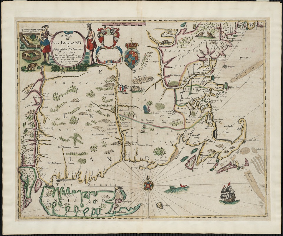
A foundation in the early history of the mapping of New England, this map is the first printed version of William Reed's original survey of 1665. The survey was commissioned by Massachusetts authorities to support the colonial boundaries as described in the first Massachusetts Charter of 1628. As originally proposed, the northern boundary was located thirty miles north of the Merrimack River, assuming the river followed an east-west course. When it was later discovered that inland the Merrimack River turned north, Massachusetts colonists aggressively claimed lands thirty miles north of the river's source, an area also claimed by New Hampshire. The survey is the earliest to depict the relative position of the Hudson, Connecticut and Merrimack rivers. Also identified on the map are several towns that had beendestroyed by Indians during the early months of King Philip's War.
- Creator:
- Seller, John, fl. 1658-1698
- Contributor:
- Hills, John, active 17th century
- Date:
-
[1675]
- Format:
-
Maps/Atlases
- Location:
- Private Collection
- Collection (local):
-
Mapping Boston Collection
- Subjects:
-
New England--Maps--Early works to 1800
- Places:
-
New England (area)
- Extent:
- 1 map : hand col. ; 43 x 54 cm.
- Terms of Use:
-
No known copyright restrictions.
This work is licensed for use under a Creative Commons Attribution Non-Commercial Share Alike License (CC BY-NC-SA).

- Publisher:
-
London :
And are to bee sold at his shop at the Hermitage in Wapping and by Iohn Hills in Exchange Alley in Cornhill
- Scale:
-
Scale [ca. 1:1,170,000]
- Language:
-
English
- Notes:
-
First state.
Relief shown by pictorially.
Depths shown by soundings and shading.
Appears in author's Atlas maritimus, or, The sea-atlas. London. 1675.
Includes ill.
- Notes (date):
-
This date is inferred.
- Notes (citation):
-
McCorkle, B. New England in Early Printed Maps, 676.5
Stevens & Tree. Comparative Cartography, 34
- Identifier:
-
06_01_001233
- Barcode:
-
39999052508338


