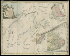
Carte du Pouldu avec ses environs et la côte de la mer : ou on y voit la disposition de nos batteries, et corps de garde, avec l'endroit ou les Anglois, ont faits leur descente, le premier octobre mil sept cent quarente six, dans l'esperance ou ils estoient de se rendre maistres de l'Orient et par cette conqueste, s'emparer de la Bretagne; mais ou ils ont perdûs leurs peines
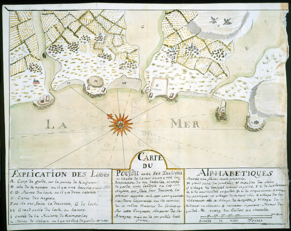
This map is also available in American Revolutionary Geographies Online (ARGO), a collections portal especially built for material relating to the American Revolutionary War Era. Visit ARGO to learn more about this item and explore the historical geography of North America in the late eighteenth century.
Item Information
- Title:
- Carte du Pouldu avec ses environs et la côte de la mer : ou on y voit la disposition de nos batteries, et corps de garde, avec l'endroit ou les Anglois, ont faits leur descente, le premier octobre mil sept cent quarente six, dans l'esperance ou ils estoient de se rendre maistres de l'Orient et par cette conqueste, s'emparer de la Bretagne; mais ou ils ont perdûs leurs peines
- Description:
-
Identifies military sites important during the British retreat from Pouldu, France in 1746. The combined naval and army campaign against Brittany, led by vice admiral Richard Lestock, failed to capture the Compagnie des Indes dockyard in nearby Lorient (not shown on map). Keyed to references A-Z and AA. From French army officer Dumont de Montigny's 1747 manuscript memoire of his experiences in Louisiana between 1715-1737.
- Creator:
- Dumont de Montigny
- Date:
-
[1747]
- Format:
-
Maps/Atlases
Manuscripts
- Location:
- Newberry Library
- Collection (local):
-
Edward E. Ayer Manuscript Map Collection
- Subjects:
-
Austrian Succession, War of, 1740-1748--Campaigns--France--Brittany--Maps--Early works to 1800
Manuscript maps--Early works to 1800
Pouldu (France)--Maps--Early works to 1800
- Places:
-
FranceBrittany (region)Le Pouldu
- Extent:
- 1 ms. map : hand col. ; 223 x 390 mm.
- Terms of Use:
-
No known copyright restrictions.
Contact host institution for more information.
- Scale:
-
Scale [ca. 1:19,500]
- Language:
-
French
- Catalog Record:
-
https://i-share-nby.primo.exlibrisgroup.com/permalink/01CARLI_NBY/i5mcb2/alma991477298805867
- Notes:
-
Relief shown pictorially.
Oriented with northeast at top.
Note on verso: No. 12, page 308.
Pen-and-ink and watercolor (green, yellow, red, blue).
No. 12 of 23 maps and drawings detached and bound together, from: Dumont de Montigny. Memoire de Lxx Dxx Officiere Ingenieur, contenant les evenemens qui se sont passés à la Louisiane depuis 1715 jusqu'a present [1747]
Ms. memoire adapted by Jean Baptiste Le Mascrier and published as Dumont de Montigny, Mémoires historiques sur la Louisiane. Paris: C.J.B. Bauche, 1753.
- Notes (date):
-
This date is inferred.
- Call #:
-
Ayer MS 257 map 12 (NLO)
 IIIF Manifest