Toggle navigation
LMEC Home
Exhibitions
Georeferencing
Tools for Teachers
Collections
My Favorites
Sign Up / Log In
Search
Search the map portal
Map Collection
Map Collection
Map Sets
Search
Search
Search for
Search In
All Fields
Creator
Title
Subject
Place
Search All Digital Collections
Advanced Search
8604 Results
My Search
Start Over
More Like
commonwealth:wd376646w
Remove constraint More Like: commonwealth:wd376646w
Filter your Search
Place
North and Central America
5,353
United States
4,041
Suffolk (county)
1,453
Boston
1,426
Europe
963
Canada
427
Massachusetts
319
France
269
more
Place
»
Topic
Boston (Mass.)--Maps
740
City planning--Massachusetts--Boston--Maps
417
United States--Maps
270
Urban renewal--Massachusetts--Boston--Maps
253
Real property--Massachusetts--Boston--Maps
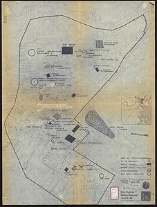
224
Massachusetts--Maps
163
Landowners--Massachusetts--Boston--Maps
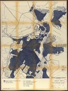
143
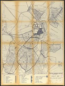
North America--Maps--Early works to 1800
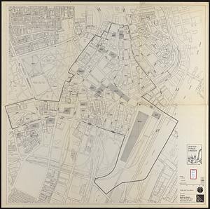
103
more
Topic
»
Date
Date range begin
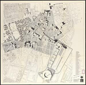
–
Date range end
Current results range from
1482
to
2023
View distribution
Creator
Boston Redevelopment Authority
398
United States. Hydrographic Office
357
O.H. Bailey & Co
148
Des Barres, Joseph F. W. (Joseph Frederick Wallet), 1722-1824
124
United States. Post Office Dept
120
Ptolemy, 2nd cent
100
Walling, Henry Francis, 1825-1888
94
Jefferys, Thomas, -1771
84
more
Creator
»
Format
Maps/Atlases
8,545
Manuscripts
215
Prints
51
Books
36
Objects/Artifacts
10
Drawings/Illustrations
8
Posters
4
Georeferenced
Yes
885
No
7,719
Collection
Norman B. Leventhal Map Center Collection
8,197
Boston and New England Maps
2,574
Urban Maps
2,307
Maritime Charts and Atlases
750
American Revolutionary War-Era Maps
638
Boston Redevelopment Authority Collection
453
Mapping Boston Collection
20
Massachusetts Real Estate Atlases
18
more
Collection
»
Available to use
No known restrictions
8,402
Creative Commons license
69
Search Constraints
Sort by relevance
relevance
title
date (asc)
date (desc)
Number of results to display per page
100 per page
10
per page
20
per page
50
per page
100
per page
View results as:
grid view
map view
Search Results
1.
Proposed Charles River Park
2.
Plan of the parkway between Muddy River gate house and Jamaica Park 1892
3.
Suggestion for the improvement of Muddy River and for completing a continuous promenade from the Common to Jamaica Pond
4.
[Mill dam survey : Boston, Roxbury, Brookline &c.]
5.
Contract documents for the Waterfront Park, Boston, Massachusetts : planting plan
6.
Fenway urban renewal area, Massachusetts R-115 : illustrative site plan
7.
Broad Canal, Cambridge : condition of retaining walls and bed of Canal, inspection for Committee on Charles River Dam, Oct. 30,...
8.
Compiled plan, showing Millers Creek and a portion of Charles River
9.
Lechmere Canal, Cambridge : condition of retaining walls and bed of canal, inspection for Committee on Charles River Dam, Nov....
10.
Back Bay Fens master plan
11.
Back Bay park
12.
Jamaica Pond master plan
13.
James Hayes Park
14.
Olmsted Park master plan
15.
The Riverway master plan
16.
Rose garden in Fens-Back Bay
17.
Sears Park conceptual site plan with historic waterway
18.
West Canton Community Park
19.
Boston water works : map showing the several sources of supply already constructed, also the drainage areas of Lake Cochituate...
20.
New Boston and Charles River Bay
21.
Plan of Charles River and Warren bridges, with the vicinity
22.
Public reservations on the banks of the Charles River between Watertown and Cragies Bridge
23.
City of Boston plan of Columbia Road, showing connection with Franklin Park and Marine Park : under chapter 394 acts of 1897
24.
Gentlemen's driving map showing the park system of Boston
25.
Location of public open spaces
26.
Map of Boston and of a part of its suburbs : showing public recreation grounds, burial grounds and certain other public...
27.
Map of Boston and the country adjacent, showing rural parks
28.
Map of Boston and the country adjacent, showing rural parks
29.
Map of Boston Common : with surrounding streets & adjacent parts of Beacon Hill
30.
Map of the metropolitan district of Boston, Massachusetts : showing local public reservations and holdings of the Metropolitan...
31.
Open space 2017
32.
Proposed park system from the Common to the West Roxbury Park including the Back Bay and Muddy river improvements, Jamaica Pond...
33.
Proposed parks and parkways
34.
Sketch showing arrangement for park-way with adjacent streets and building lots
35.
Map of central Boston and Cambridge
36.
Map of the cities of Boston, Cambridge, Somerville and Chelsea, and the town of Brookline with parts of Newton, Malden and...
37.
A new & complete map of the city of Boston, with part of Charlestown, Cambridge & Roxbury
38.
A new & complete map of the city of Boston, with part of Charlestown, Cambridge & Roxbury
39.
A new & complete map of the city of Boston, with part of Charlestown, Cambridge & Roxbury
40.
Back Bay urban renewal area r-47 : existing and proposed community facilities
41.
Charlestown urban renewal area r-42 : GNRP map no. 2
42.
Copley Square : layout and pavement plan with tree numbers added
43.
East Boston urban renewal area r-44 : existing & proposed public facilities
44.
General plan of Franklin Park
45.
McConnell Park
46.
McConnell Park Dorchester : site plan
47.
Parker Hill-Fenway urban renewal area r-48 : existing and proposed community facilities
48.
Roxbury-N. Dorchester G.N.R.P. r-50 : existing & proposed community facilities
49.
South Boston urban renewal area r-51 : existing and proposed community facilities
50.
South Boston urban renewal area r-51 : existing and proposed public facilities
51.
Campus High School urban renewal area Mass. r-129 : property map
52.
Central business district urban renewal area project no. Mass. R-82L site preparation contract T : planting plan and details
53.
Maps from General plan for Boston : preliminary report, December, 1950
54.
Outline map of Boston
55.
Rose F. Kennedy Garden
56.
Rose Kennedy Garden : contract documents August 1986 : prepared for City of Boston ; Parks & Recreations Department ; Boston...
57.
Site preparation contract tree planting - various locations
58.
Boston urban wilds
59.
1975 general land use plan
60.
Boston thorofare plan existing routes and proposals
61.
Campus High School urban renewal area Mass. r- : locality map blighted areas
62.
Campus High School urban renewal area Mass. r- : locality map important features
63.
Central business district project no Mass r- : existing land use
64.
Central business district project no Mass r- : existing building condition
65.
Central business district project no Mass r- : locality map 2
66.
Central business district project no Mass r- : locality map 1
67.
Central business district urban renewal area Massachusetts r-82 : pedestrian circulation
68.
Central business district urban renewal area Massachusetts r-82 : vehicular circulation
69.
Central business district urban renewal area Massachusetts r-82 : disposition parcels
70.
Central business district urban renewal area Massachusetts r-82 : acquisition plan
71.
Central business district urban renewal area Massachusetts r-82 : street adjustments
72.
Central business district urban renewal area Massachusetts r-82 : zoning plan
73.
Central business district urban renewal area Massachusetts r-82 : illustrative site plan
74.
Central business district urban renewal area, Massachusetts r-82 : illustrative site plan
75.
Central business district urban renewal area, Massachusetts r-82 : illustrative site plan
76.
Central business district urban renewal area Massachusetts r-82 : disposition parcels
77.
Central business district urban renewal area Massachusetts r-82 : illustrative site plan
78.
Central business district urban renewal area Massachusetts r-82 : zoning
79.
Central business district urban renewal area Massachusetts r-82 : proposed land use
80.
Central business district urban renewal area Massachusetts r-82 : property map
81.
Central business district urban renewal area Massachusetts r-82 A,B,C : disposition parcels
82.
Central business district urban renewal area Massachusetts r-82 A,B,C : proposed land use
83.
Central business district urban renewal area Massachusetts r-82 A,B,C : zoning
84.
Central business district urban renewal area r-82 : parcel acquisition map
85.
Central business district urban renewal area r-82 : existing land use
86.
Central business district urban renewal area r-82 : building deficiencies
87.
Charles River embankment, section A
88.
Charlestown renewal area : location map
89.
Charlestown renewal area : blighted areas
90.
Conceptual plan
91.
Conceptual plan
92.
Cultural facilities conceptual plan
93.
Disposition parcel plan, central area
94.
Downtown and neighborhood cultural facilities
95.
Downtown existing buildings conditions
96.
Downtown project no. Mass. r-46 : existing and proposed community facilities
97.
Downtown project no. Mass. r-46 : proposed circulation and boundary adjustments
98.
Downtown project no. Mass. r-46 : existing land use
99.
Downtown Waterfront Faneuil Hall renewal area : locality map 1
100.
Downtown waterfront-Faneuil Hall project urban renewal area Massachusetts R-77 : illustrative site plan
‹ Prev
Next ›
1
2
3
4
5
…
86
87