McConnell Park


Item Information
- Title:
- McConnell Park
- Cartographer:
- Boston (Mass.). Public Facilities Department
- Cartographer:
- Walter J. Hickey Associates
- Name on Item:
-
the city of Boston Public Facilities Department ; Walter J. Hickey Associates, Inc.
- Date:
-
August 6, 1972
- Format:
-
Maps/Atlases
- Location:
-
Boston Public Library
Central Library in Copley Square - Collection (local):
-
Boston Public Library Collection
- Subjects:
-
Dorchester (Boston, Mass.)--Maps
Parks--Massachusetts--Boston--Maps
McConnell Park (Boston, Mass.)--Maps
Playgrounds--Massachusetts--Boston--Maps
Baseball fields--Massachusetts--Boston--Maps
Site plans
Storm sewers--Massachusetts--Boston--Maps
Manholes--Massachusetts--Boston--Maps
Trees--Massachusetts--Boston--Maps
Underground utility lines--Massachusetts--Boston--Maps
City planning--Massachusetts--Boston--Maps
- Places:
-
Suffolk (county)BostonDorchester
- Extent:
- 6 maps ; 57 x 85 cm
- Terms of Use:
-
No known copyright restrictions.
No known restrictions on use.
- Place of origin:
-
[Boston]
- Language:
-
English
- Table of Contents:
-
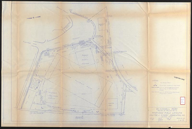
McConnell Park project no. PFD 323-PR-1-72 proposed field layouts
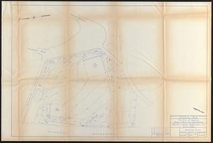
McConnell Park site plan
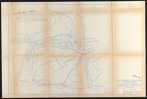
McConnell Park grading plan
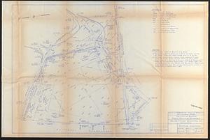
McConnell Park utilities
McConnell Park existing conditions
McConnell Park field layouts & details
- Catalog Record:
-
Accompanying text
- Notes:
-
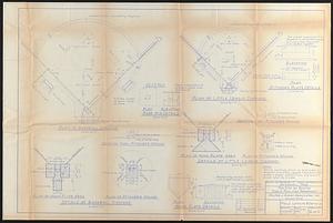
Accompanies a report on the design, construction supervision, and construction of a baseball diamond at McConnell Park.
Maps show trees, floodlights, playground area, utilities, elevation, fencing, baseball diamond layout and other park features.
Relief shown by spot heights.
Oriented with north to the left.
- Identifier:
-
06_01_017357c
06_01_017357d
06_01_017357e
06_01_017357f
06_01_017357g
06_01_017357h
- Call #:
-
BRA/165 map G
- Barcode:
-
39999063522377


