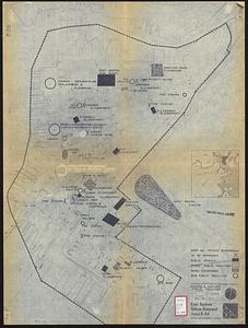
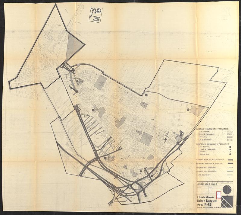
Charlestown urban renewal area r-42 : GNRP map no. 2
Item Information
- Title:
- Charlestown urban renewal area r-42 : GNRP map no. 2
- Cartographer:
- Boston Redevelopment Authority
- Date:
-
April 2, 1964
- Format:
-
Maps/Atlases
- Location:
-
Boston Public Library
Central Library in Copley Square - Collection (local):
-
Boston Public Library Collection
- Subjects:
-
Charlestown (Boston, Mass.)--Maps
City planning--Massachusetts--Boston--Maps
Fire stations--Massachusetts--Boston--Maps
Parks--Massachusetts--Boston--Maps
Playgrounds--Massachusetts--Boston--Maps
Streets--Massachusetts--Boston--Maps
Urban renewal--Massachusetts--Boston--Maps
- Places:
-
MassachusettsSuffolk (county)BostonCharlestown
- Extent:
- 1 map ; sheet 107 x 119 cm
- Terms of Use:
-
No known copyright restrictions.
No known restrictions on use.
- Publisher:
-
[Boston] :
Boston Redevelopment Authority
- Language:
-
English
- Catalog Record:
-
Accompanying text
- Notes:
-
Accompanies an urban renewal plan for Boston's Charlestown neighborhood.
Shows existing community facilities, proposed community facilities, existing R.O.W. to be abandoned, proposed streets & highways, and project boundaries.
- Identifier:
-
06_01_017308b
- Call #:
-
BRA/FOLIO/50 map 2
- Barcode:
-
mq6311515