Roxbury-N. Dorchester G.N.R.P. r-50 : existing & proposed community facilities
Item Information
- Title:
- Roxbury-N. Dorchester G.N.R.P. r-50 : existing & proposed community facilities
- Description:
-
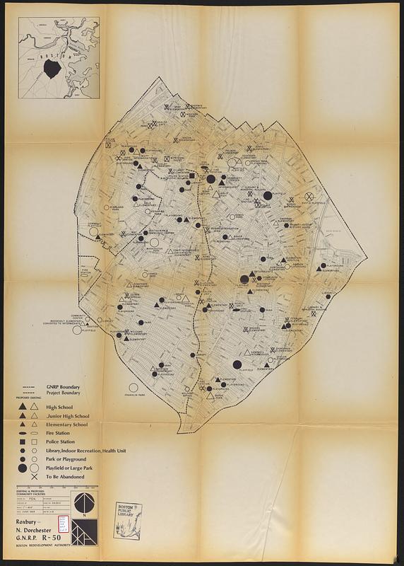
Part of a set of 8 maps (Boston Public Library lacking map 3) accompanying an urban renewal plan for the Roxbury / North Dorchester neighborhoods of Boston.
- Cartographer:
- Boston Redevelopment Authority
- Date:
-
1963
- Format:
-
Maps/Atlases
- Location:
-
Boston Public Library
Central Library in Copley Square - Collection (local):
-
Boston Public Library Collection
- Subjects:
-
Roxbury (Boston, Mass.)--Maps
City planning--Massachusetts--Boston--Maps
Urban renewal--Massachusetts--Boston--Maps
School buildings--Massachusetts--Boston--Maps
Police stations--Massachusetts--Boston--Maps
Fire stations--Massachusetts--Boston--Maps
Library buildings--Massachusetts--Boston--Maps
Parks--Massachusetts--Boston--Maps
Playgrounds--Massachusetts--Boston--Maps
Recreation centers--Massachusetts--Boston--Maps
- Places:
-
Suffolk (county)BostonRoxbury
- Extent:
- 1 map ; sheet 117 x 87 cm
- Terms of Use:
-
No known copyright restrictions.
No known restrictions on use.
- Publisher:
-
[Boston] :
Boston Redevelopment Authority
- Scale:
-
Scale 1:4,800
- Language:
-
English
- Catalog Record:
-
Accompanying text
- Notes:
-
Shows proposed and existing high school, junior high school, elementary school, fire station, police station, library, indoor recreation, health unit, park or playground, playfield or large park, and to be abandoned.
Inset: [Location map].
- Identifier:
-
06_01_017758
- Call #:
-
BRA/FOLIO/108 map 6
- Barcode:
-
mq6311154


