Suggestion for the improvement of Muddy River and for completing a continuous promenade from the Common to Jamaica Pond
Item Information
- Title:
- Suggestion for the improvement of Muddy River and for completing a continuous promenade from the Common to Jamaica Pond
- Description:
-
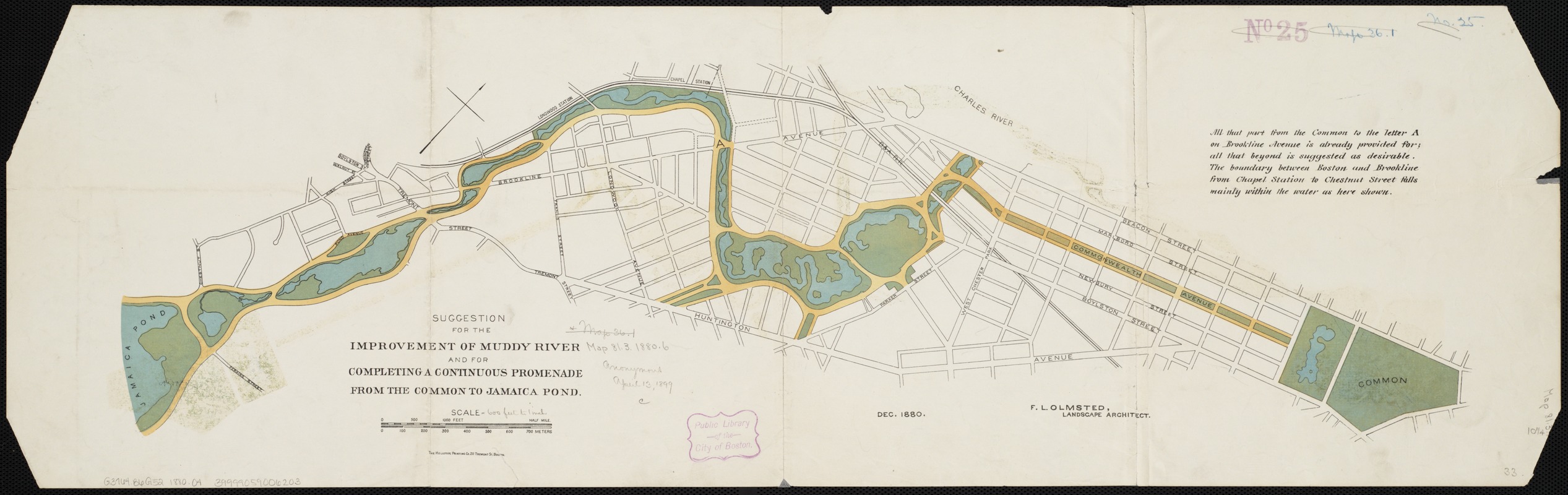
Originally part of the Back Bay salt marsh, the narrow, tidal Muddy River formed the boundary between Boston and Brookline. By 1880, urban growth had taken its toll, and the once-flowing tributary was notoriously polluted and prone to flooding. The simple schematic plan shown here was Olmsted’s preliminary design for improving the waterway. In it, he sculpted the erratic river into a gently meandering stream, and transformed the swamp south of Tremont Street into a large pond. Olmsted would later alter this plan, going so far as to reroute the river and shift the Boston-Brookline border; this change was legally adopted in 1890.
- Creator:
- Olmsted, Frederick Law, 1822-1903
- Name on Item:
-
F.L. Olmsted.
- Date:
-
1880
- Format:
-
Maps/Atlases
- Location:
-
Boston Public Library
Norman B. Leventhal Map & Education Center - Collection (local):
-
Norman B. Leventhal Map & Education Center Collection
- Subjects:
-
Parks--Massachusetts--Boston--Maps
City planning--Massachusetts--Boston--Maps
Landscape architecture--Massachusetts--Boston--Maps
Muddy River (Norfolk County and Suffolk County, Mass. : River)--Maps
Boston (Mass.)--Maps
- Places:
-
MassachusettsMuddy River
MassachusettsSuffolk (county)Boston
- Extent:
- 1 map : col. ; 22 x 76 cm.
- Terms of Use:
-
No known copyright restrictions.
No known restrictions on use.
- Publisher:
-
Boston :
Heliotype Print. Co.
- Scale:
-
Scale [ca. 1:7,200].
- Language:
-
English
- Notes:
-
Oriented with north toward the upper right.
Includes note.
"Dec. 1880."
- Notes (exhibitions):
-
Exhibited: "Breathing Room: Mapping Boston's Green Spaces" organized by the Norman B. Leventhal Map Center at the Boston Public Library, 2018.
- Identifier:
-
06_01_004327
- Call #:
-
G3764.B6G52 1880 .O4
- Barcode:
-
39999059006203


