Toggle navigation
LMEC Home
Exhibitions
Georeferencing
Tools for Teachers
Collections
My Favorites
Sign Up / Log In
Search
Search the map portal
Map Collection
Map Collection
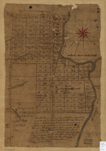
Map Sets
Search
Search
Search for
Search In
All Fields
Creator
Title
Subject
Place
Search All Digital Collections
Advanced Search
527 Results
My Search
Start Over
More Like
commonwealth:q524nh01g
Remove constraint More Like: commonwealth:q524nh01g
Filter your Search
Place
North and Central America
459
United States
324
New York
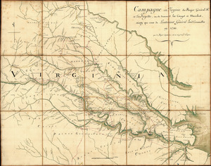
41
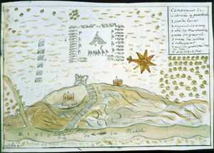
Canada
26
Florida
20
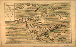
Mississippi
18
Alabama
17
Chatham (county)
16
more
Place
»
Topic
Manuscript maps--Early works to 1800
138
Manuscript maps
21
Gulf Coast (U.S.)--Maps, Manuscript--Early works to 1800
12
Fortification--New York (State)--New York--Maps--Early works to 1800
11
New York (N.Y.)--Buildings, structures, etc--Maps, Manuscript--Early works to 1800
9
New York (N.Y.)--Maps, Manuscript--Early works to 1800
8
Saratoga Campaign, N.Y., 1777--Maps, Manuscript--Early works to 1800
8
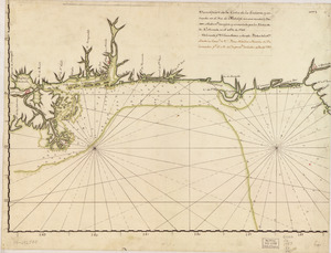
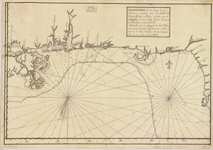
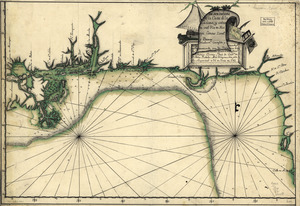
Coasts--Florida--Maps--Early works to 1800
7
more
Topic
»
Date
Date range begin
–
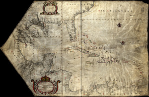
Date range end
Current results range from
1700
to
1899
View distribution
Creator
Hills, John, (Surveyor)
18
Montrésor, John, 1736-1799
16
Dumont de Montigny
14
Bingham, William, 1752-1804
12
Adlum, John, 1759-1836
10
Washington, George, 1732-1799
9
Faden, William, 1749-1836
7
Morgan, Benjamin, (Draftsman)
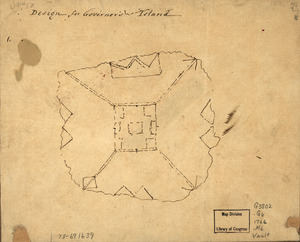
7
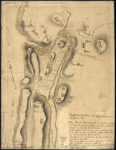
more
Creator
»
Format
Maps/Atlases
525
Manuscripts
522
Objects/Artifacts
2
Georeferenced
Yes
6
No
521
Collection
American Revolutionary War-Era Maps
522
Library of Congress Collection
485
Newberry Library Collection
39
Maritime Charts and Atlases
31
Urban Maps
17
Boston and New England Maps
4
Norman B. Leventhal Map Center Collection
3
Available to use
Creative Commons license
485
No known restrictions
3
Search Constraints
Sort by title
relevance
title
date (asc)
date (desc)
Number of results to display per page
100 per page
10
per page
20
per page
50
per page
100
per page
View results as:
grid view
map view
Search Results
1.
1. Prise de Newport par d'Estaing, 1778 : 2. Embossage de Ternay à Newport, 1780
2.
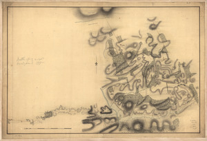
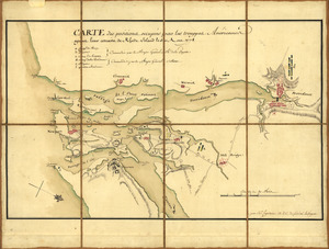
1st. & 2d. position of that part of the army engaged on the 19th Sept. 1777 : 3d & 4th postn. Sept. 19
3.
20 tracts, Charleston
4.
20 tracts, Tioga County
5.
The Above is a plan of the town of Cabot, State of Vermont
6.
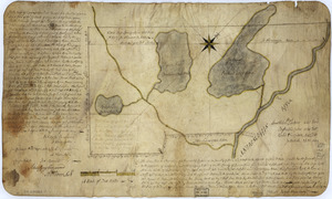
The above plan is a discription of a new township called Royalsborough in the county of Cumberland : bounded southeasterly on...
7.
The above plan is a discription of a new township containing the quantity of seven and a half mile of land & water, granted by...
8.
An accurate map of His Majesty's Province of New-Hampshire in New England & all the adjacent country northward to the River St....
9.
Amboy to Elizabethtown
10.
Amerique Septentrionale : Acadie ou Nouvelle Ecosse aux anglois : Annapolis Royal
11.
Armée de Rochambeau, 1782 : Carte des environs de Williamsburg en Virginie où les armées françoise et américaine ont...
12.
Armstrong County
13.
Armstrong C[ount]y
14.
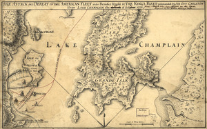
The Attack and defeat of the American fleet under Benedict Arnold : by the King's fleet commanded by Sir Guy Carleton upon Lake...
15.
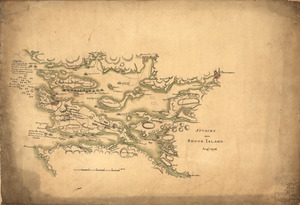
Attacks upon Rhode Island, Augt. 1778
16.
Barbadoes
17.
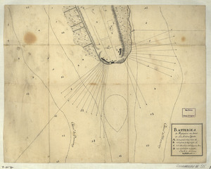
Batteries de West-point au haut de la Rivière d'York
18.
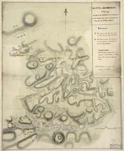
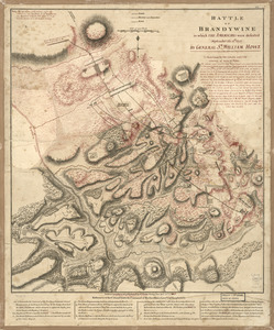
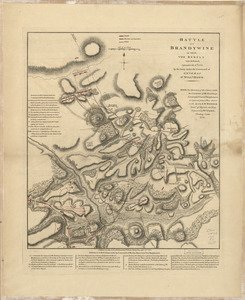
Battle of Brandywine : 11th Septr. 1777, in which the rebels were defeated by the army under the command of General Sir William...
19.
Battle of Brandywine, 11 Septr. 1777
20.
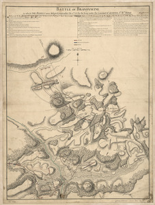
Battle of Brandywine, 11th Septr. 1777 : in which the rebels were defeated by the Army under the command of Genl. Sir Willm. Howe
21.
Battle of Brandywine in which the Americans were defeated : September the 11th, 1777 by General Sr. William Howe
22.
Battle of Brandywine, in which the rebels were defeated : September the 11th 1777, by the army under the command of General Sr....
23.
Battle of Brandywine in which the rebels were defeated : September the 11th. 1777, by the army under the command of General Sr....
24.
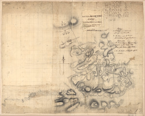
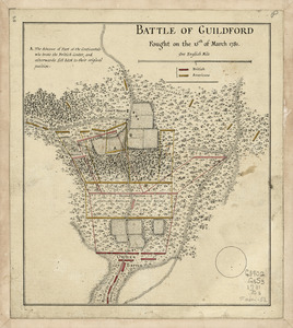
Battle of Guildford fought on the 15 of March 1781
25.
Battle of Guildford fought on the 15th of March 1781
26.
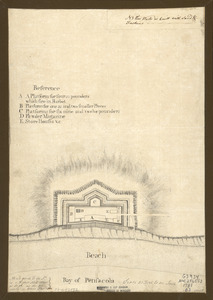
Bay of Pensacola, fortification
27.
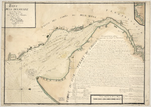
Baye de la Delaware avec les ports, sondes, dangers, bancs, &c. depuis les caps jusqu'a Philadelphie : d'après la carte de...
28.
Bend of the Missouri River
29.
Boston & harbour
30.
Boston Harbor, Massachusetts
31.
[Boston Harbour, with the surroundings, &c]
32.
Boston, its environs and harbour : with the rebels works raised against that town in 1775
33.
Boston, S. West part : No. 25
34.
Braddock's route, 1755, Fort Cumberland to Fort Pitt
35.
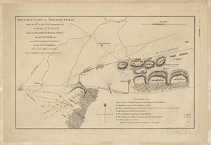
British camp at Trudruffrin from [sic] : with the attack made by Major General Grey against the rebels near White Horse Tavern
36.
British camp at Trudruffrin from the 18th. to the 21st. of September 1777 : with the attack made by Major General Grey against...
37.
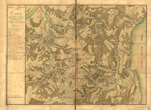
Campagne en Virginie du Major Général M'is de LaFayette : ou se trouvent les camps et marches, ainsy que ceux du Lieutenant...
38.
Campement de l'armée à Tombecbe
39.
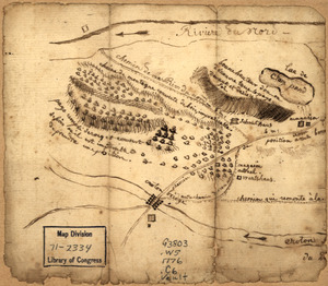
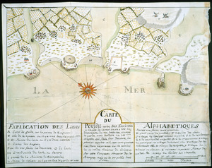
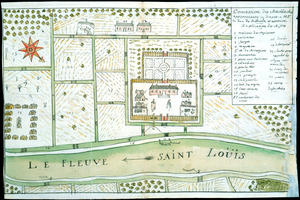
[Campement] de l'armée franc̦oise [devant u]n village des ennemis, les Chicachas le 26 [de mais] 1736
40.
Cantonment of His Majesty's forces in N. America : according to the disposition now made & to be compleated as soon as...
41.
Cantonment of the forces in North America 11th. Octr. 1765
42.
Captain Snow's scetch of the country by himself, and the best accounts he could receive from the Indian traders
43.
Captain Snow's sketch
44.
Carta esférica de la canal entre Puerto Rico y Santo Domingo
45.
Carta esférica de la Ysla de la Granada
46.
Carta esférica de la Ysla de Tabago
47.
Carta esférica de las yslas de Sn. Martin, Sn. Bartolome y Anguila
48.
Carta esférica de las Yslas Virgenes
49.
Carta esférica de las Yslas Virgenes
50.
Carta esférica que comprehende la Ysla de Trinidad con sus adyacentes, bajos, sondas y veriles
51.
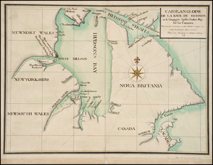
Carte angloise de la Baye de Hudson ou la compagnie apellee Hudson Bay fait son commerce : tirée de la liasse des concecions...
52.
Carte de la coste de la Louisiane, depuis la Baye de St. Bernard jusqu'a celle de Saint Joseph : ou tous les ports, rades, et...
53.
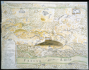
Carte de la coste de la province de la Louisiane et des bouches du Micissipy ou fleuve St. Louis
54.
Carte de la rivire du Cannada, la Terre Nevf, Cape Britton et la cotte de Lacadie
55.
Carte de l'affaire de Montmouth : ou le G'al Washington commandon l'armée américaine et le G'l Clinton l'armée angloise le...
56.
Carte de l'entrée du port et rade de Pensacola
57.
Carte des environs d'Hampton
58.
Carte des positions occupeés par les trouppes Américaines apres leur retraite de Rhode Island le 30 Aout 1778
59.
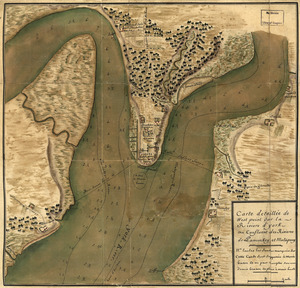
Carte detaillée de West Point sur la rivière d'York au confluent des Rivières de Pamunkey et Matapony
60.
Carte du Cap Franc̨ois de Saint Domingue, de l'isle de Cuba, de la Jamaique avec le canal de Bahama, l'entrée du fleuve St....
61.
Carte du Fort Rozalie des Natches franc̦ois avec ses dependances et village des sauvages
62.
Carte du Pouldu avec ses environs et la côte de la mer : ou on y voit la disposition de nos batteries, et corps de garde, avec...
63.
Carte d'un partie de l'Amerique Septentrionale : ou est tracée notre route d'Halifax à New York, par Quebec, Montreal, le Lac...
64.
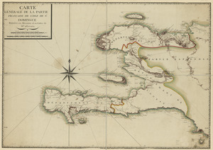
Carte générale de la partie française de l'isle de St. Domingue
65.
Cawanesque
66.
Chart of the sea coast from latitude 27⁰00ʹ00ʺ to 27⁰20ʹ00ʺ, with Little Inlet & River into Hillsborough River ; Chart of the...
67.
Chart of the sea coast from lattde. 26⁰20ʹ00ʺ to 26⁰ & 40ʹ00ʺ with the head of Sharkshead River ; Chart of New Inlet ; Chart of...
68.
Chart showing the depth of the James and York rivers as they enter Chesapeake Bay, with towns adjacent
69.
The coast of Florida from the Dry Tortugas to the old Cape
70.
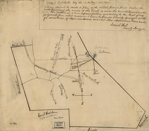
Colchester, May the: 6:th: Day: A.D.: 1765
71.
Combat naval à la hauteur de la Baye de Chézapeake [sic] le 5 7bre. 1781
72.
Concession des Chaoüachas appartenante cy devant a Mgr. le duc de Belleisle et associez
73.
[Continuation of Plan du detroit de Belle Isle et du Golphe St. Laurent]
74.
Copia, del mapa de las Indias Occidentales : y del manifiesto que presentò D. Thomas Southuel, à la Superioridad, en el año...
75.
Copy of a map presented to the Congres [sic]
76.
Copy of a sketch of the Monongahela, with the field of battle
77.
Copy of a survey return'd by Mr. Sam Lewis, surveyor of Botetourt Coun[t]y : Surveyed for George Washington 2950 acres of land...
78.
Costa de Cuba desde Cabo de San Antonio a la bahía de Cardenas
79.
Costa desde la Mobila asta la Bahía de Sn. Josef
80.
Côte de York-town à Boston: Marches de l'armée
81.
Country between North River and Croton River
82.
Cours de l'Ohio depuis sa source jusqu'a sa jonction avec la Riviere d'Ouabache et les pais voisons
83.
The course of Delaware River from Philadelphia to Chester, exhibiting the several works erected by the rebels to defend its...
84.
Crown Point & part of Lake Champlain
85.
Cuba, ciudad capittal de la ysla del mismo nombre y su famoso puerto sittuado en la costa del sur de gra. ysla, los 20 grados y...
86.
Derrotero hecho por Antonia Vélez y Escalante, misionero para mejor conocimiento de las misiones, pueblos de indios y...
87.
Descripción de la costa de la Luciana y entrada en el Río de Micisipi con sus sondas y bajos, nuebamente correjido y...
88.
Descripción de la costa de la Luciana y entrada en el Río de Micisipi con sus sondas y bajos nuebamte. corregido y enmendado...
89.
Descripción de la costa de la Luciana y entrada en el Río de Micisipi con sus sondas y bajos, nuebamte. correjido y enmendado...
90.
Descripcion de la costa de Tierra Firme desde el Cavo de la Agusa hasta la Barra de Palmas diga de la Trinidad : Con todas las...
91.
Descripcion de la costa de Tierra Firme desde el Rio de la Empalizada hasta Cavo de Clara : Por las latitudes y longitudes de...
92.
Descripcion de las costas, islas placeres, i bajos delas, Indias Occidentales
93.
Descripción ychonográfica de la ciudad, puerto y bahía de Santiago de Cuba situado en 20⁰6ʹ de latitud norte y en longd. de...
94.
Descripsión de la costa de la Luciana y entrada en el Río de Micisipi con sus zondas y bajos, nuebamente corregidos y...
95.
Descripsión de la costa de la Luciana y entrada en el Río de Micisipi con sus zonds. y baxos, nuebamte. correjido y enmendo...
96.
Design for Governor's Island
97.
Disposition of British troops, with fortifications north of Fort Knipehausen, i.e. Fort Washington to Fort Independence
98.
Done by order of His excellency Montagu Wilmot, Esq. Governor and Commander in Chief of Nova Scotia, &c., &., &
99.
Dotted line map of Washington, D.C., 1791, before Aug. 19th
100.
Draft of roads in New Jersey
‹ Prev
Next ›
1
2
3
4
5
6


![Armstrong C[ount]y](https://bpldcassets.blob.core.windows.net/derivatives/images/commonwealth:q524ng353/image_thumbnail_300.jpg)


![[Boston Harbour, with the surroundings, &c]](https://bpldcassets.blob.core.windows.net/derivatives/images/commonwealth:t722hs94d/image_thumbnail_300.jpg)


![British camp at Trudruffrin from [sic]](https://bpldcassets.blob.core.windows.net/derivatives/images/commonwealth:q524nb58k/image_thumbnail_300.jpg)
![[Campement] de l'armée franc̦oise [devant u]n village des ennemis, les Chicachas le 26 [de mais] 1736](https://bpldcassets.blob.core.windows.net/derivatives/images/commonwealth:z603vn65v/image_thumbnail_300.jpg)


![Chart of the sea coast from latitude 27⁰00ʹ00ʺ to 27⁰20ʹ00ʺ, with Little Inlet & River into Hillsborough River ; Chart of the sea coast from latitude 26⁰40ʹ00ʺ to [27⁰]00ʹ00ʺ, the Leech Shoal & Hillsborough River](https://bpldcassets.blob.core.windows.net/derivatives/images/commonwealth:q524nd97p/image_thumbnail_300.jpg)


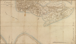
![Combat naval à la hauteur de la Baye de Chézapeake [sic] le 5 7bre. 1781](https://bpldcassets.blob.core.windows.net/derivatives/images/commonwealth:z603vn12t/image_thumbnail_300.jpg)
![[Continuation of Plan du detroit de Belle Isle et du Golphe St. Laurent]](https://bpldcassets.blob.core.windows.net/derivatives/images/commonwealth:z603vm96n/image_thumbnail_300.jpg)

![Copy of a map presented to the Congres [sic]](https://bpldcassets.blob.core.windows.net/derivatives/images/commonwealth:z603vn16x/image_thumbnail_300.jpg)
![Copy of a survey return'd by Mr. Sam Lewis, surveyor of Botetourt Coun[t]y](https://bpldcassets.blob.core.windows.net/derivatives/images/commonwealth:q524nf40r/image_thumbnail_300.jpg)