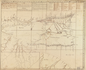
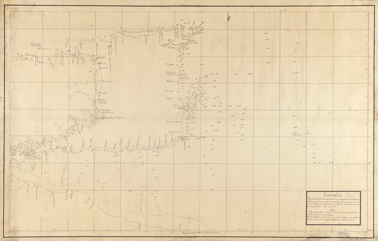
Carta esférica que comprehende la Ysla de Trinidad con sus adyacentes, bajos, sondas y veriles
This map is also available in American Revolutionary Geographies Online (ARGO), a collections portal especially built for material relating to the American Revolutionary War Era. Visit ARGO to learn more about this item and explore the historical geography of North America in the late eighteenth century.
Item Information
- Title:
- Carta esférica que comprehende la Ysla de Trinidad con sus adyacentes, bajos, sondas y veriles
- Name on Item:
-
construida con precenua de los documentos de las dos divisiones u Bergantines, destinados a la notificación del Atlas de la América septentrional, año 1793
- Date:
-
[1793]
- Format:
-
Maps/Atlases
Manuscripts
- Location:
- Library of Congress Geography and Map Division
- Collection (local):
-
Library of Congress Collection
- Subjects:
-
Trinidad--Maps, Manuscript--Early works to 1800
Coasts--Trinidad and Tobago--Trinidad--Maps, Manuscript--Early works to 1800
- Places:
-
Trinidad (island)
- Extent:
- 1 map : ms. ; 58 x 95 cm.
- Terms of Use:
-
No known copyright restrictions.
This work is licensed for use under a Creative Commons Attribution Non-Commercial Share Alike License (CC BY-NC-SA).

- Scale:
-
Scale [ca. 1:260,000]
- Language:
-
Spanish
- Catalog Record:
-
https://lccn.loc.gov/90680580
- Notes:
-
Depths shown by soundings.
Prime meridian: Port of Spain.
Watermark: J. Honig & Zoonen; and, beehive over the characters JH & Z.
Pen-and-ink.
Mounted on cloth backing.
Maggs number annotated in pencil in lower right margin: 28.
- Notes (date):
-
This date is inferred.
- Notes (citation):
-
LC Luso-Hispanic World, 805
- Identifier:
-
lh000805