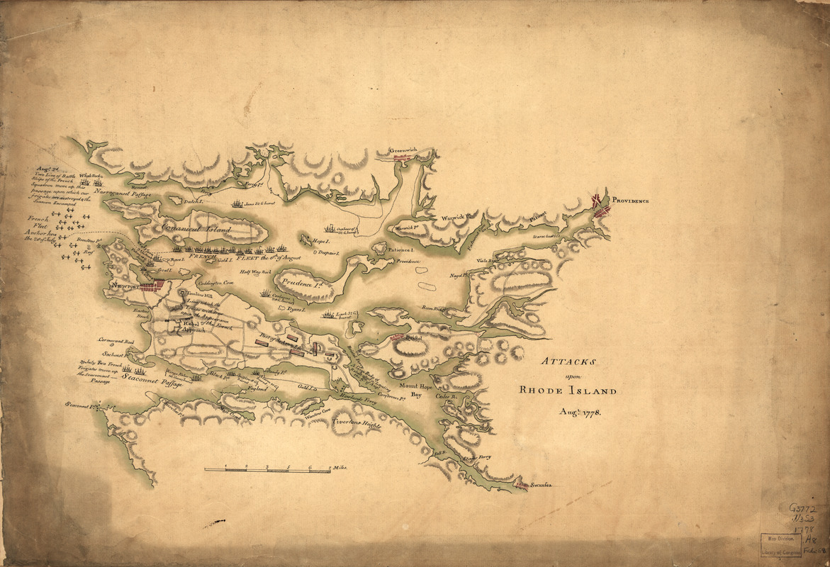
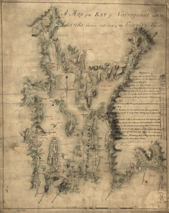
Attacks upon Rhode Island, Augt. 1778
This map is also available in American Revolutionary Geographies Online (ARGO), a collections portal especially built for material relating to the American Revolutionary War Era. Visit ARGO to learn more about this item and explore the historical geography of North America in the late eighteenth century.
Item Information
- Title:
- Attacks upon Rhode Island, Augt. 1778
- Date:
-
[1778]
- Format:
-
Maps/Atlases
Manuscripts
- Location:
- Library of Congress Geography and Map Division
- Collection (local):
-
Library of Congress Collection
- Subjects:
-
Rhode Island, Battle of, R.I., 1778--Maps, Manuscript--Early works to 1800
Narragansett Bay (R.I.)--Maps, Manuscript--Early works to 1800
- Places:
-
Bristol (county)Narragansett Bay
- Extent:
- 1 manuscript map : hand color on sheet 37 x 54 cm.
- Terms of Use:
-
No known copyright restrictions.
This work is licensed for use under a Creative Commons Attribution Non-Commercial Share Alike License (CC BY-NC-SA).

- Scale:
-
Scale ca. 1:120,000
- Language:
-
English
- Catalog Record:
-
https://lccn.loc.gov/gm71000685
- Notes:
-
Manuscript, pen-and-ink and watercolor.
Shows all of Narragansett Bay.
Relief shown by shading.
Oriented with north to the right.
- Notes (date):
-
This date is inferred.
- Notes (citation):
-
LC Maps of North America, 1750-1789, 1015
- Identifier:
-
ar101500

 IIIF Manifest