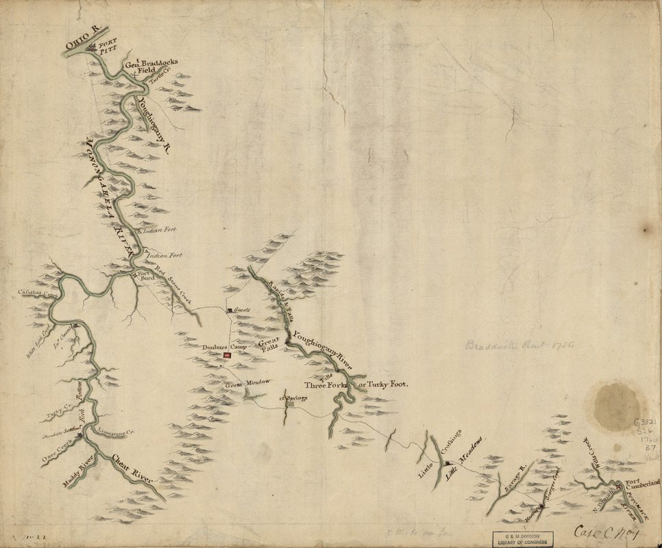
Braddock's route, 1755, Fort Cumberland to Fort Pitt
This map is also available in American Revolutionary Geographies Online (ARGO), a collections portal especially built for material relating to the American Revolutionary War Era. Visit ARGO to learn more about this item and explore the historical geography of North America in the late eighteenth century.
Item Information
- Title:
- Braddock's route, 1755, Fort Cumberland to Fort Pitt
- Title (alt.):
-
Braddock's rout, 1755
- Date:
-
[1760?]
- Format:
-
Maps/Atlases
Manuscripts
- Location:
- Library of Congress Geography and Map Division
- Collection (local):
-
Library of Congress Collection
- Subjects:
-
Pennsylvania--History--French and Indian War, 1754-1763--Maps, Manuscript--Early works to 1800
Monongahela River (W. Va. and Pa.)--Maps, Manuscript--Early works to 1800
- Places:
-
Monongahela River
Pennsylvania
- Extent:
- 1 manuscript map : hand color on sheet 38 x 46 cm.
- Terms of Use:
-
No known copyright restrictions.
This work is licensed for use under a Creative Commons Attribution Non-Commercial Share Alike License (CC BY-NC-SA).

- Scale:
-
Scale 1:316,800
- Language:
-
English
- Catalog Record:
-
https://lccn.loc.gov/gm71002325
- Notes:
-
Title from manuscript catalog of Peter Force map collection.
Manuscript, pen-and-ink and watercolor.
Has watermark.
Relief shown pictorially.
In pencil: Braddock's rout 1755.
Shows "Genl. Braddock field," but the route is via Fort Burd, built in 1759. The Monongahela River is extensively mapped.
"No. 22. Case C, no. 1."
- Identifier:
-
ar306400


